The warmly cool, clear, ringing, perfumed, overflowing, redundant days, were as crystal goblets of Persian sherbet, heaped up – flaked up, with rose-water snow. — Herman Melville
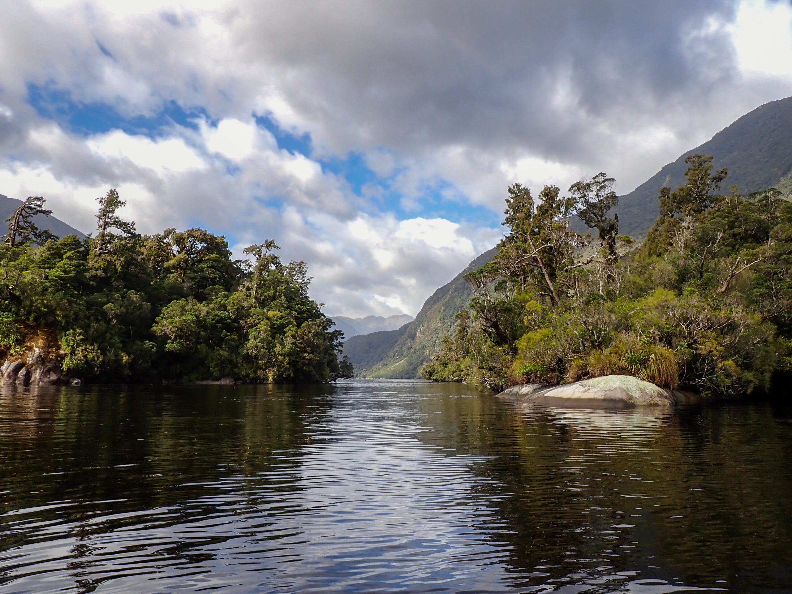
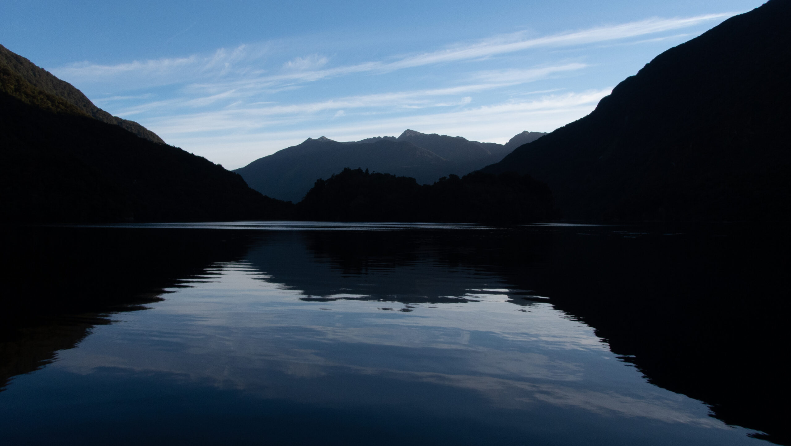
Northward to Charles/Taiporoporo Sound, Mesmerizing – Fiordland
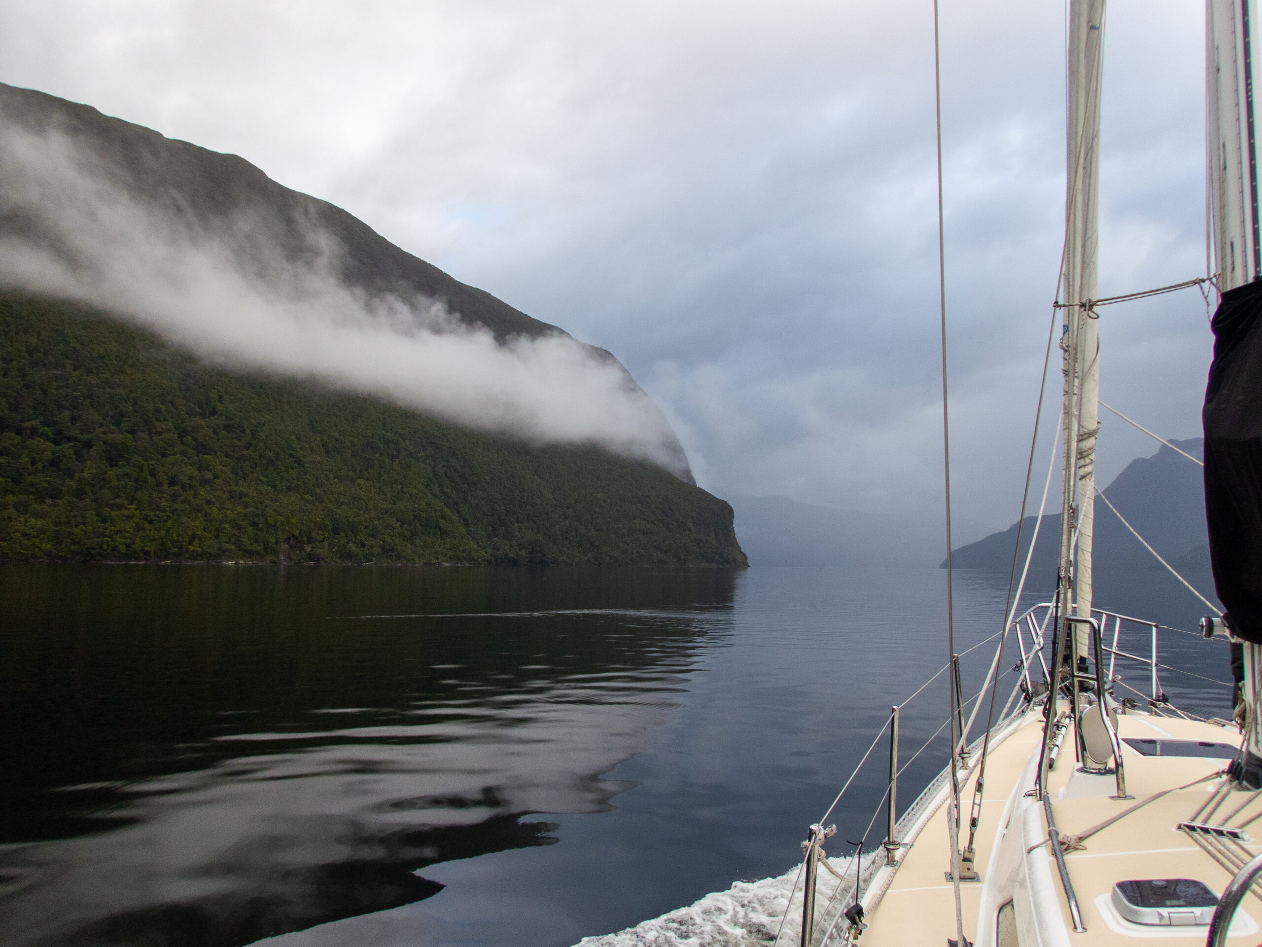
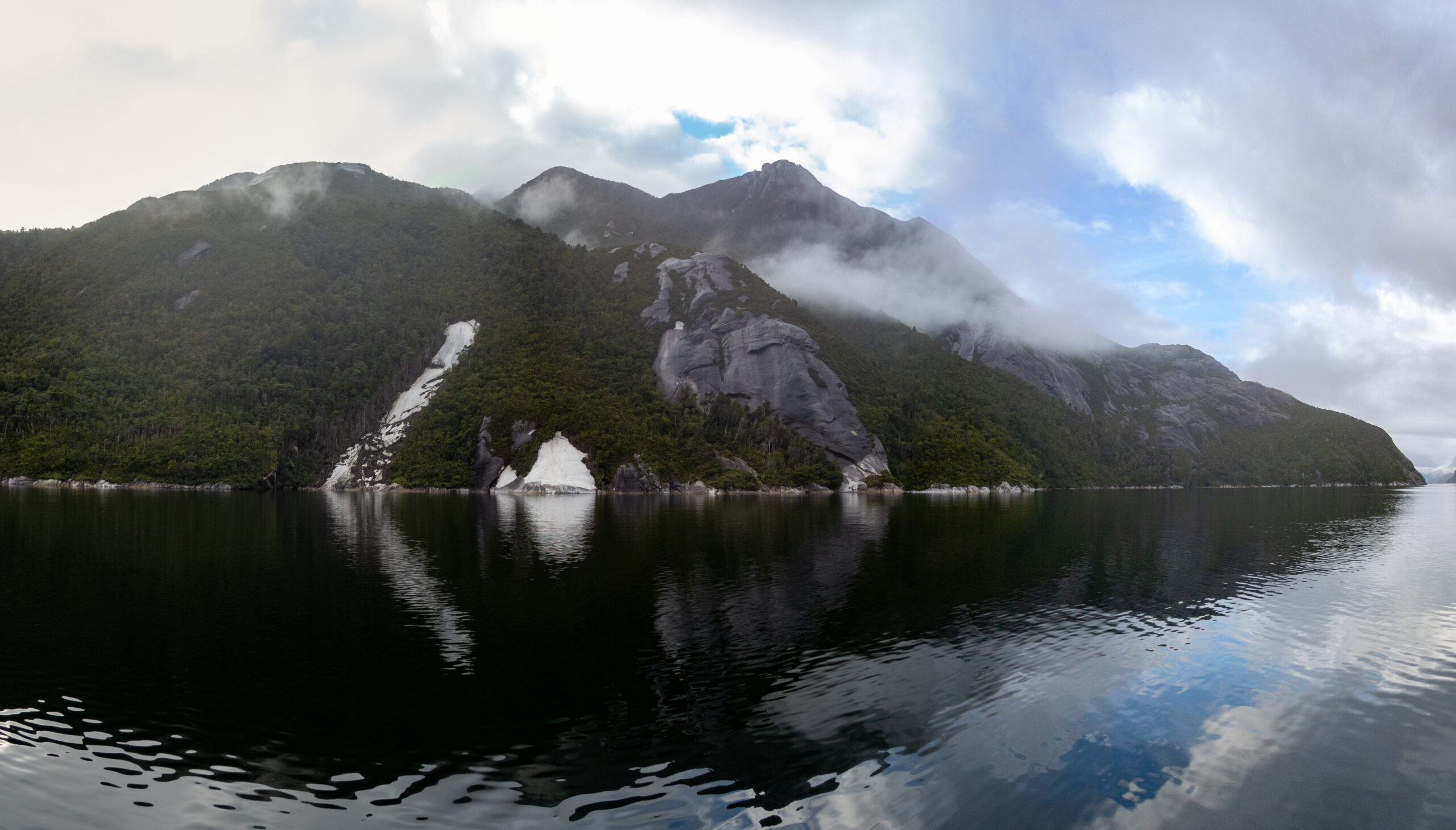
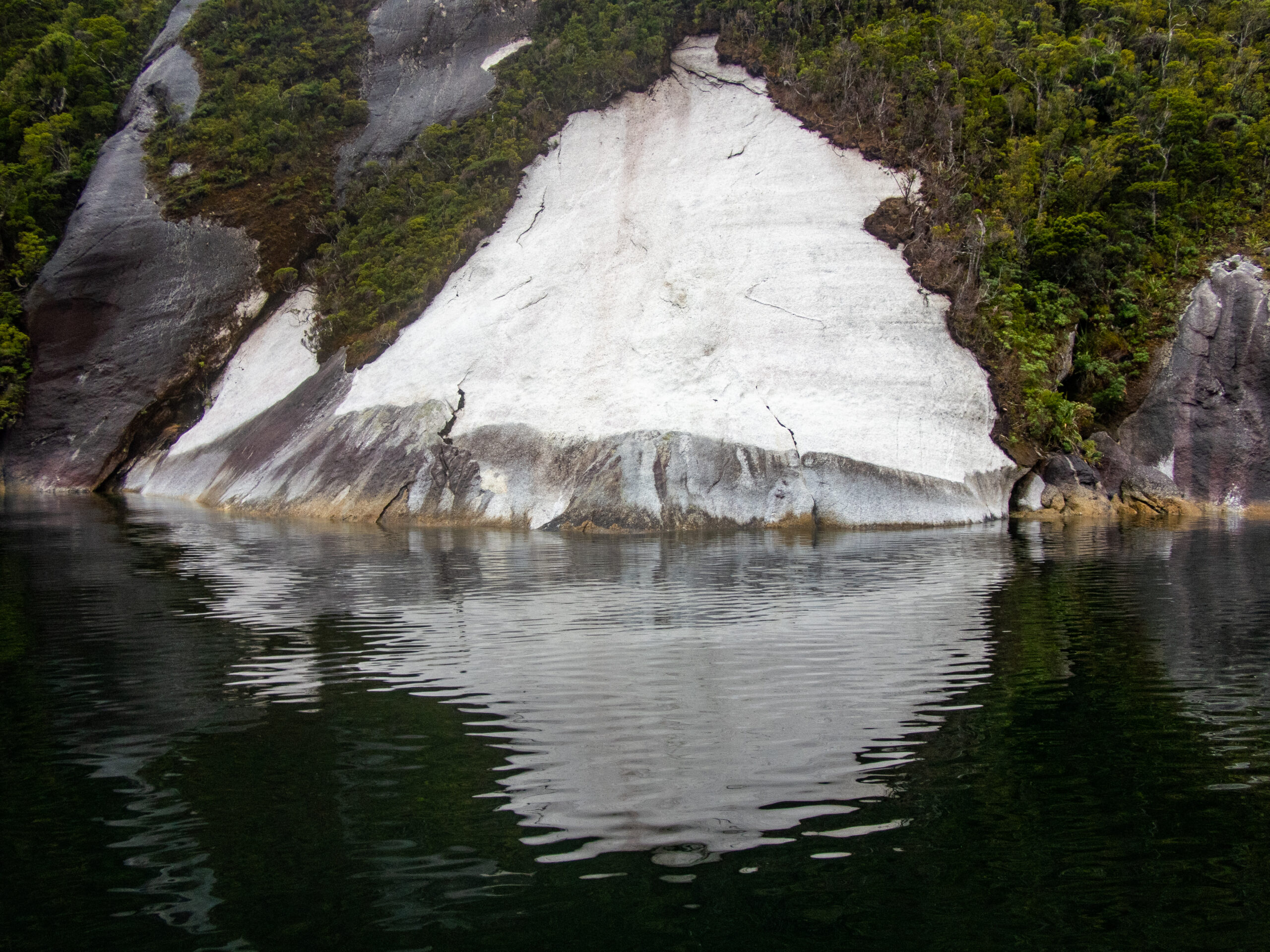
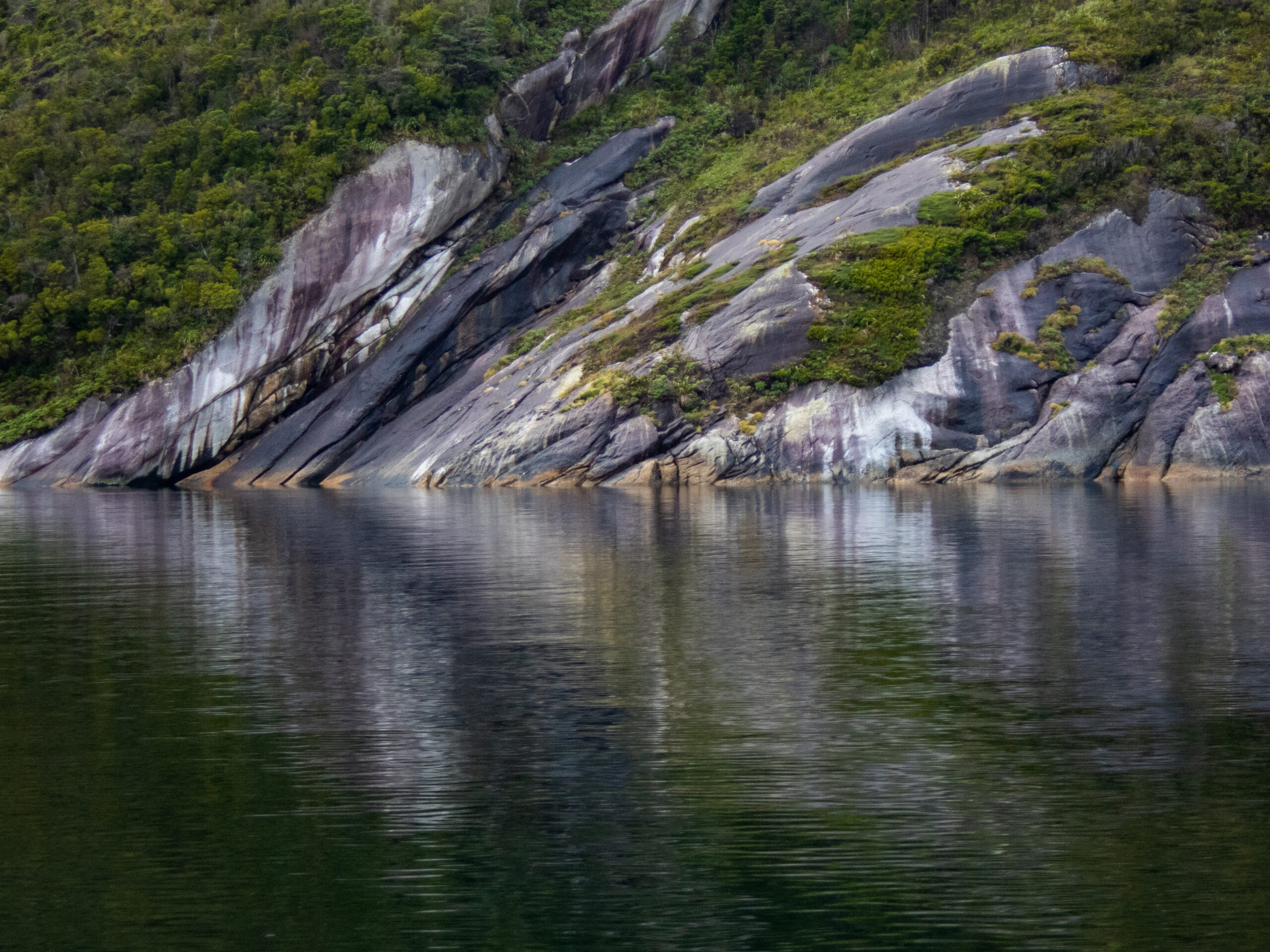
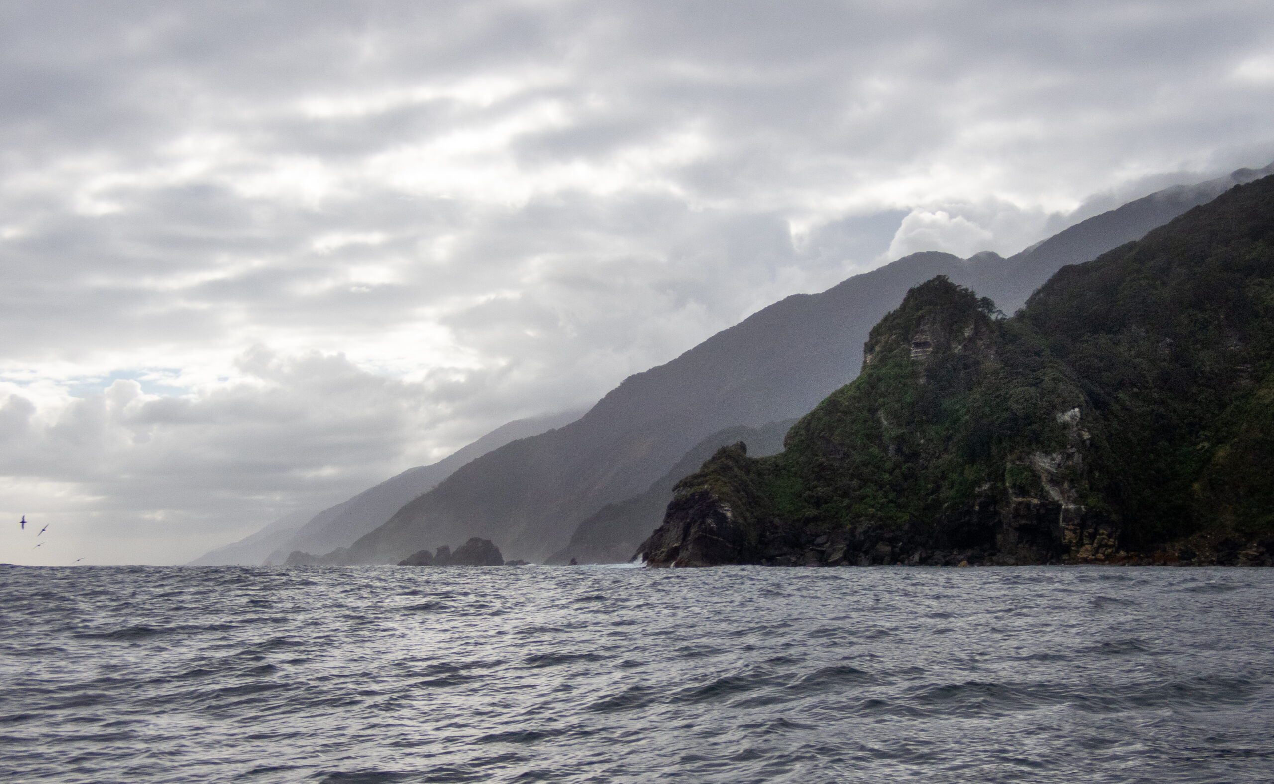
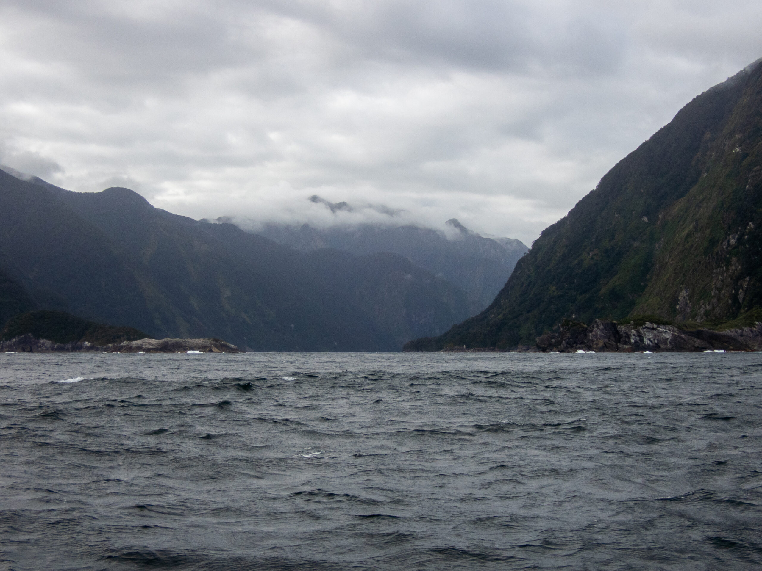
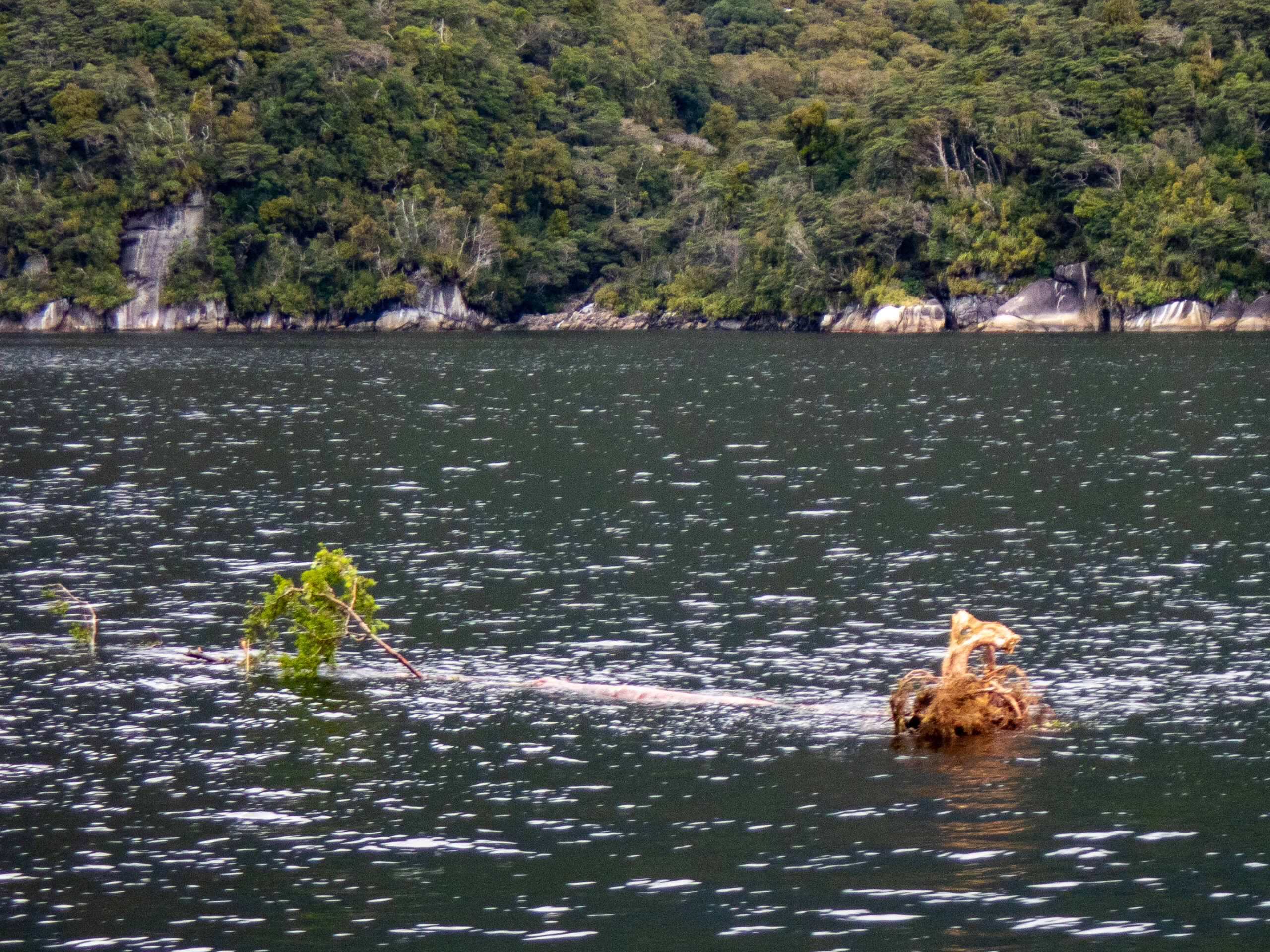
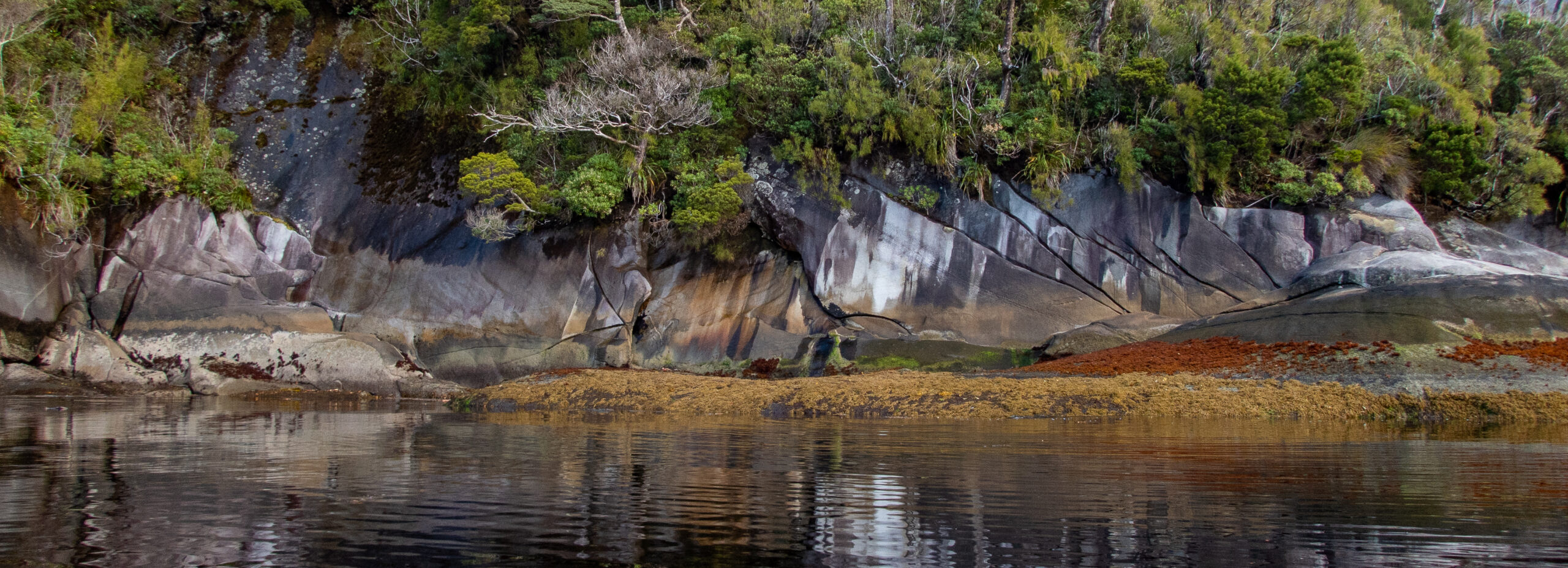
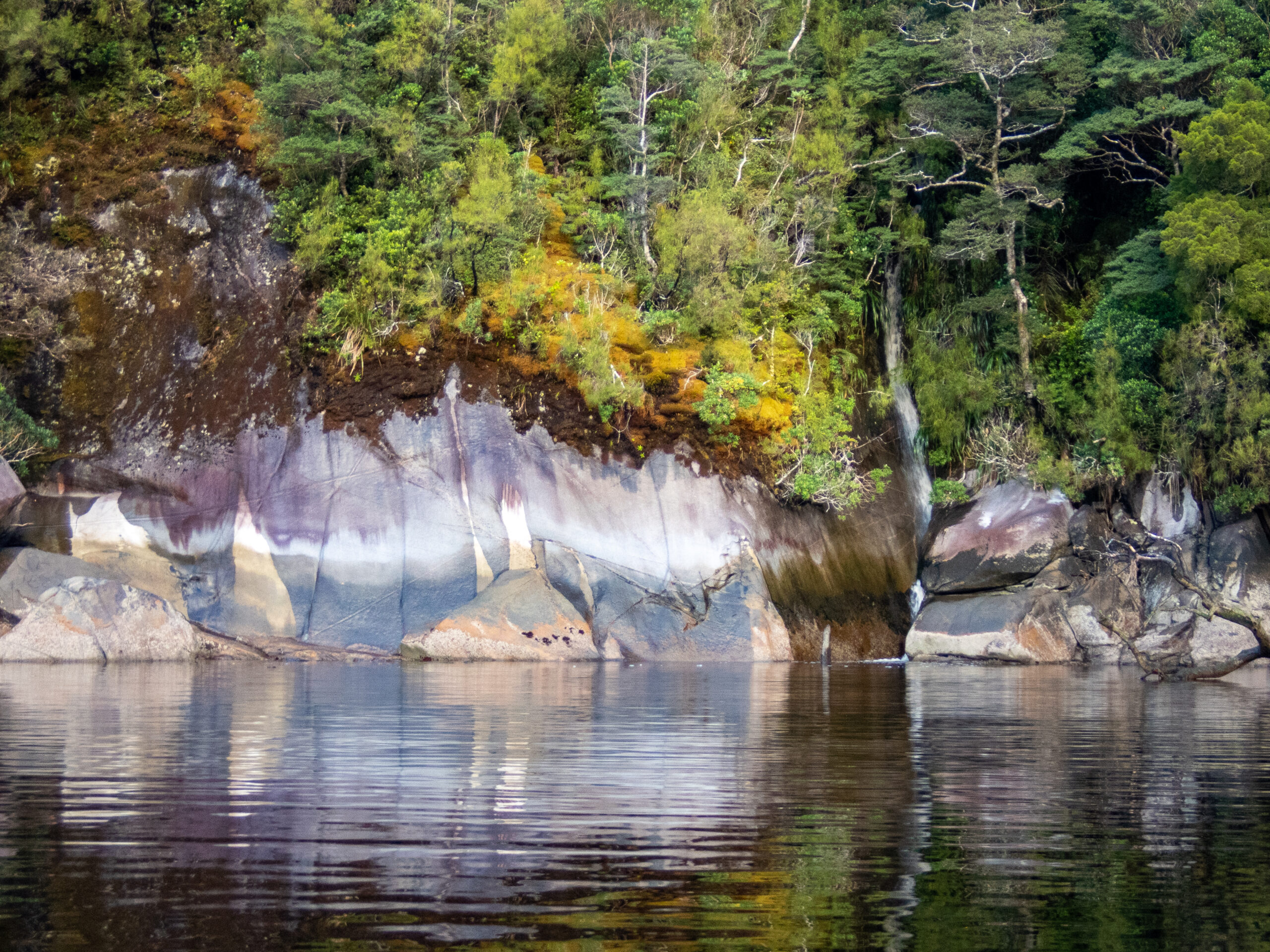
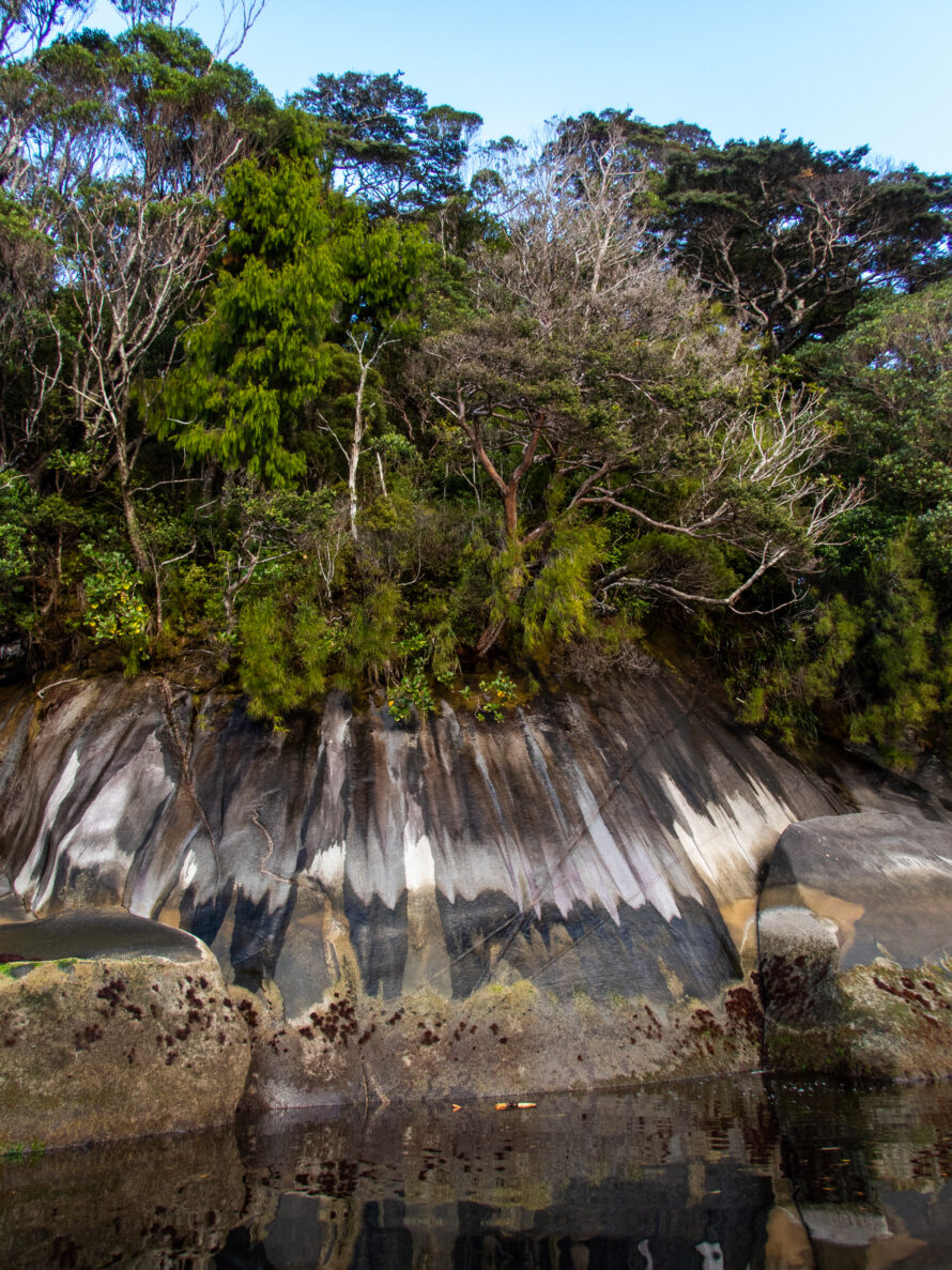
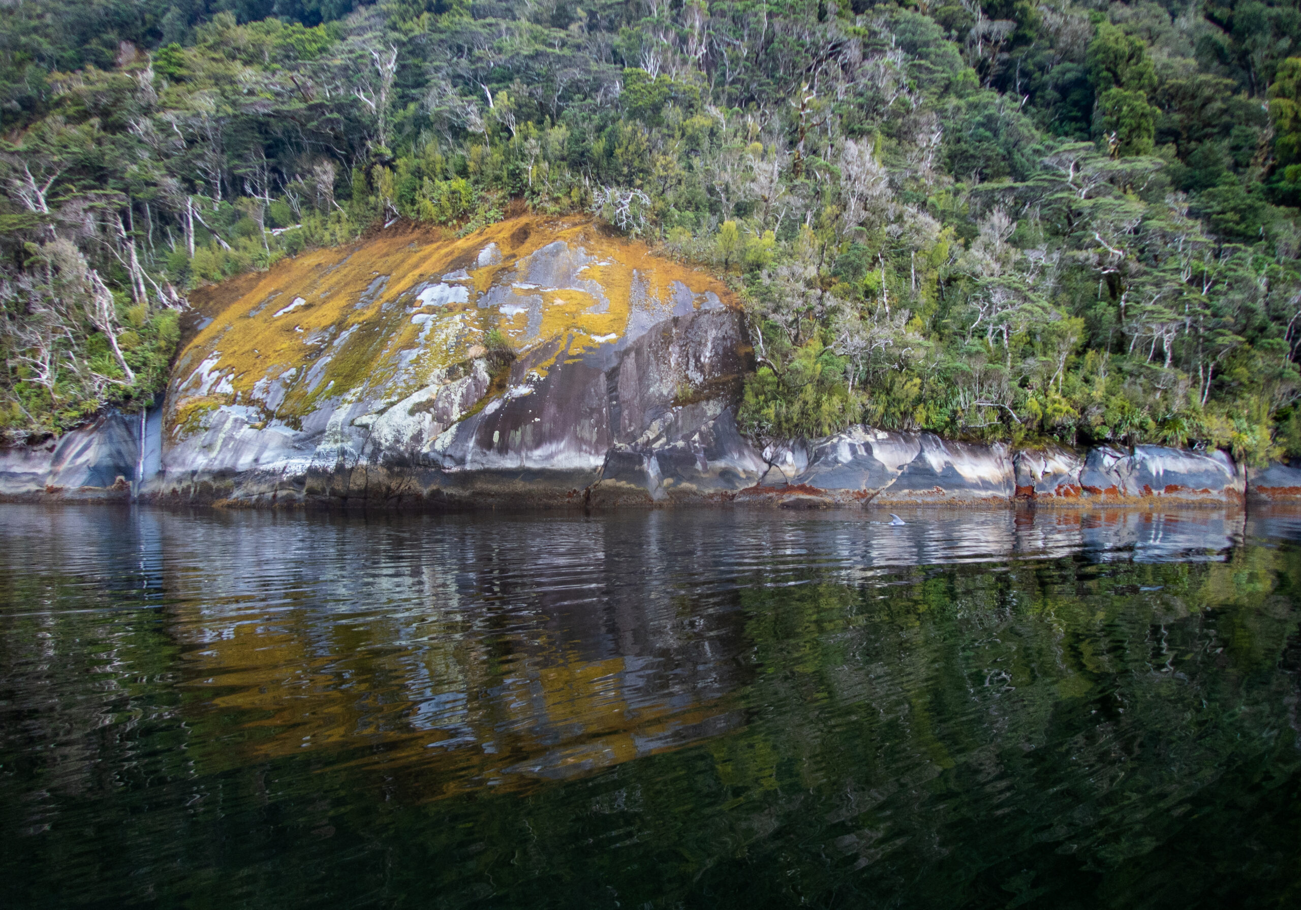
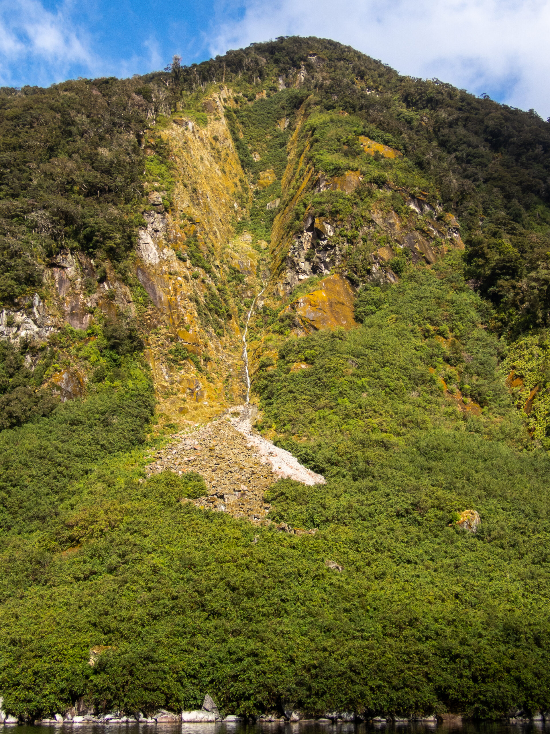
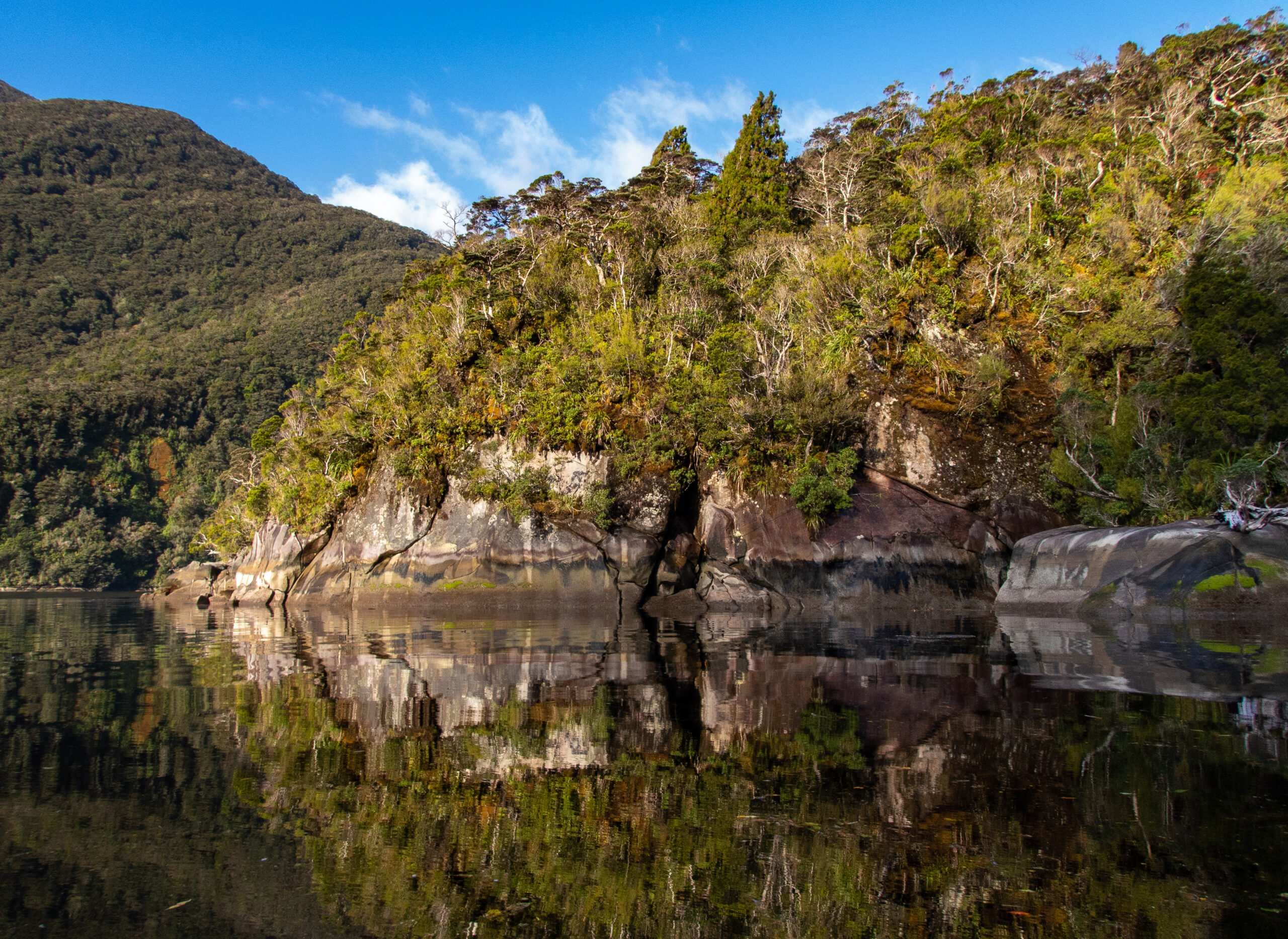
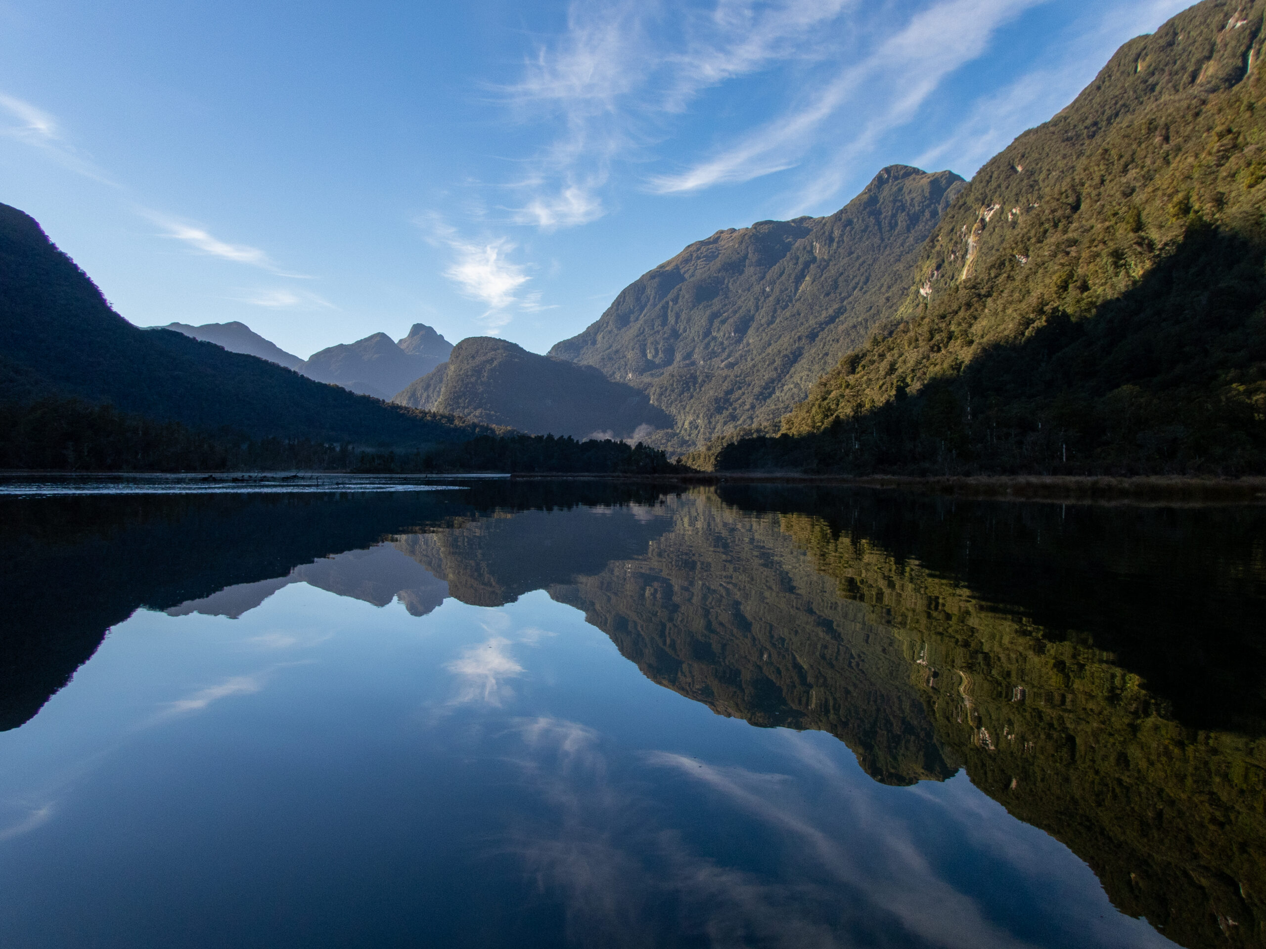
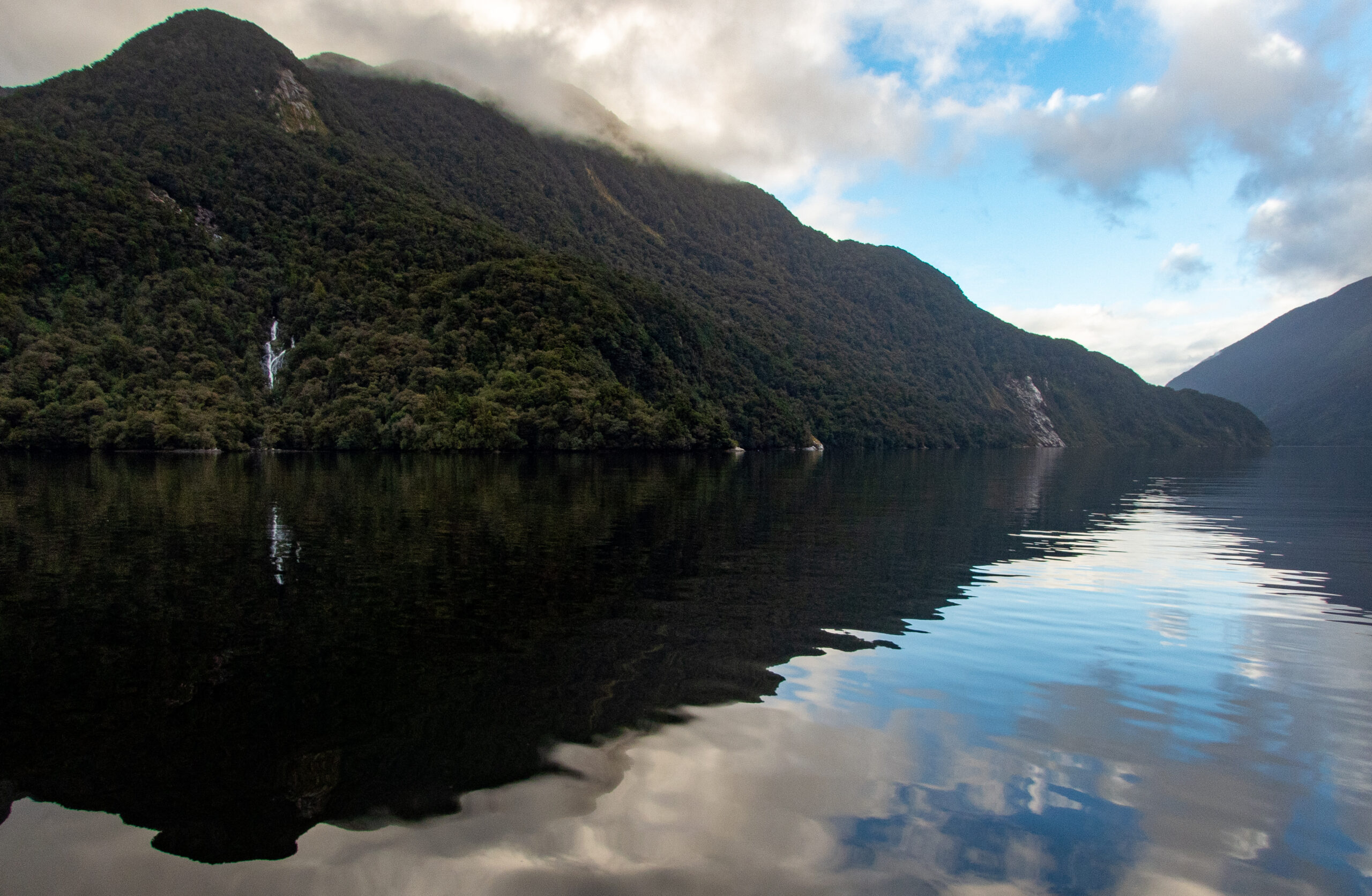
We glided through Thompson Sound early in the am so as to avoid forecasted weather and seas on the outside.On our way out to open ocean. Had to go check out this unusual formation?!What looked like snow was actually bare white stone under shallow rooted vegetation (including trees) which ‘slide’ in big rains.This mauve color was authentic and WOW!The rocks at the fiord ‘mouth’ are always treacherous and we keep PLENTY of distance. This weather is more characteristic of the area than the gorgeous month + we’ve been wildly lucky to enjoy.Of all the fiords, we only skipped Chalky Inlet and Nancy Sound. This was the narrow entrance to Nancy and although you can’t see it in this pic, it looked sufficiently tight and rough to make us feel ok about our earlier decision to give it a miss (based on our need to get to Picton for some much needed boat work before our Fiji passage in June).Charles Sound/Taiporoporo. It had rained the day before, and often we are on the lookout for debris, but this downright tree wasn’t going to be missed! Later, we did hit a log at full speed and never saw it, just heard the dull thud on Allora’s hull 🙁
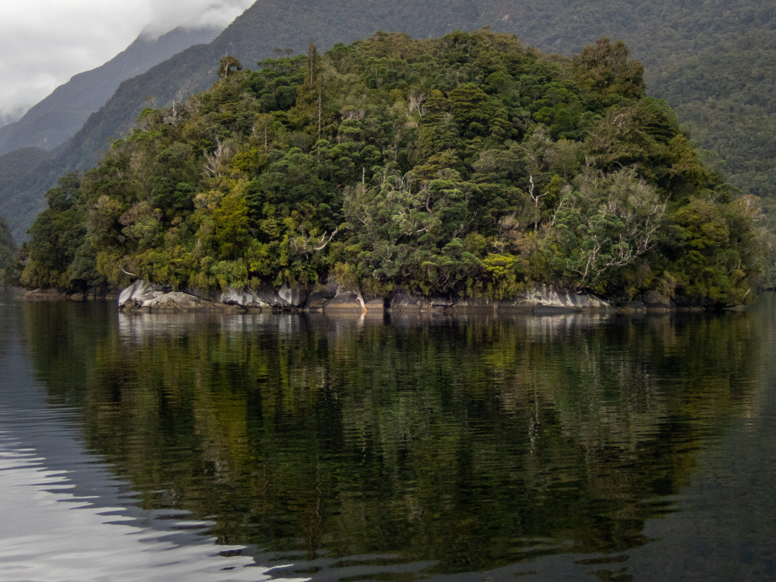
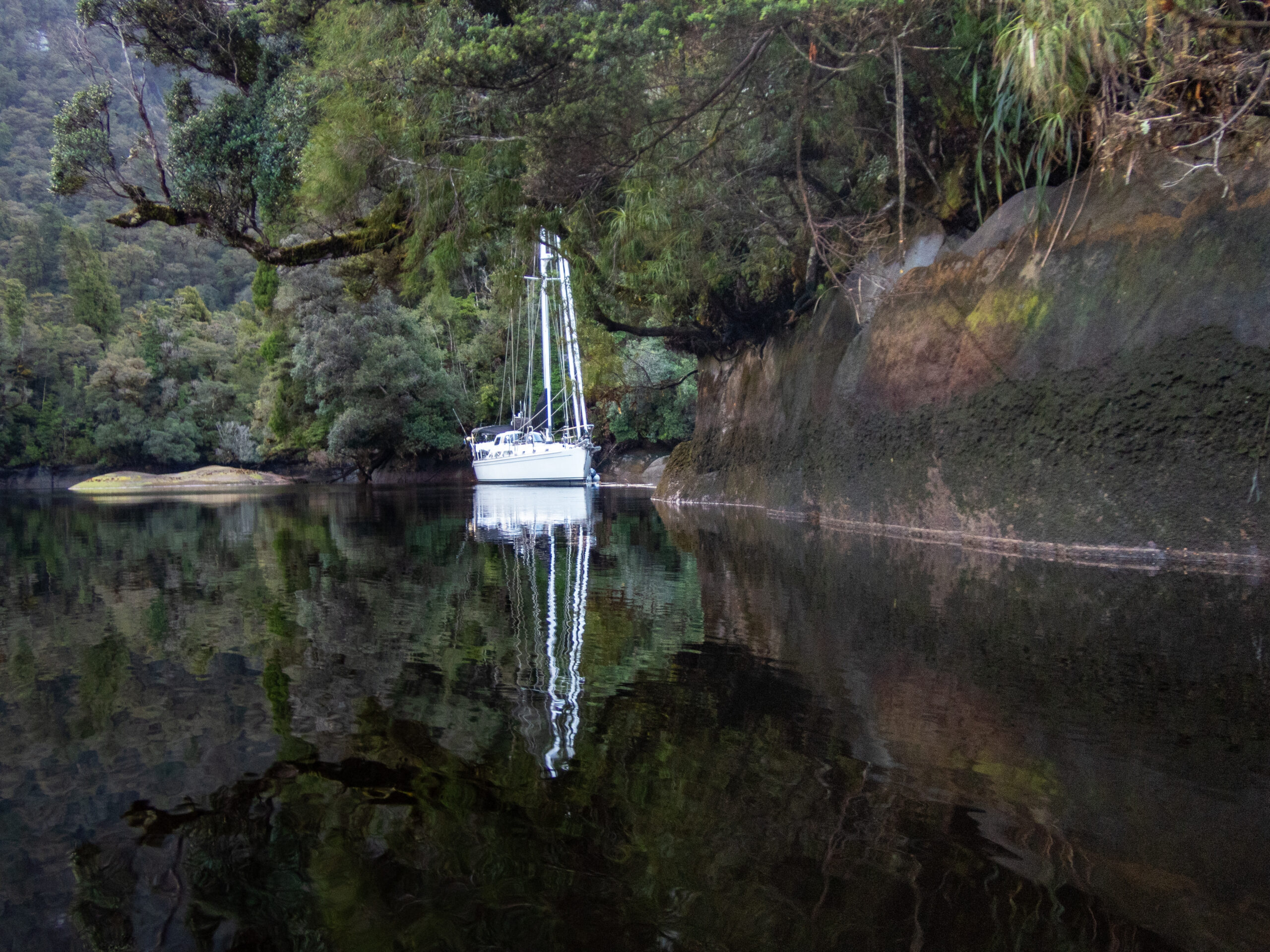
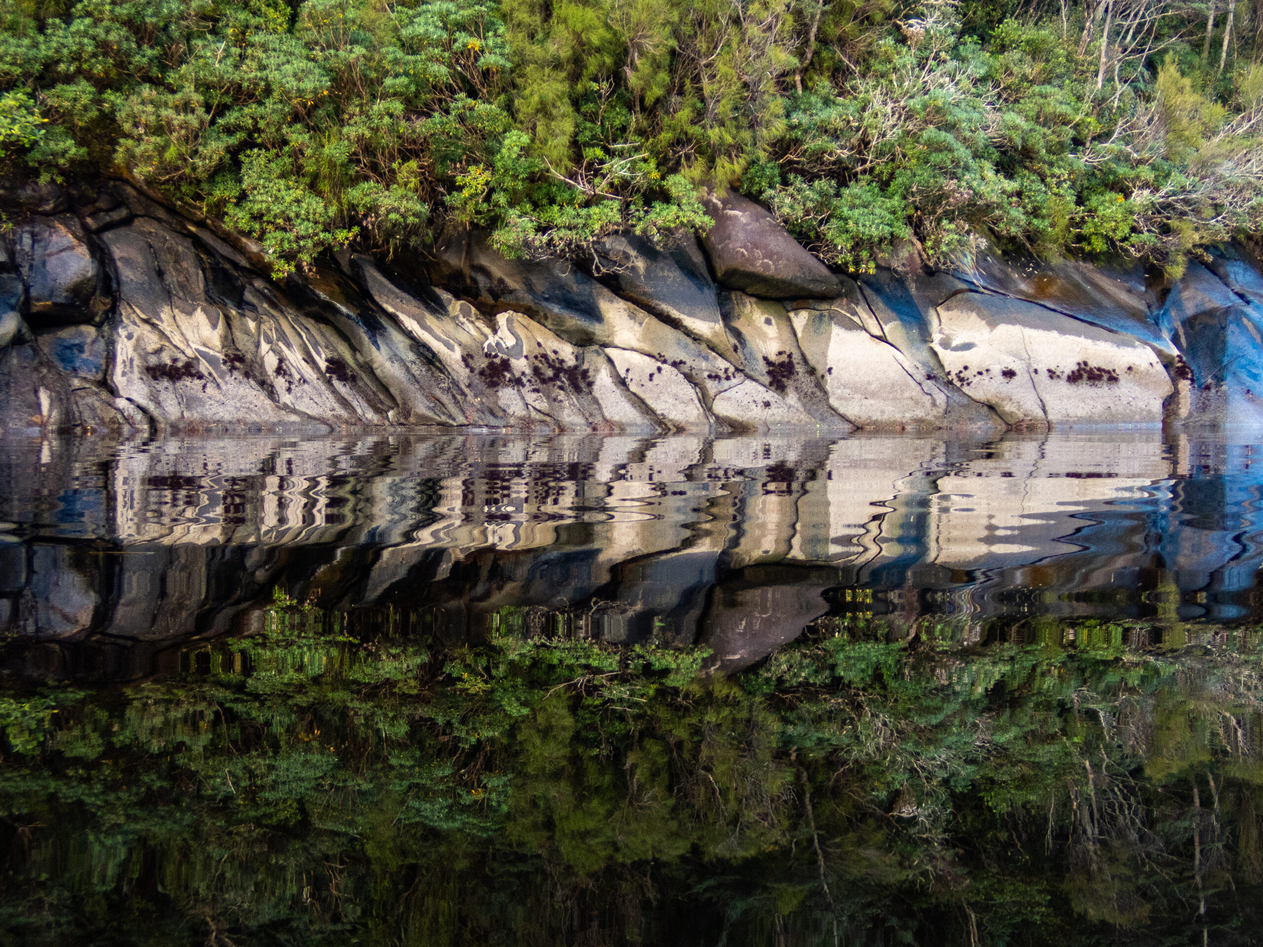
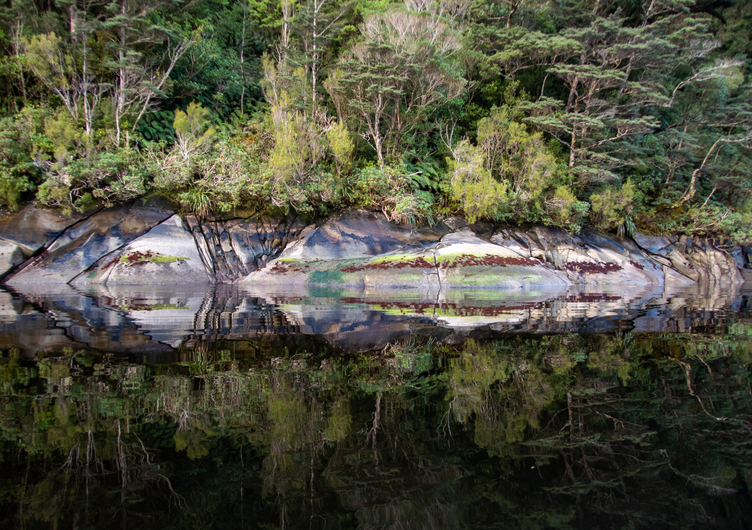
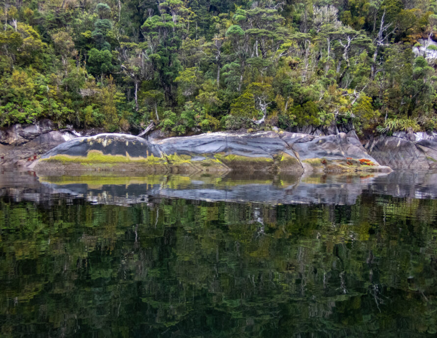
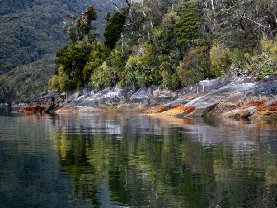
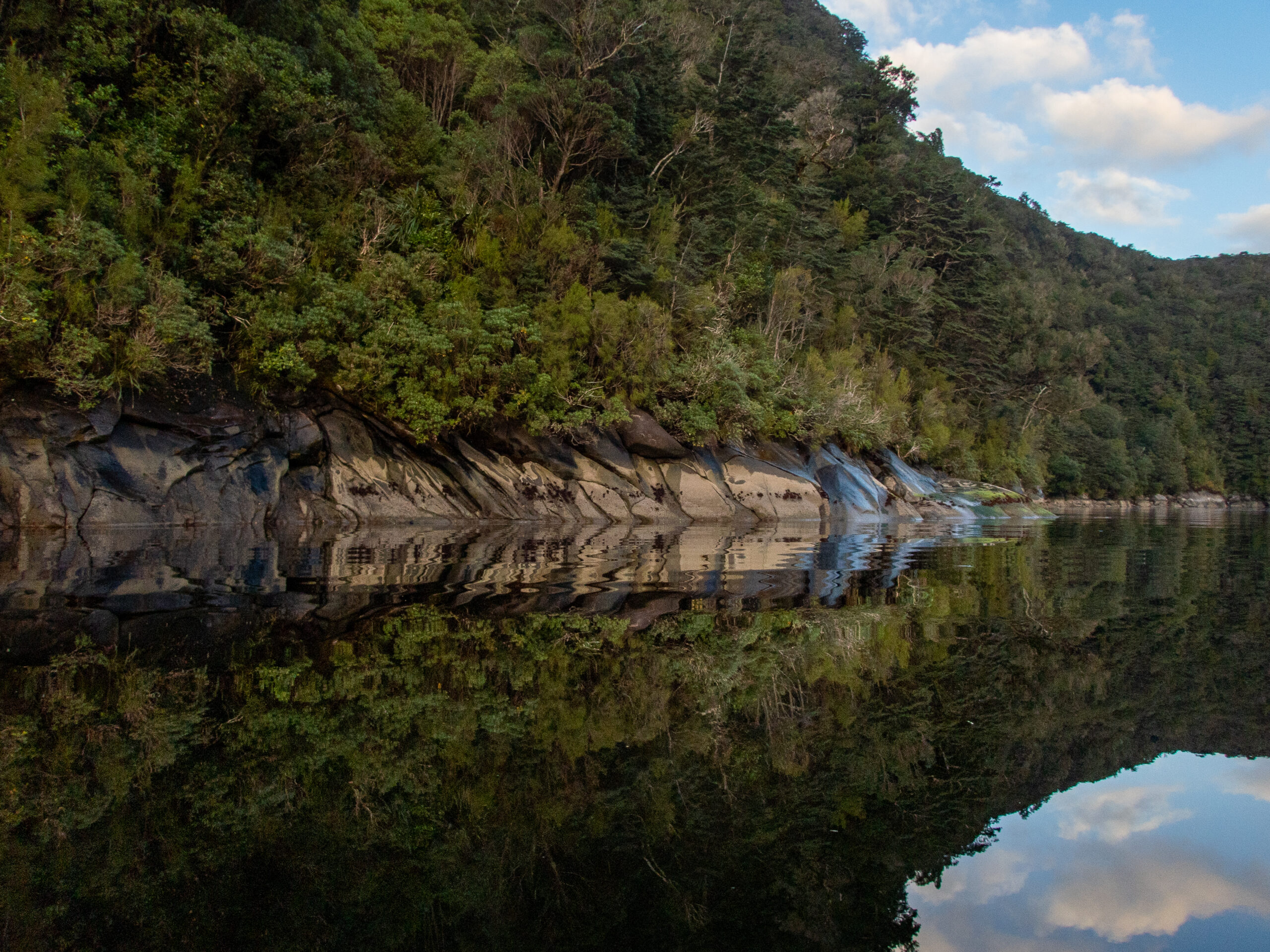
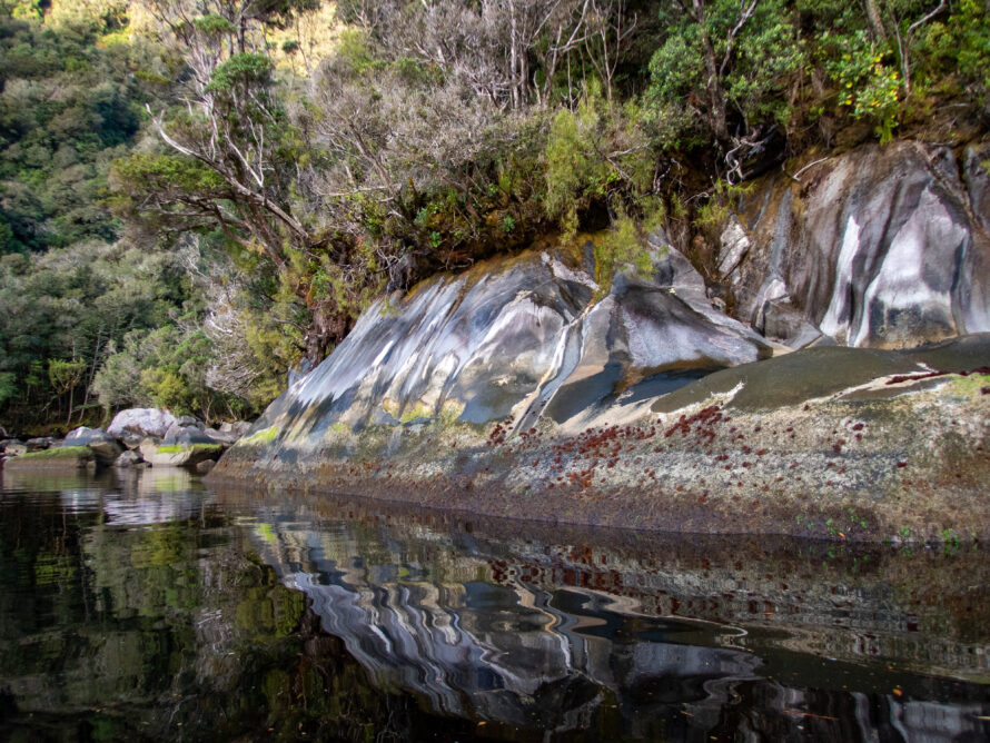
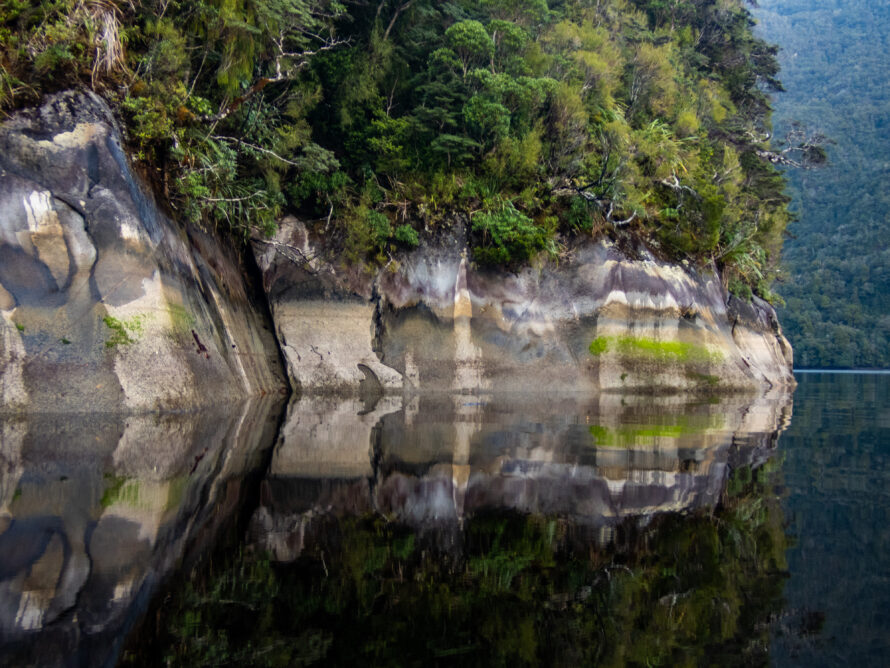
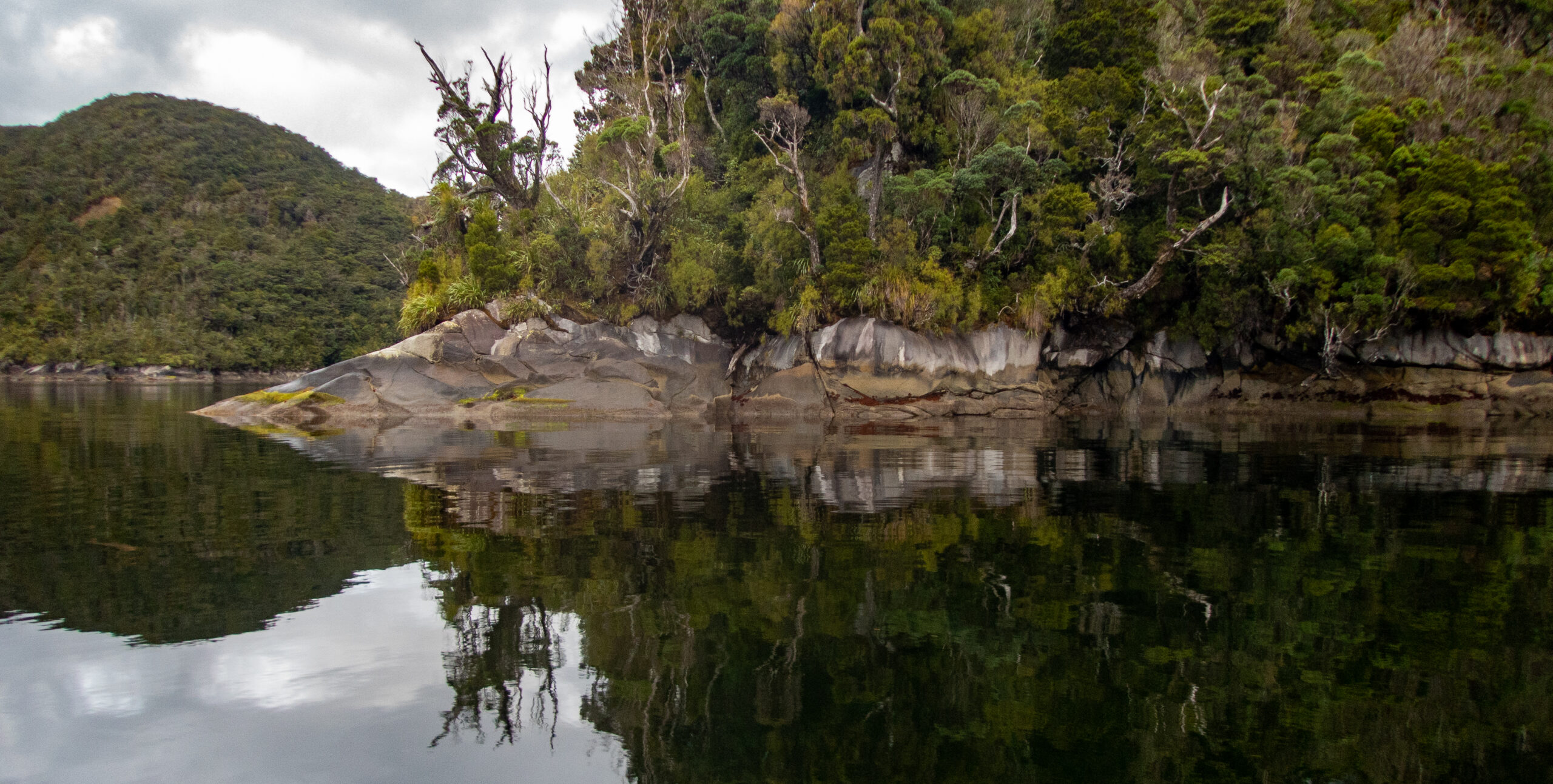
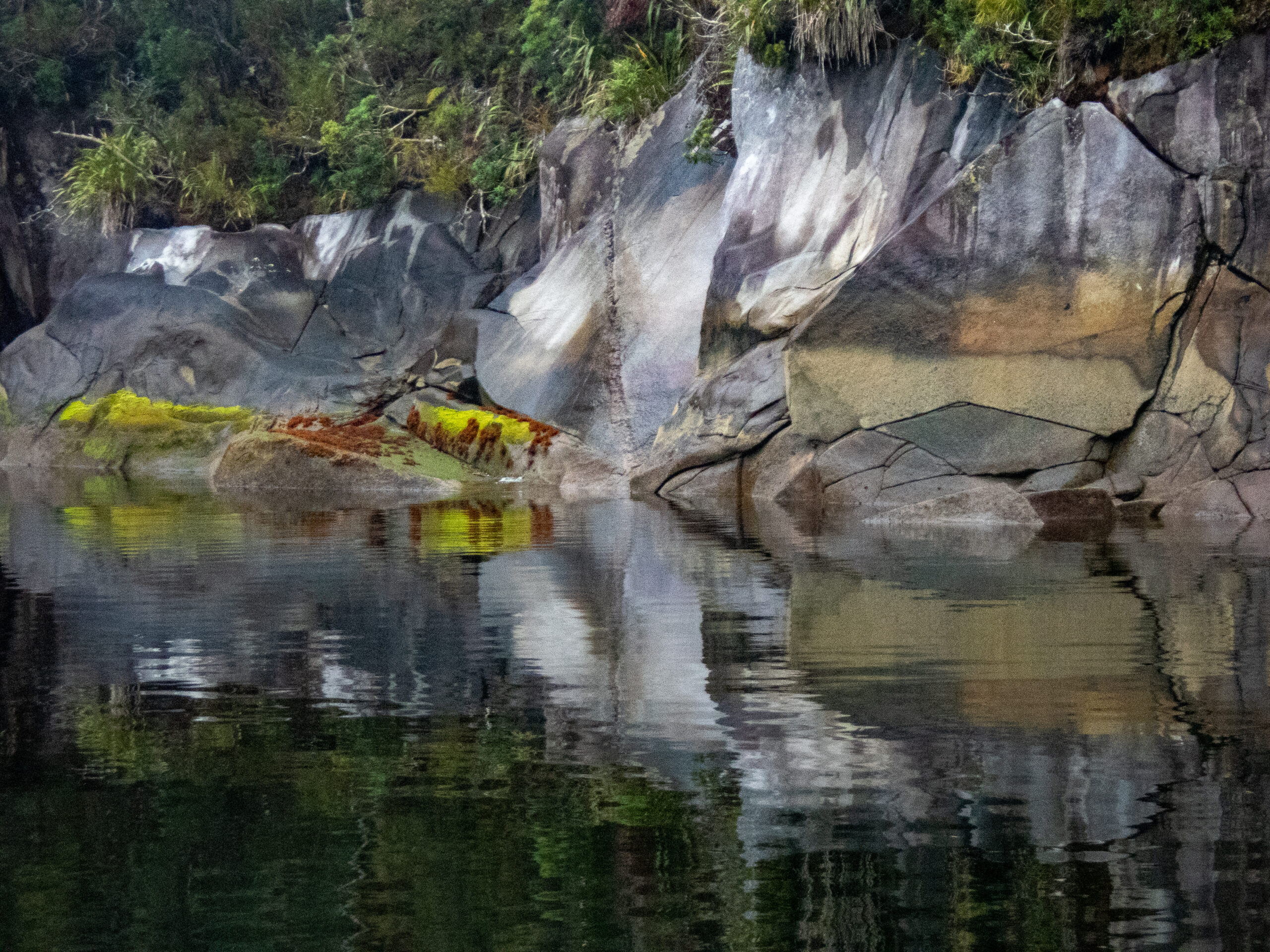
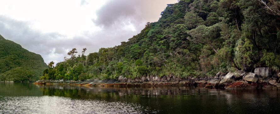
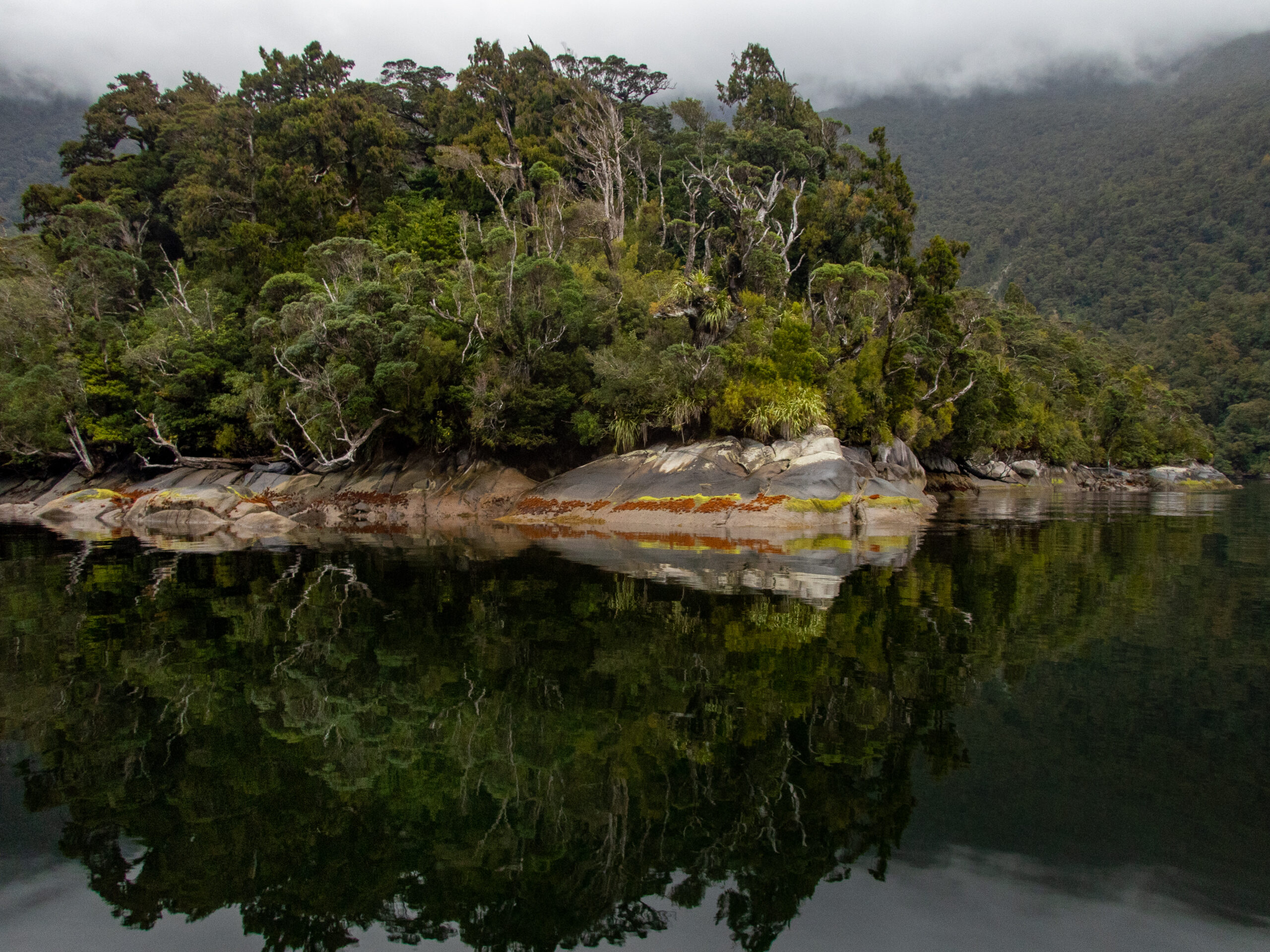
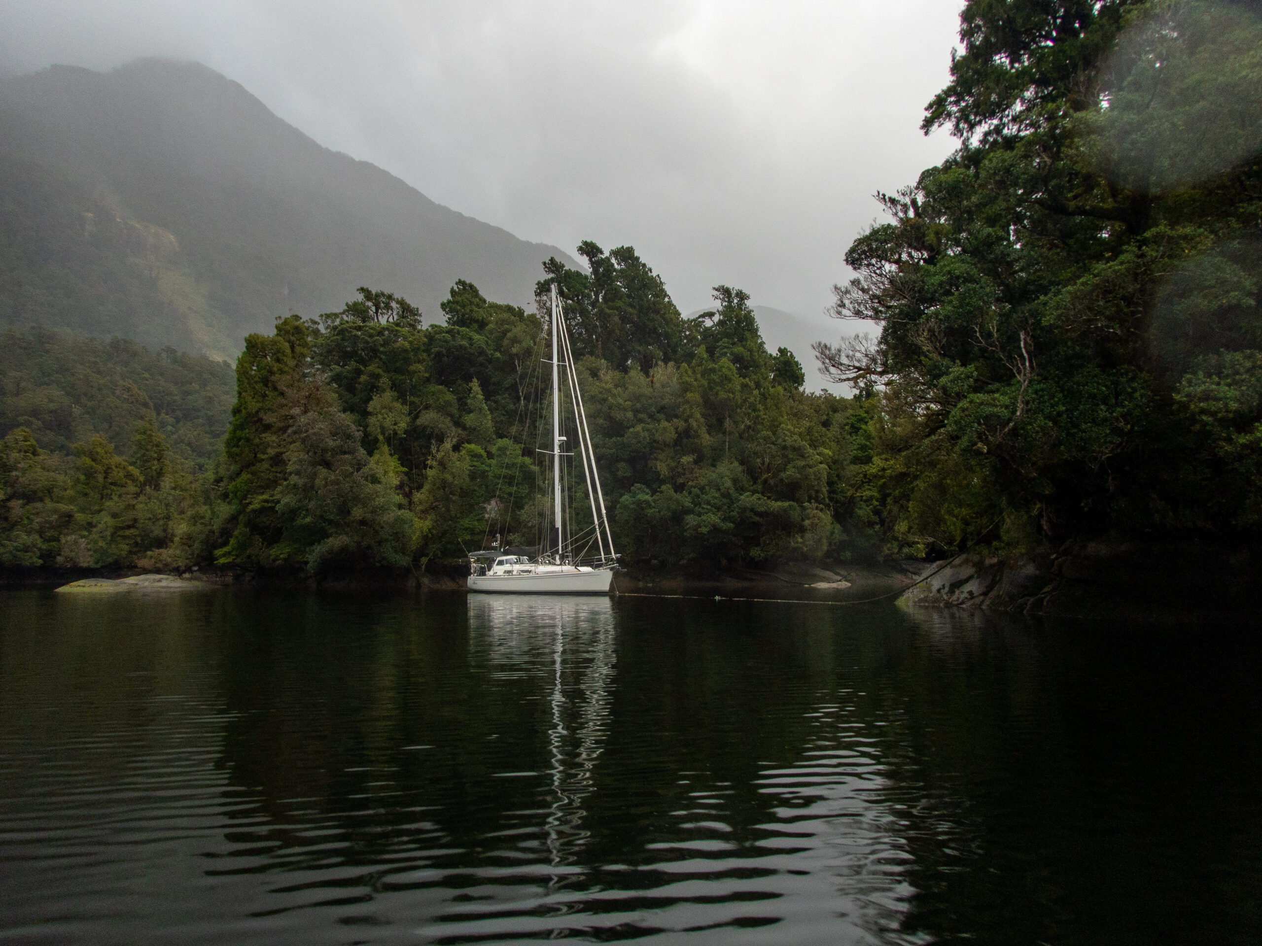
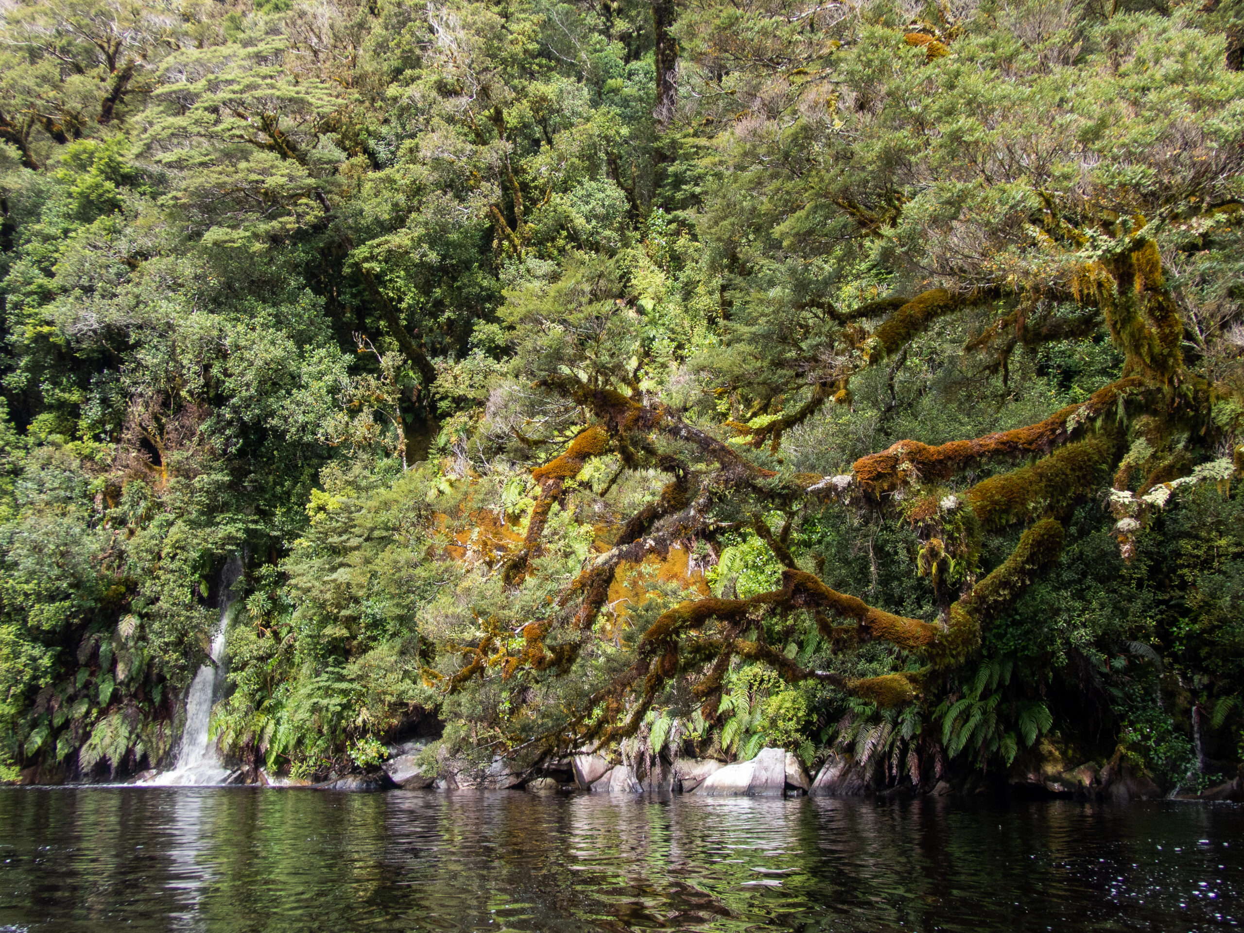
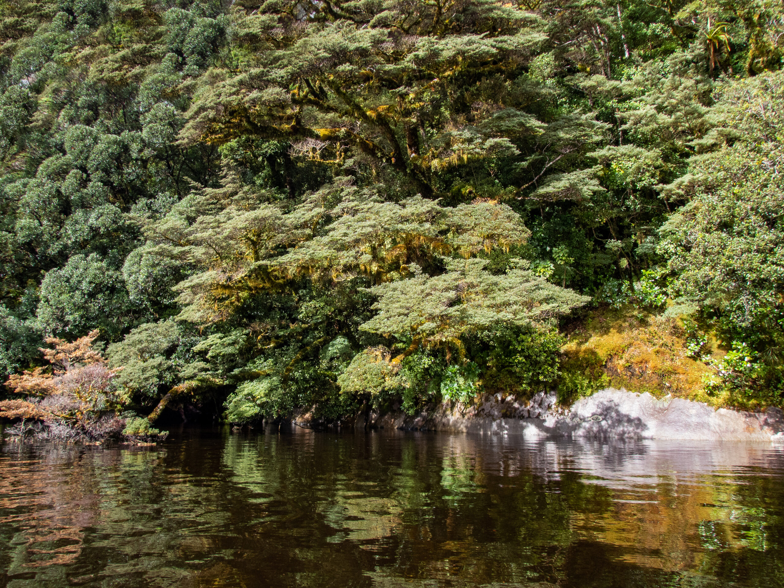
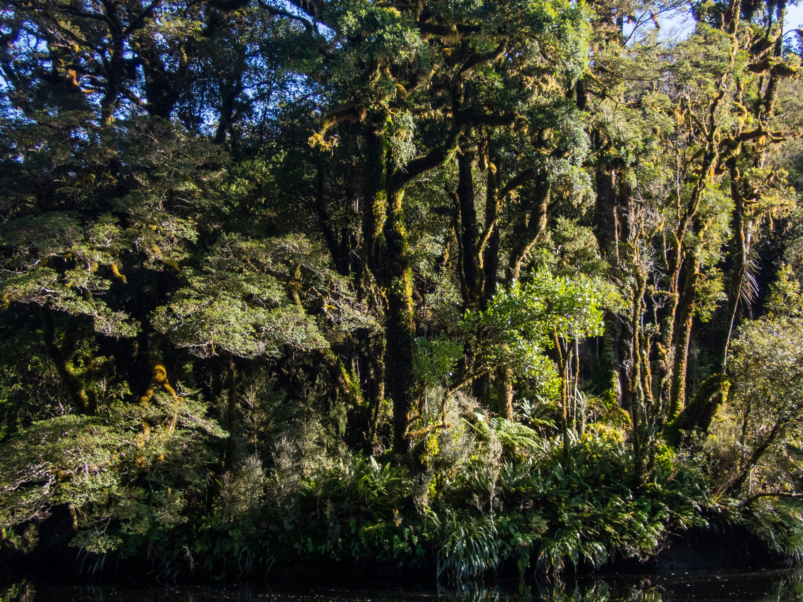
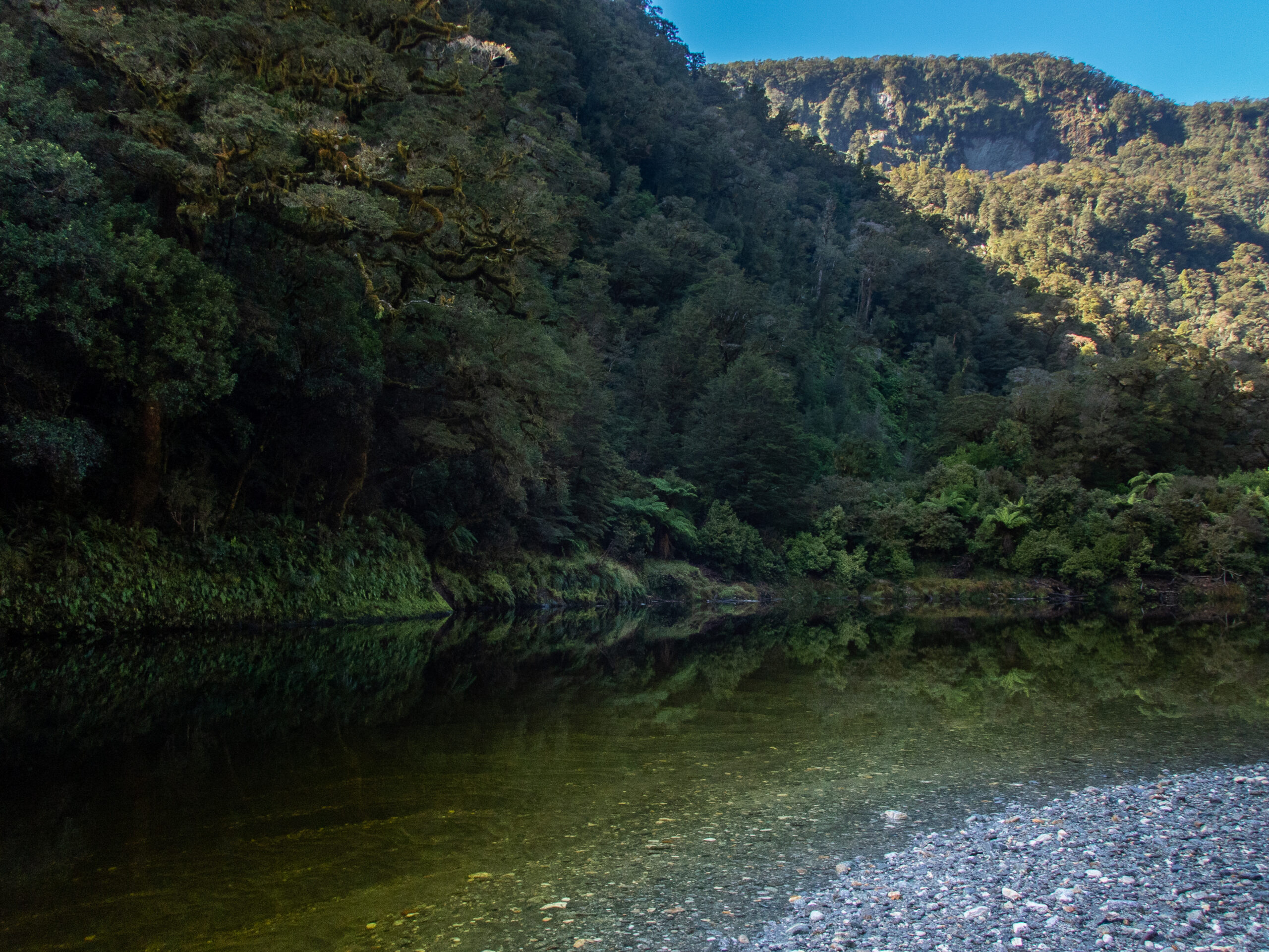
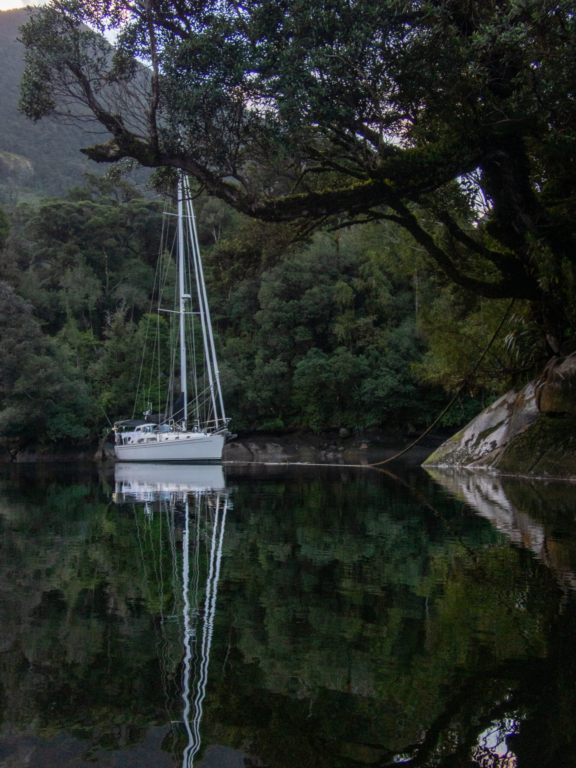
Charles Sound doesn’t have quite the extensive ‘tentacles’ as Doubtful or Dusky – there are only two! We chose Gold Arm and found such a dear spot for Allora just through this narrow gap, behind Catherine Island. There was a fisherman’s line in place, so we pulled right up alongside it and secured Allora at all 3 cleats, Voilá! (No anchor.)Birdsong and sandflies aplenty!The shoreline of Charles is entrancing!
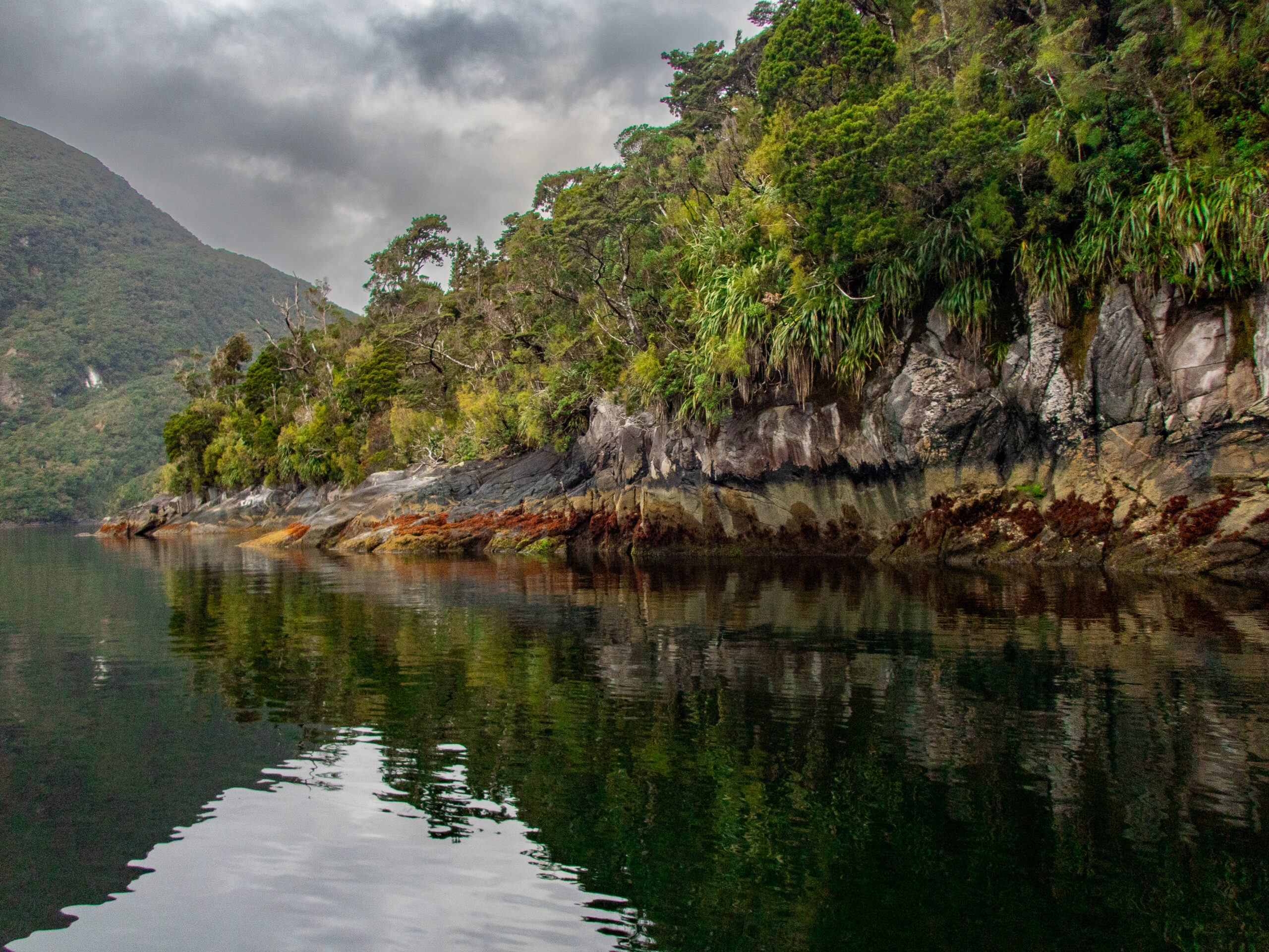
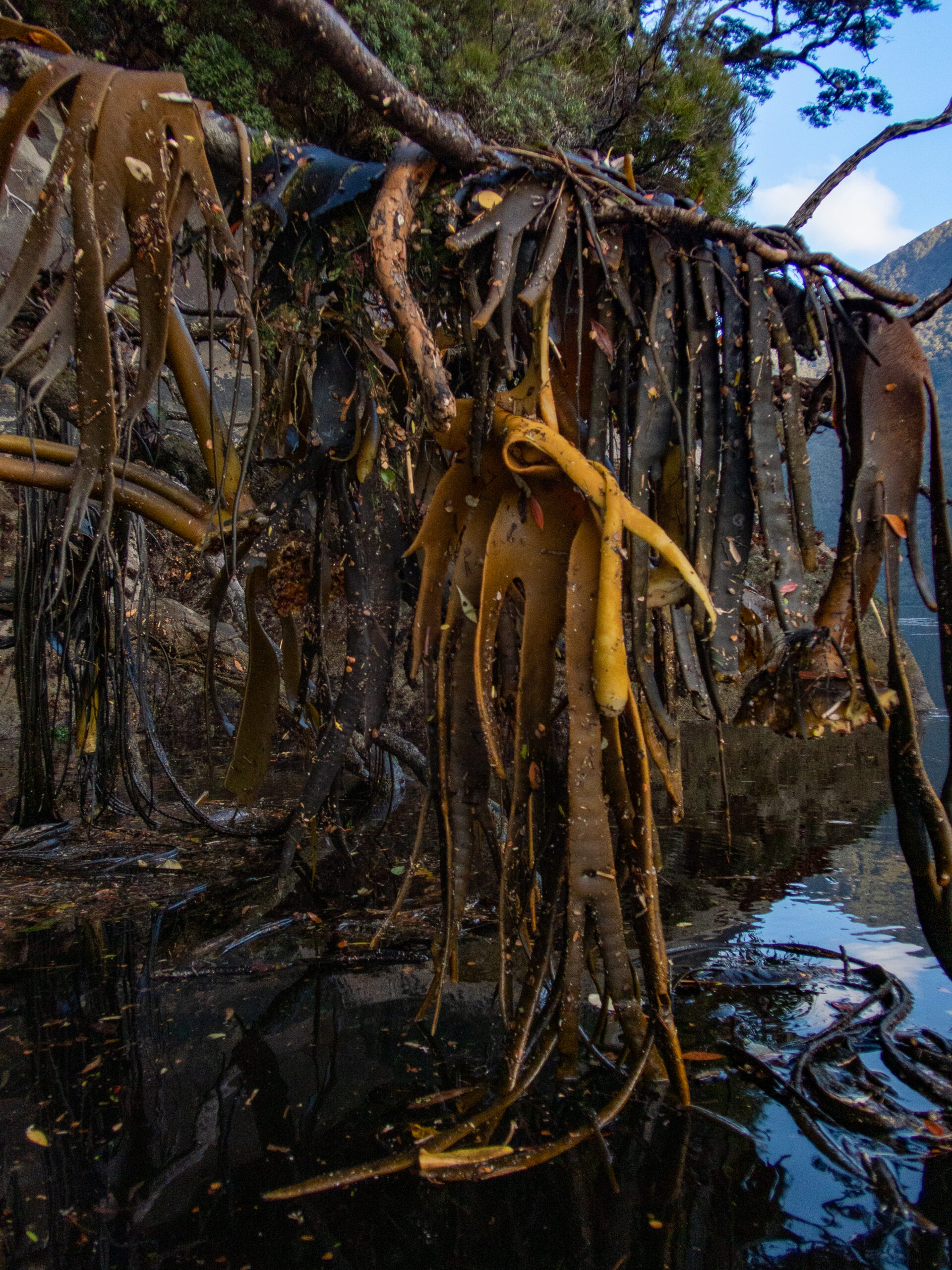
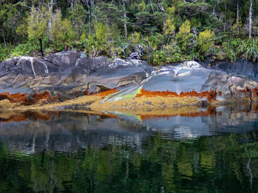
Seaweed left high and dry on display at low tide.
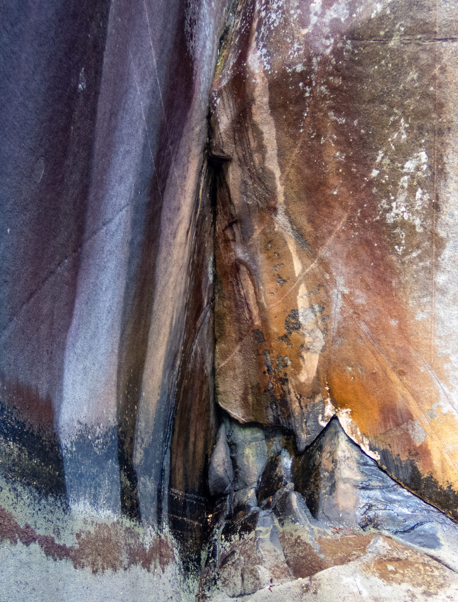
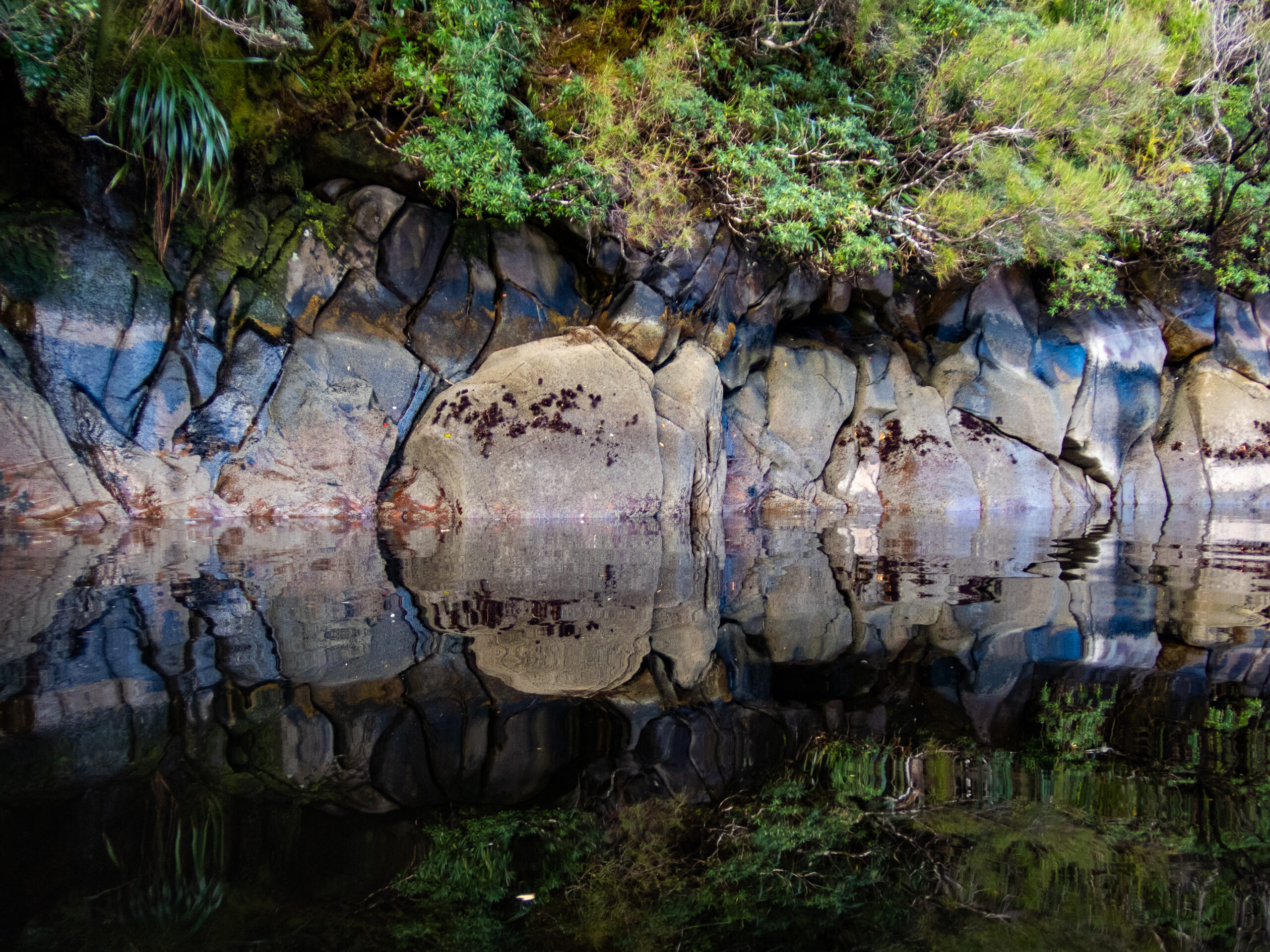
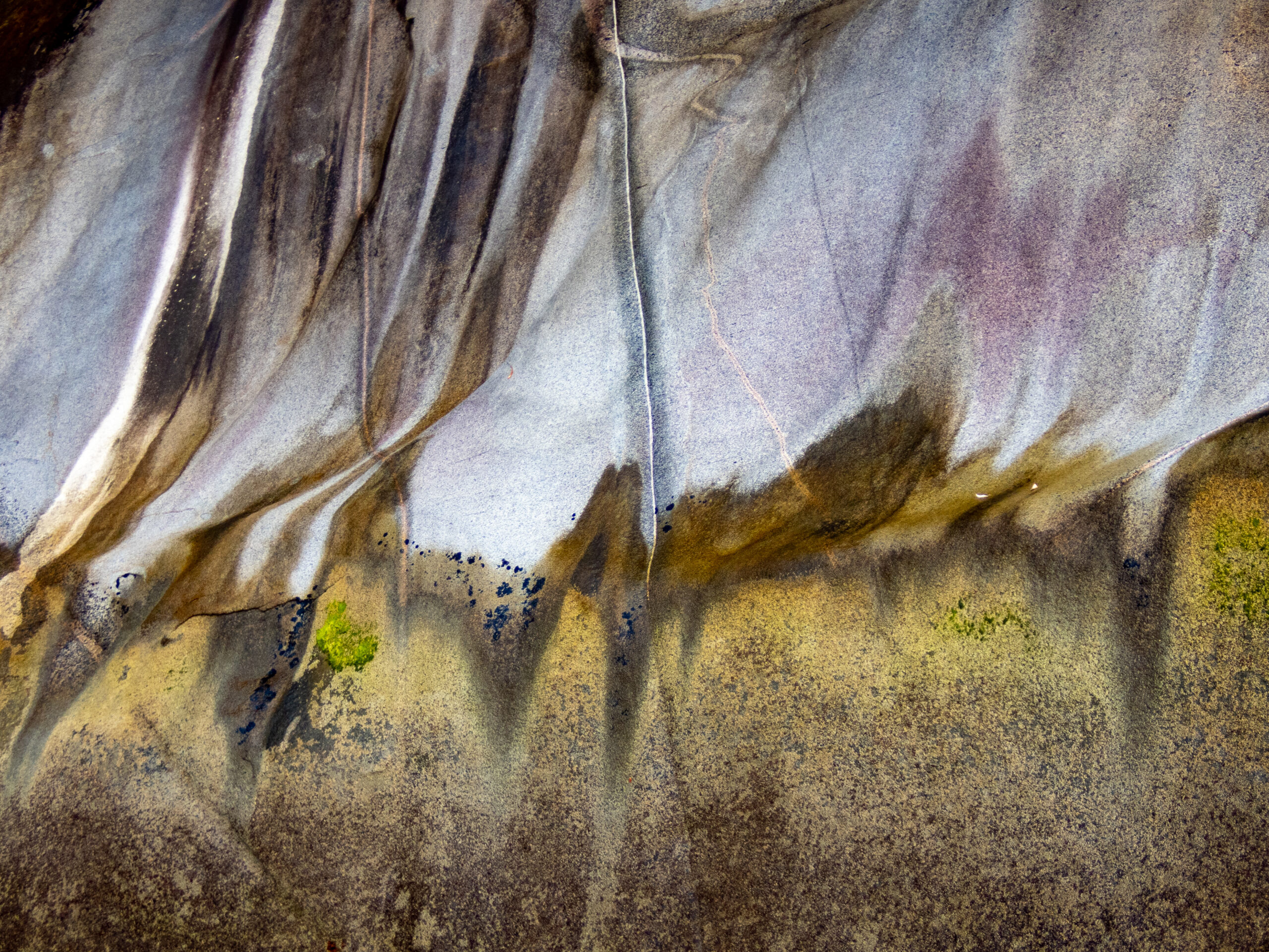
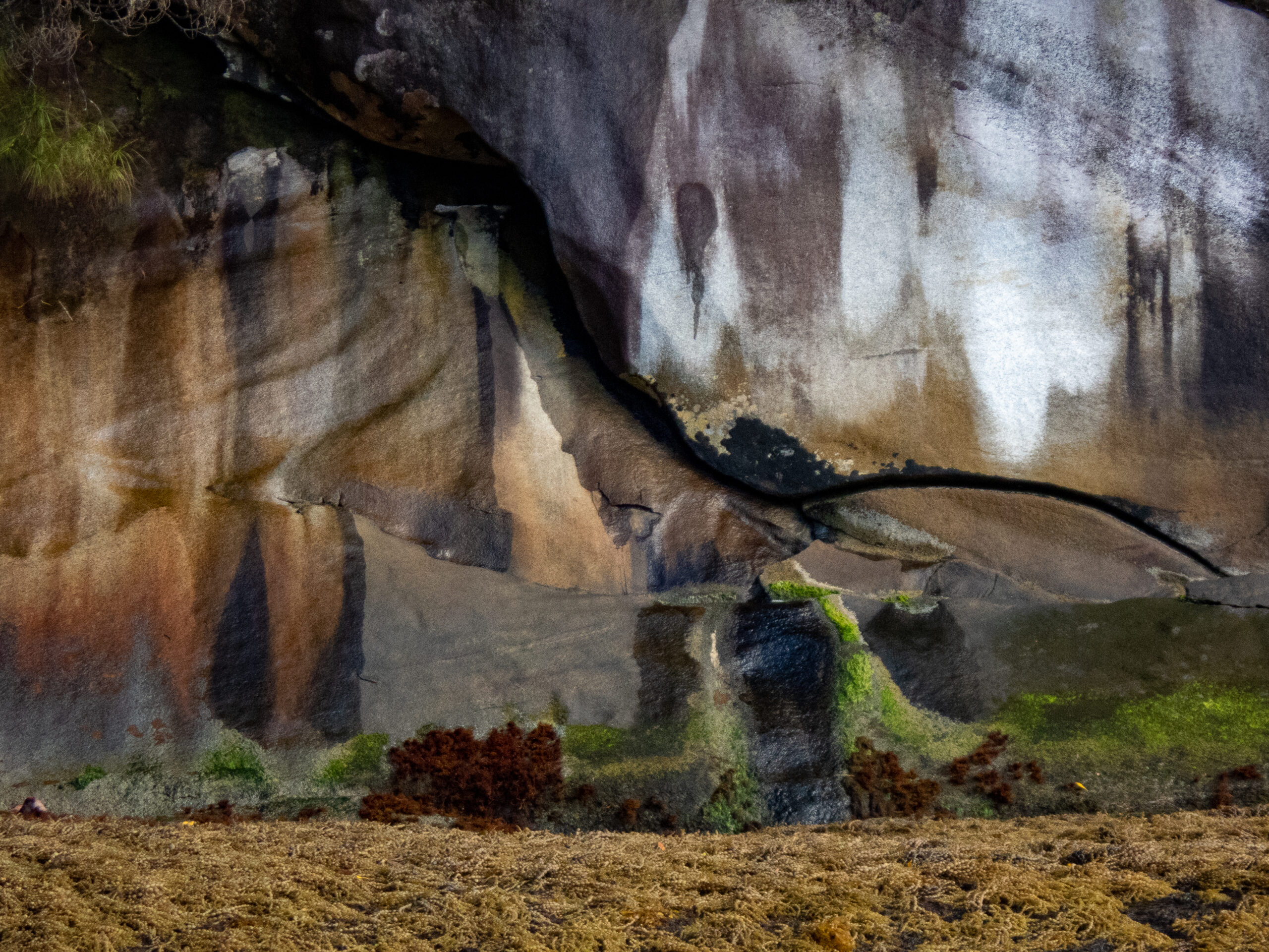
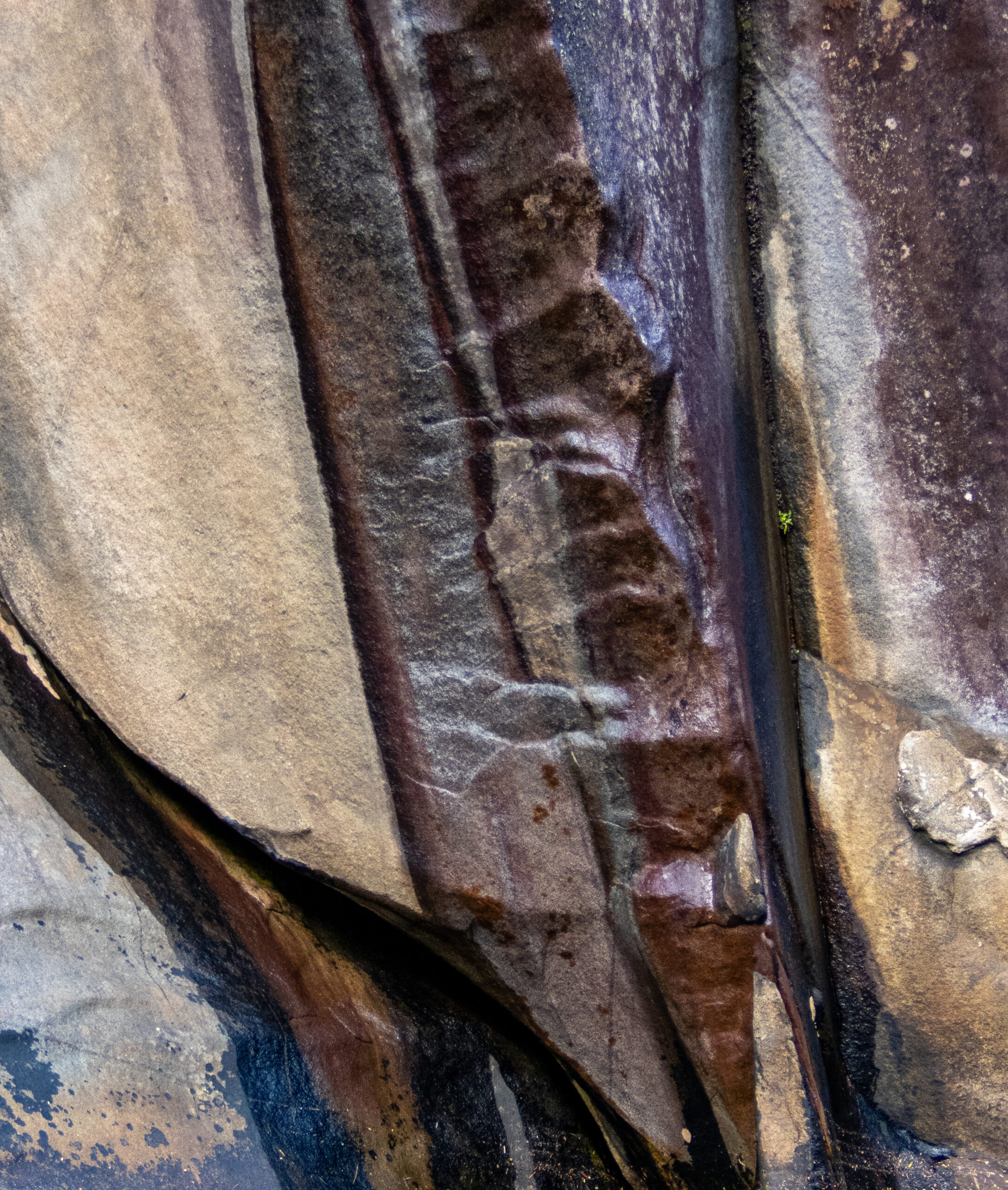
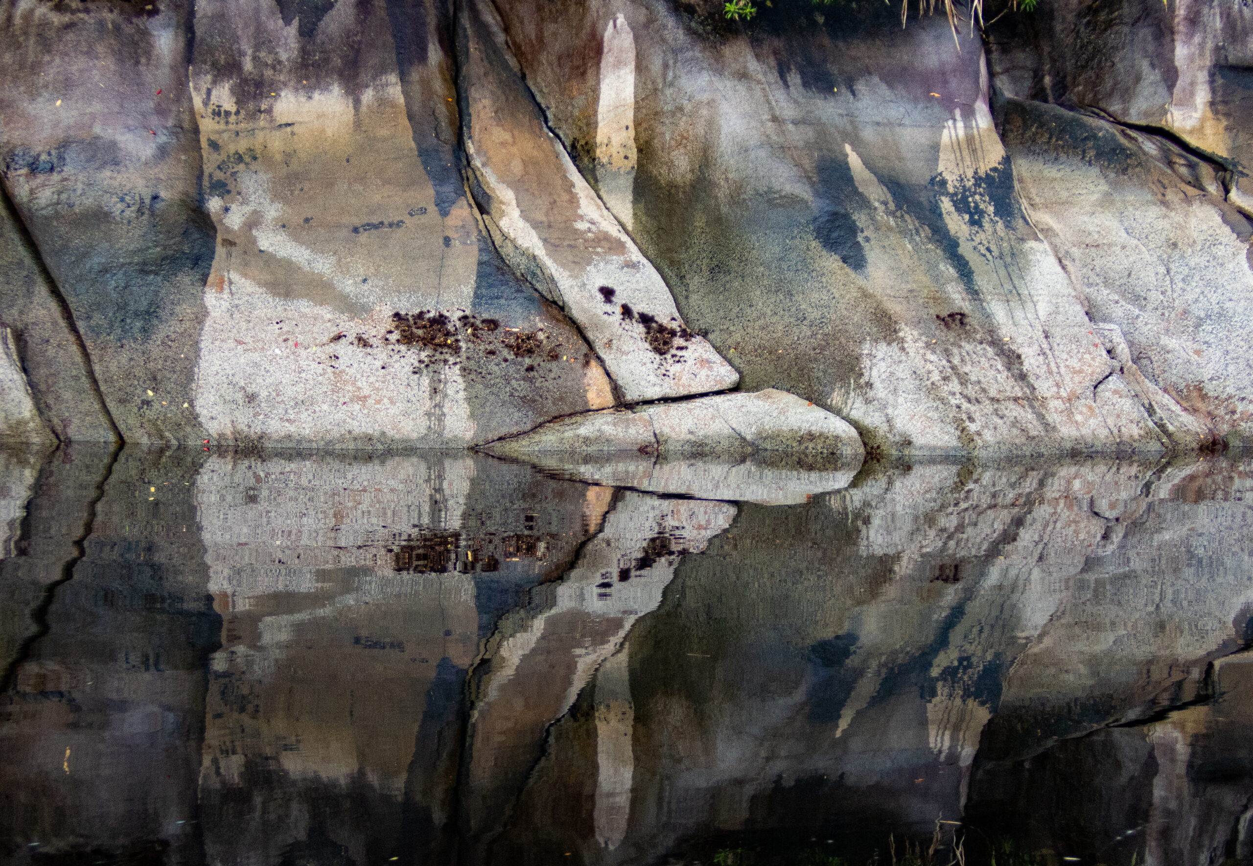
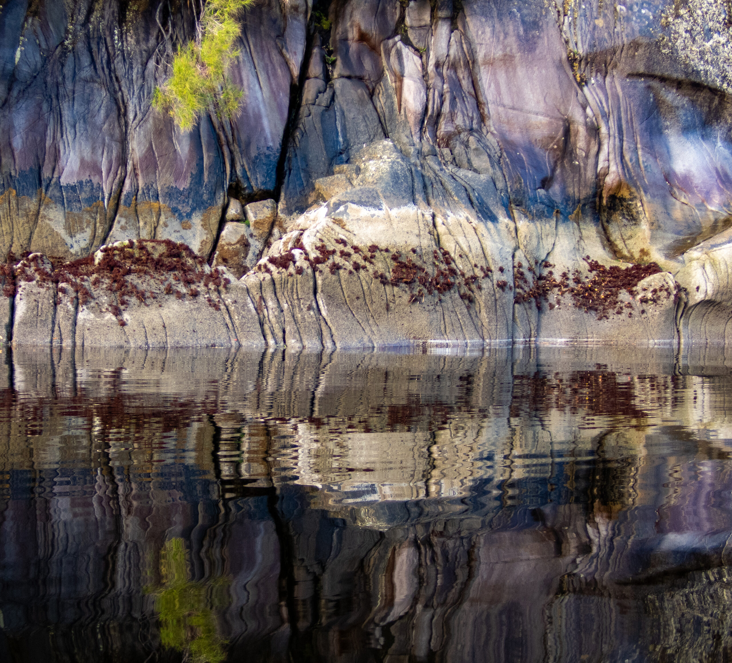
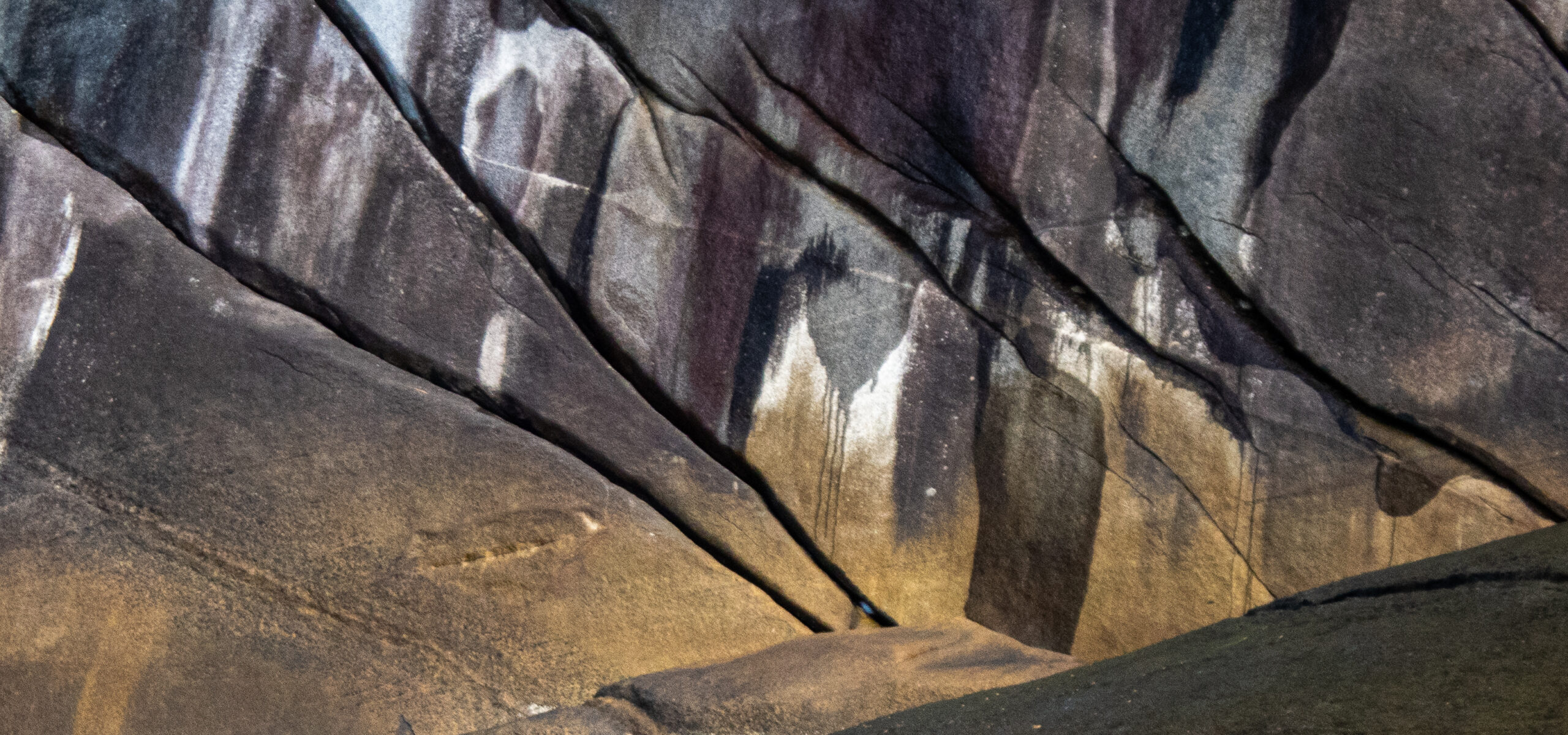
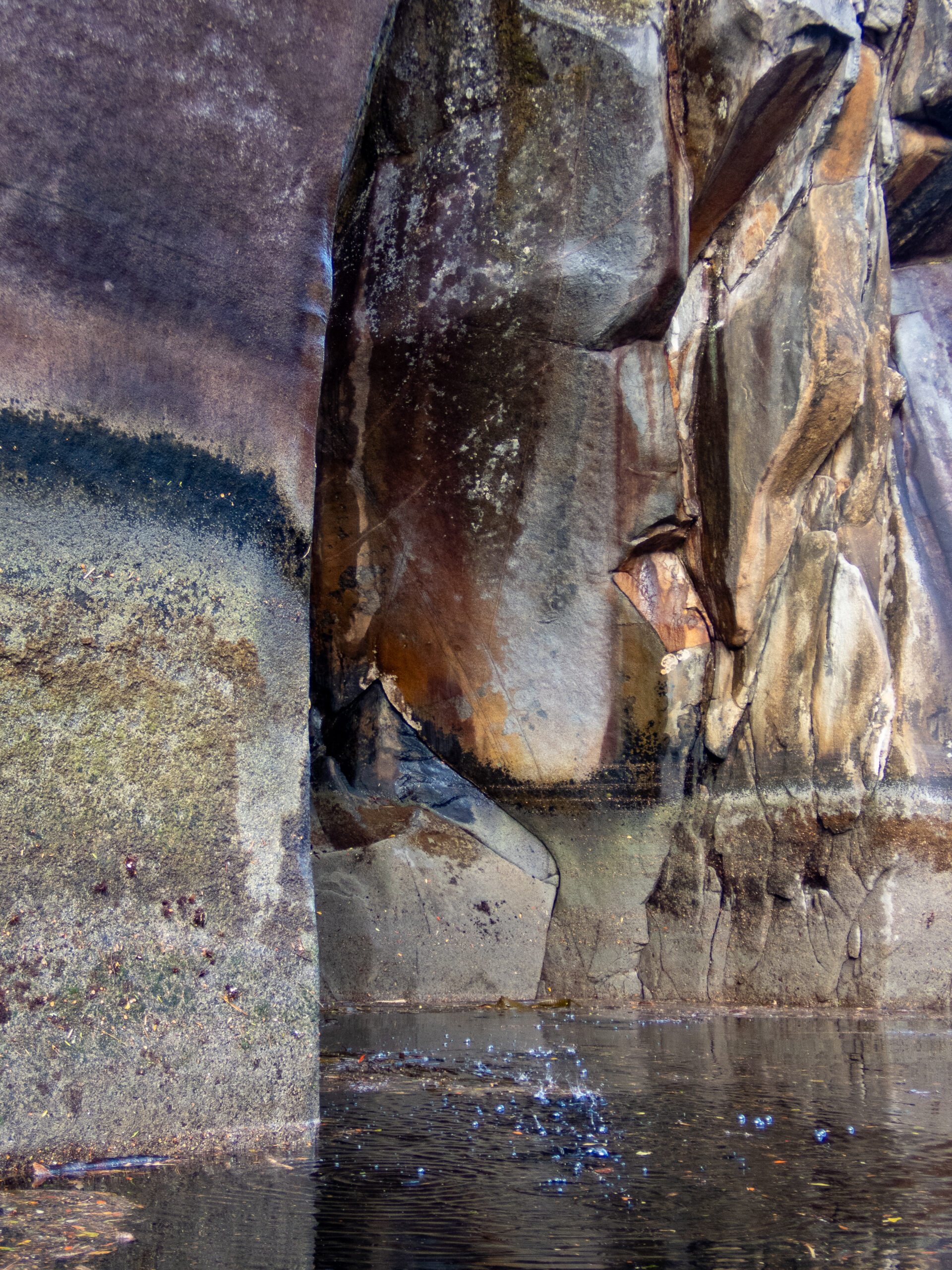
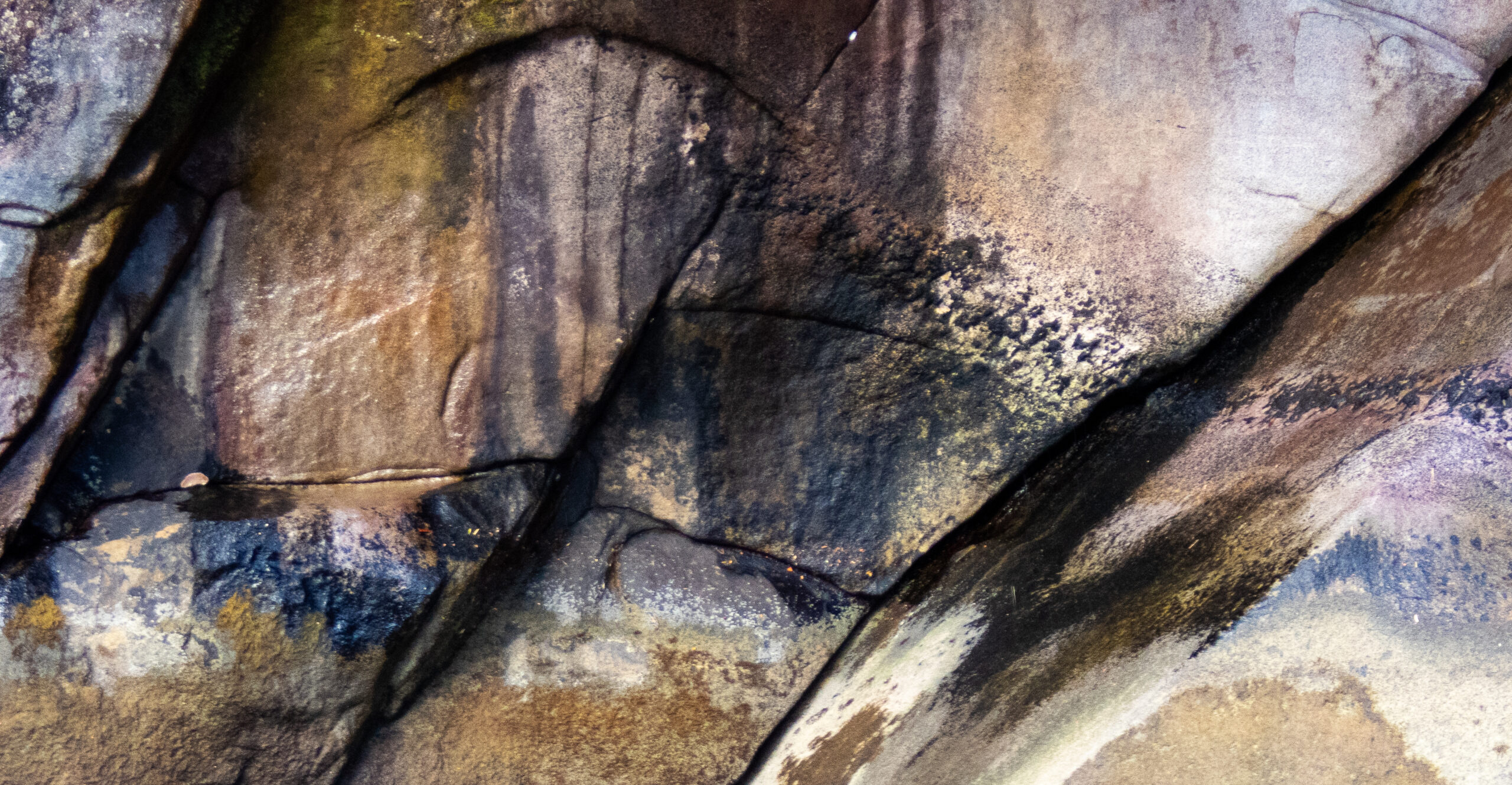
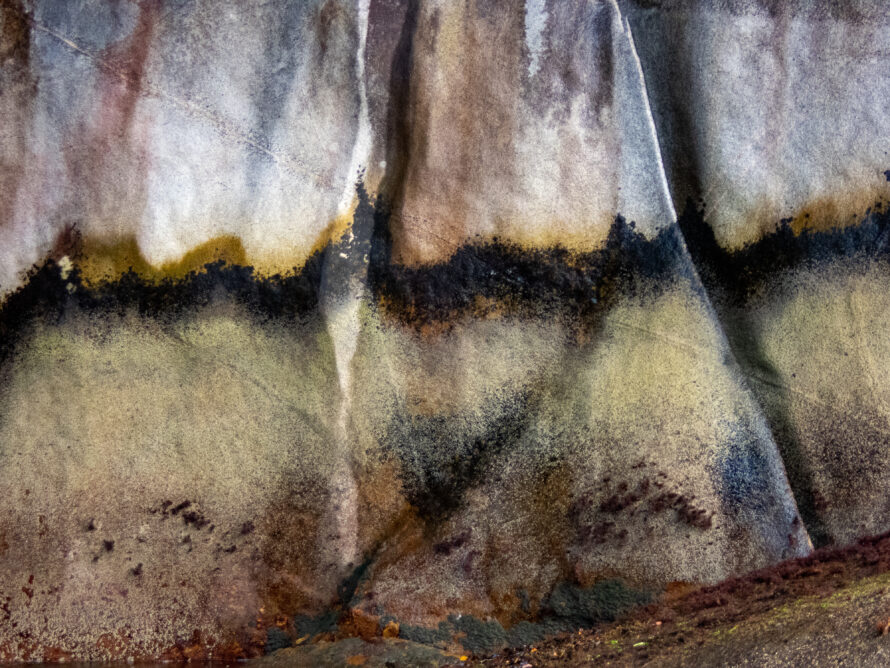
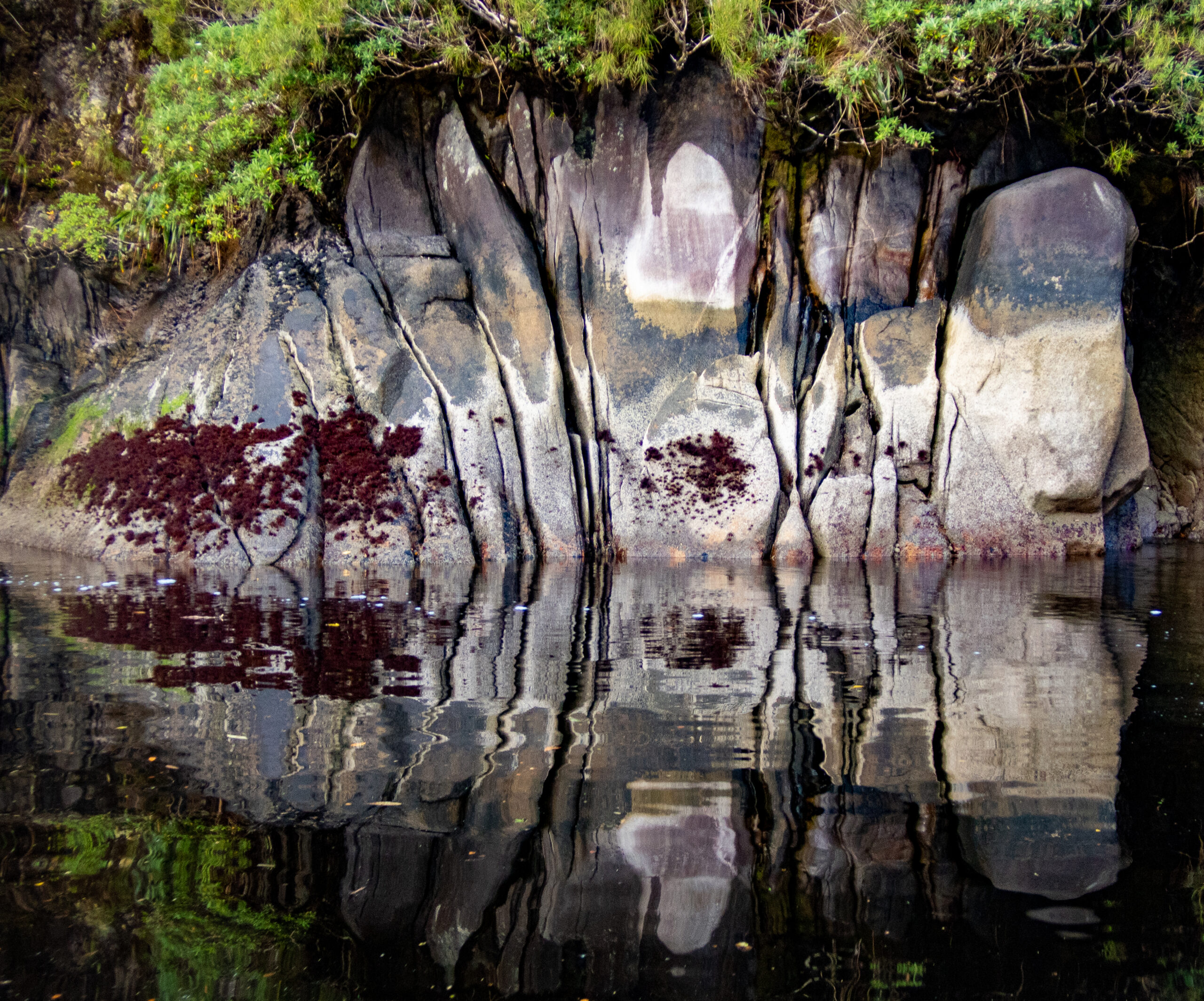
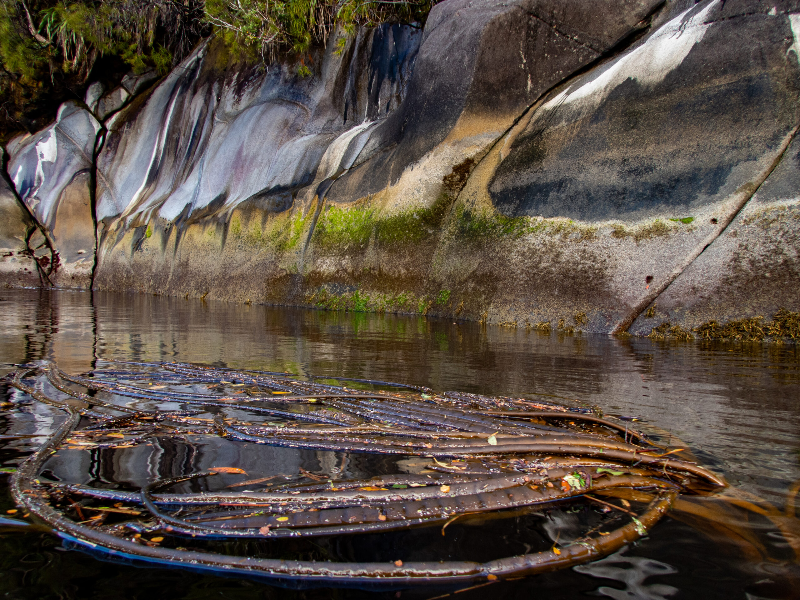
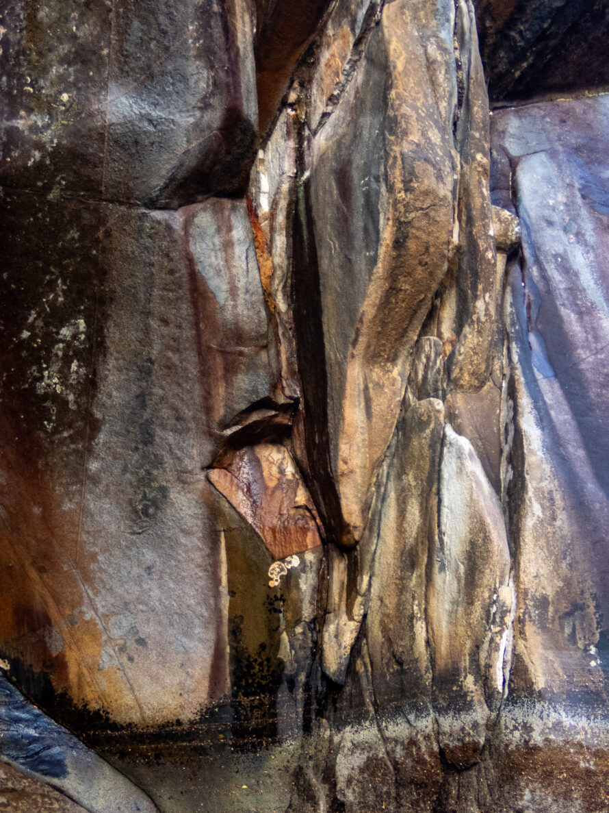
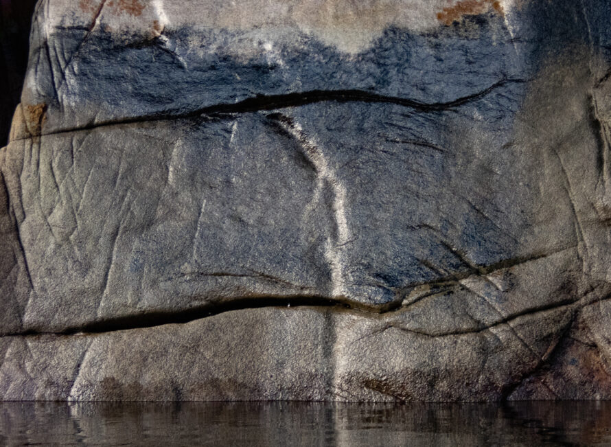
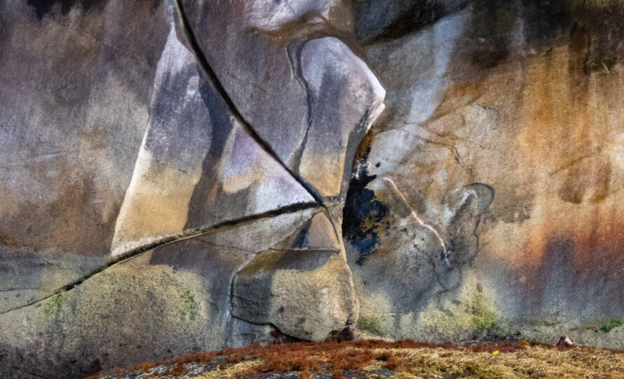
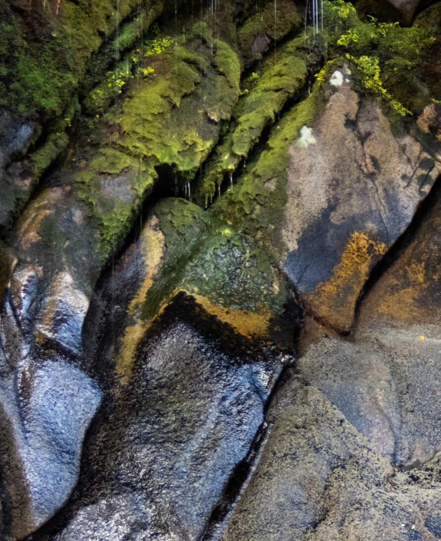
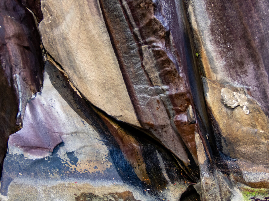
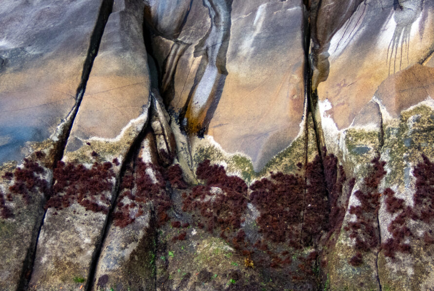
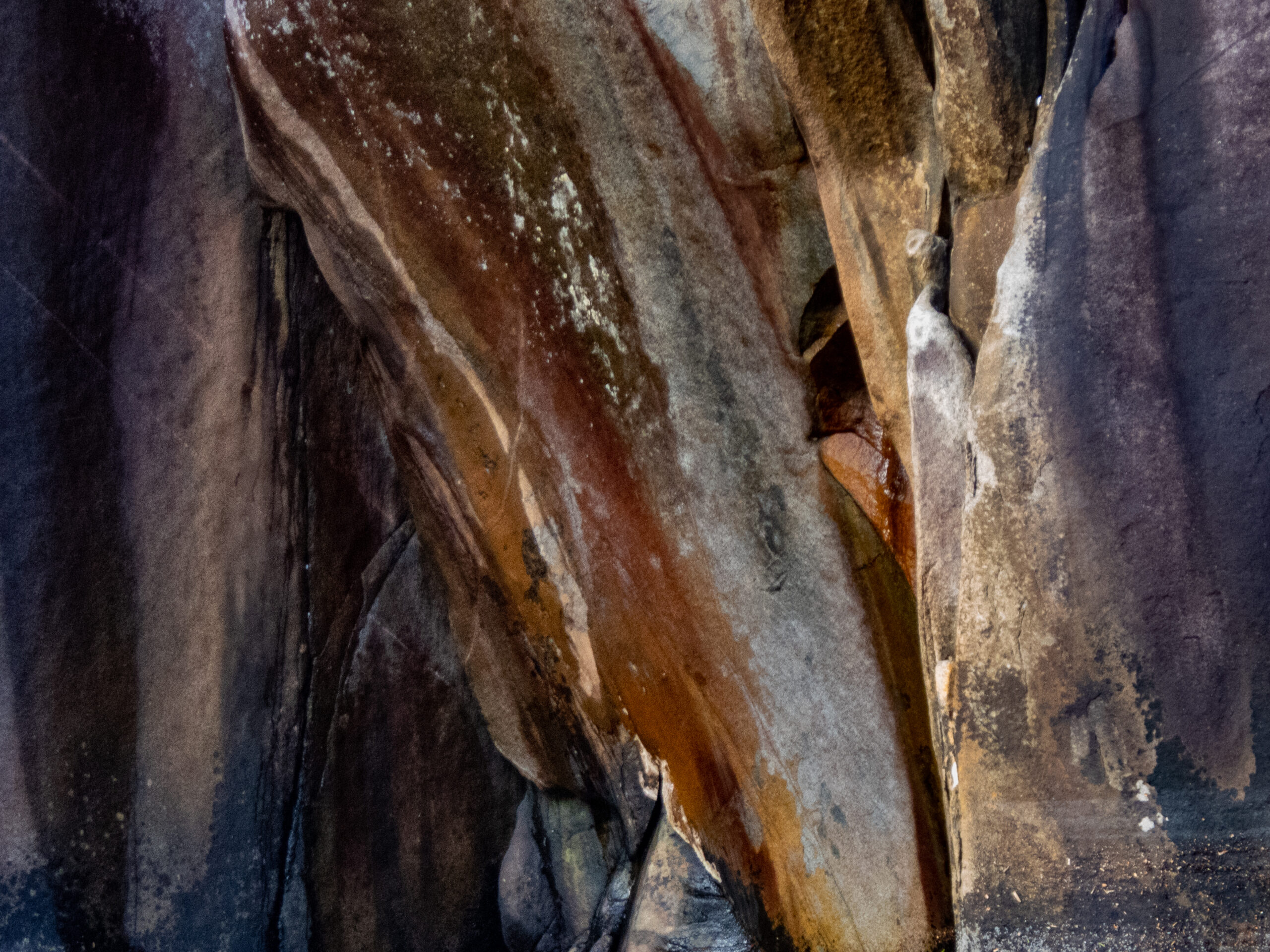
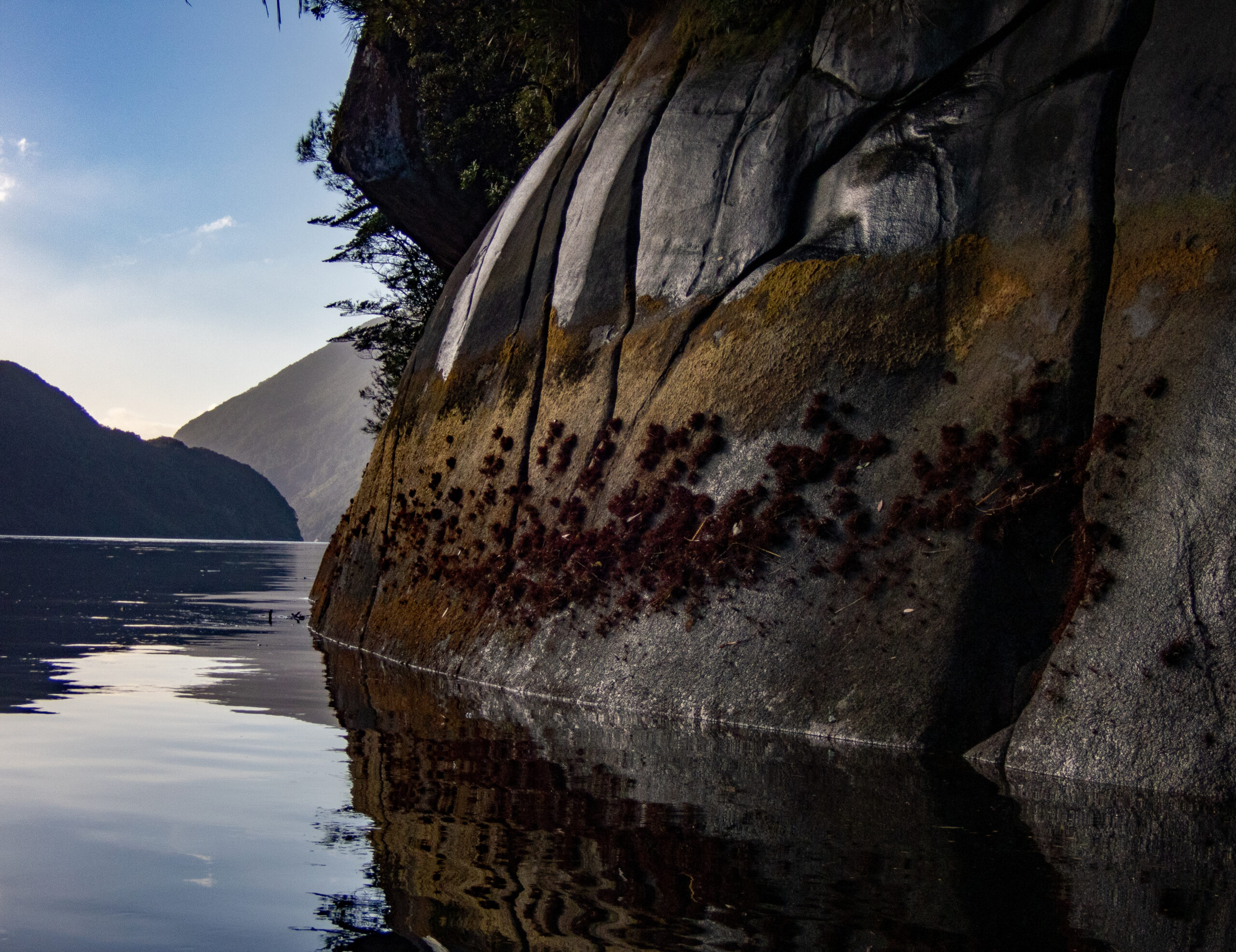
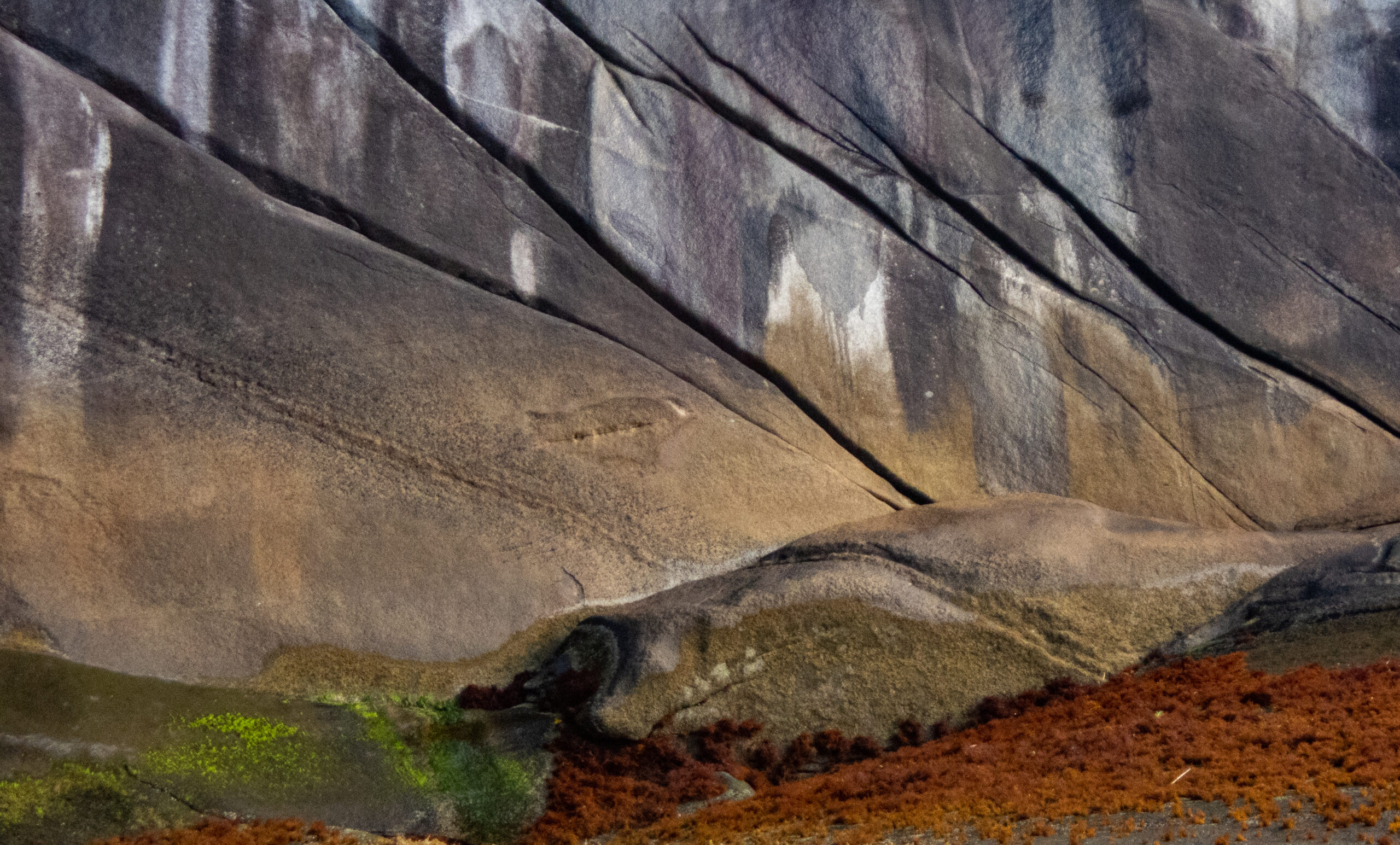
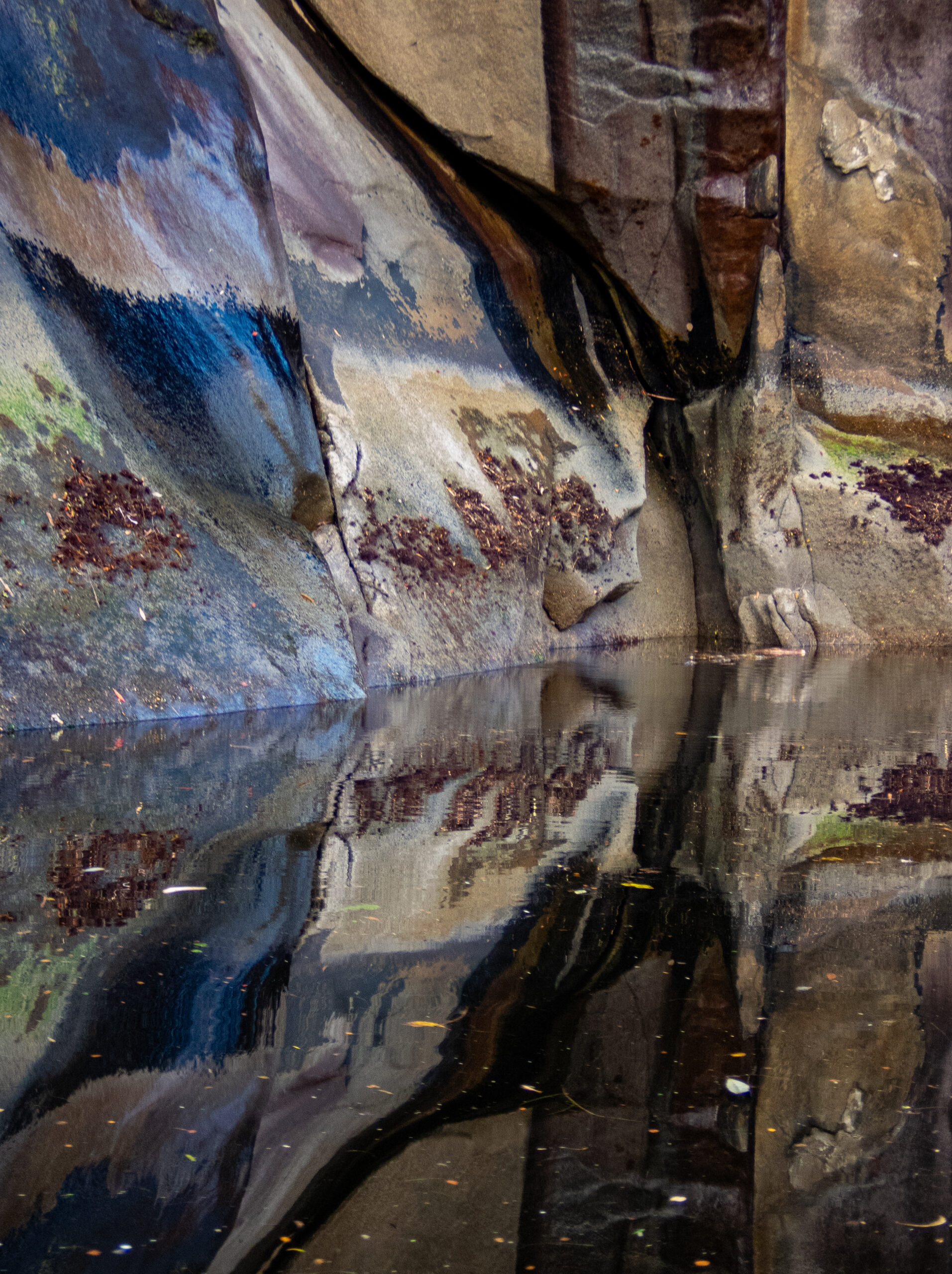
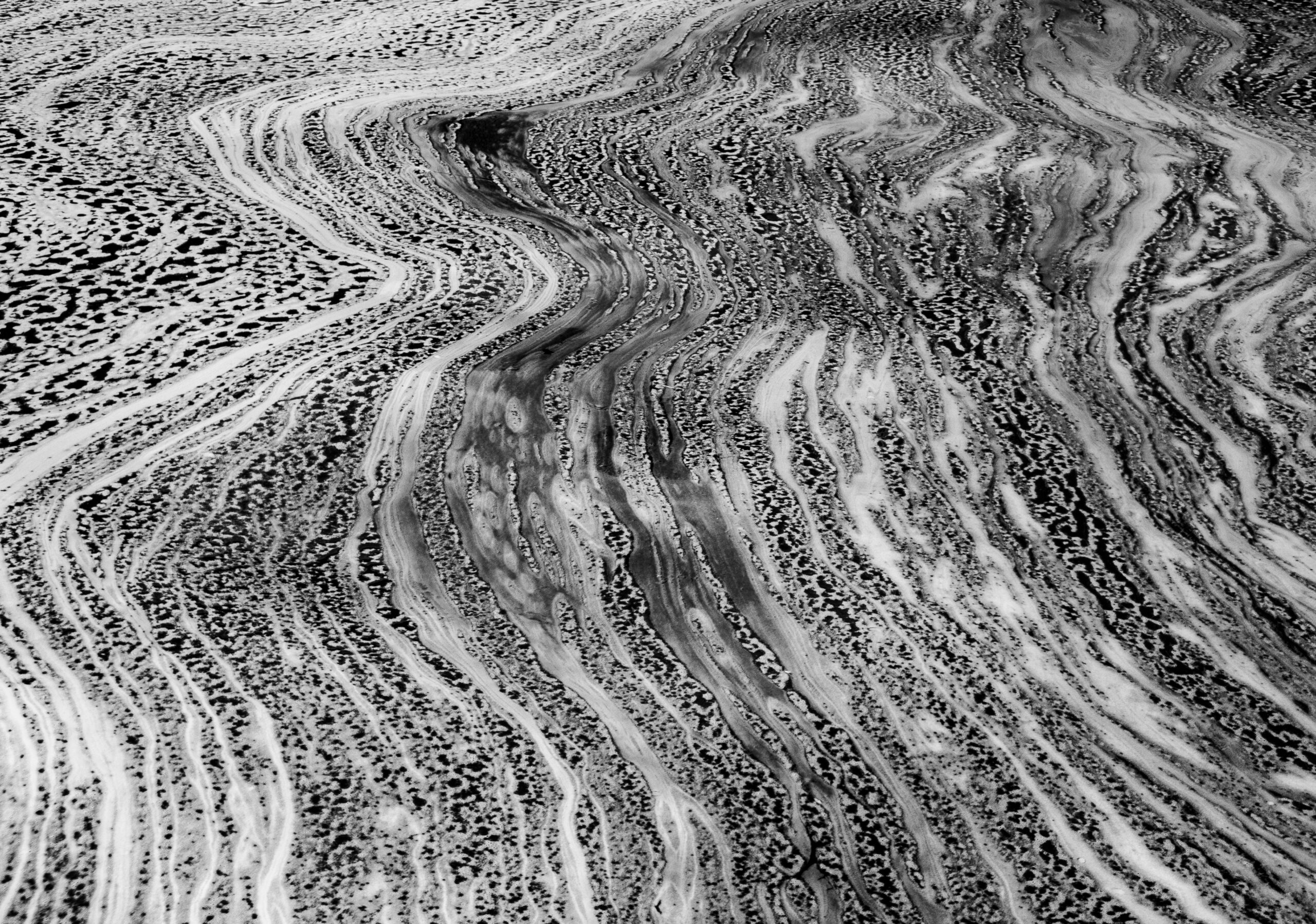
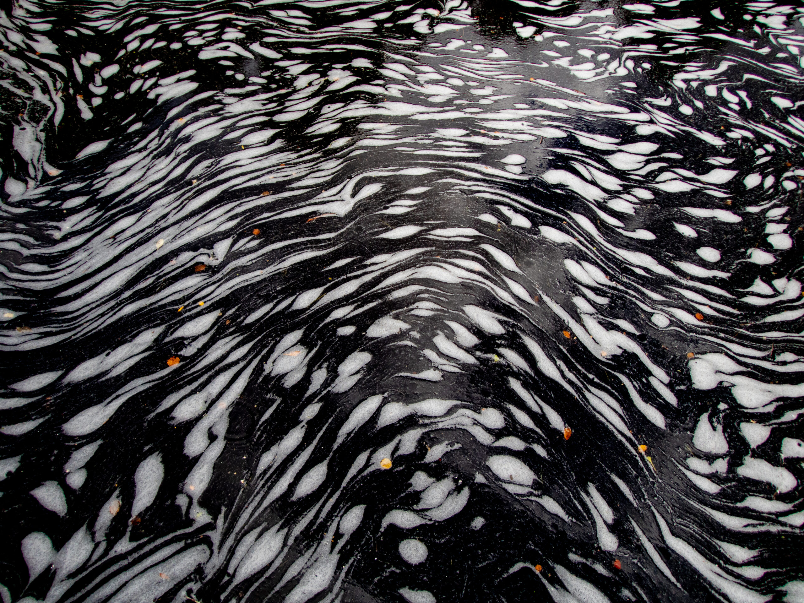
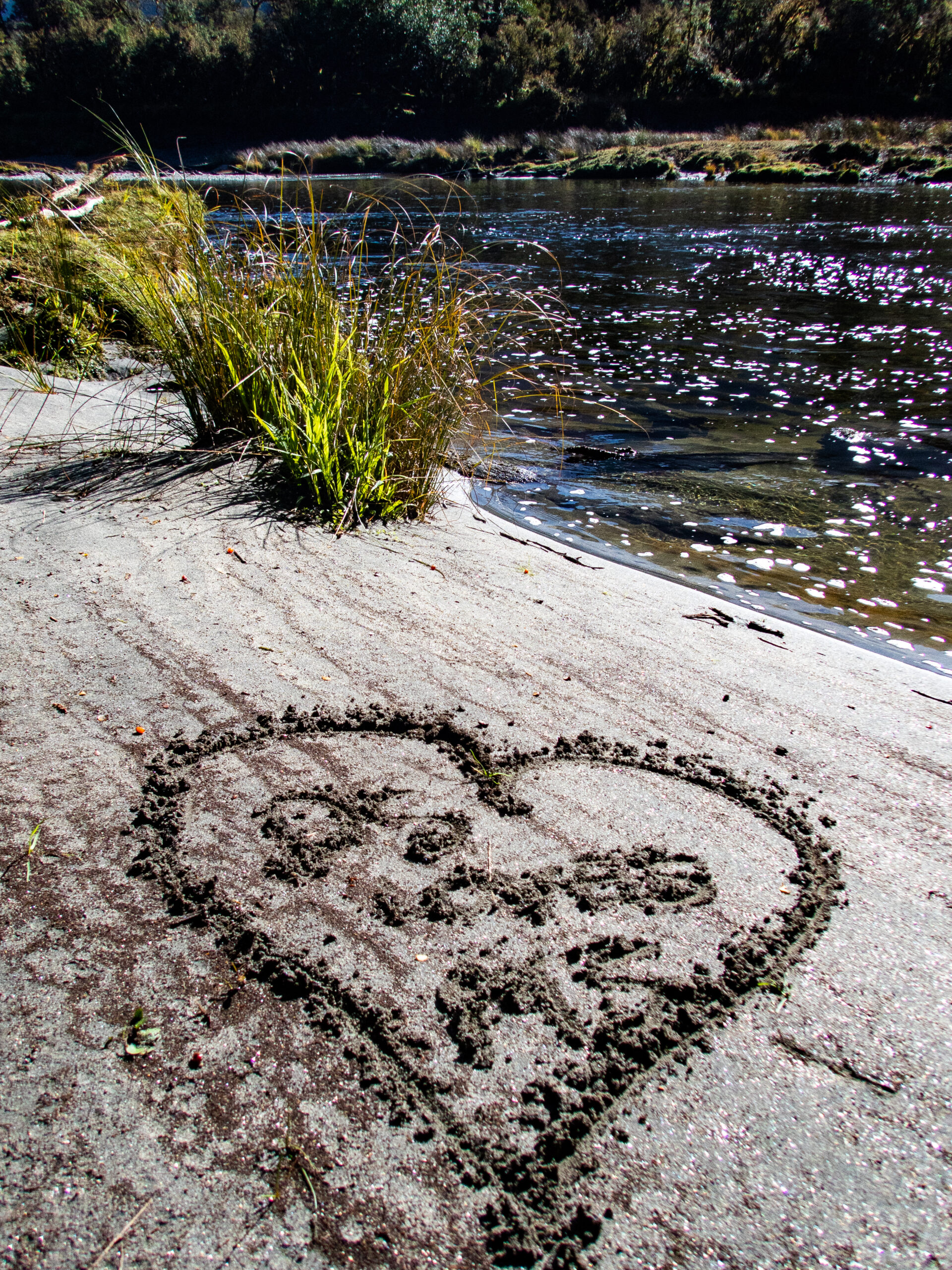
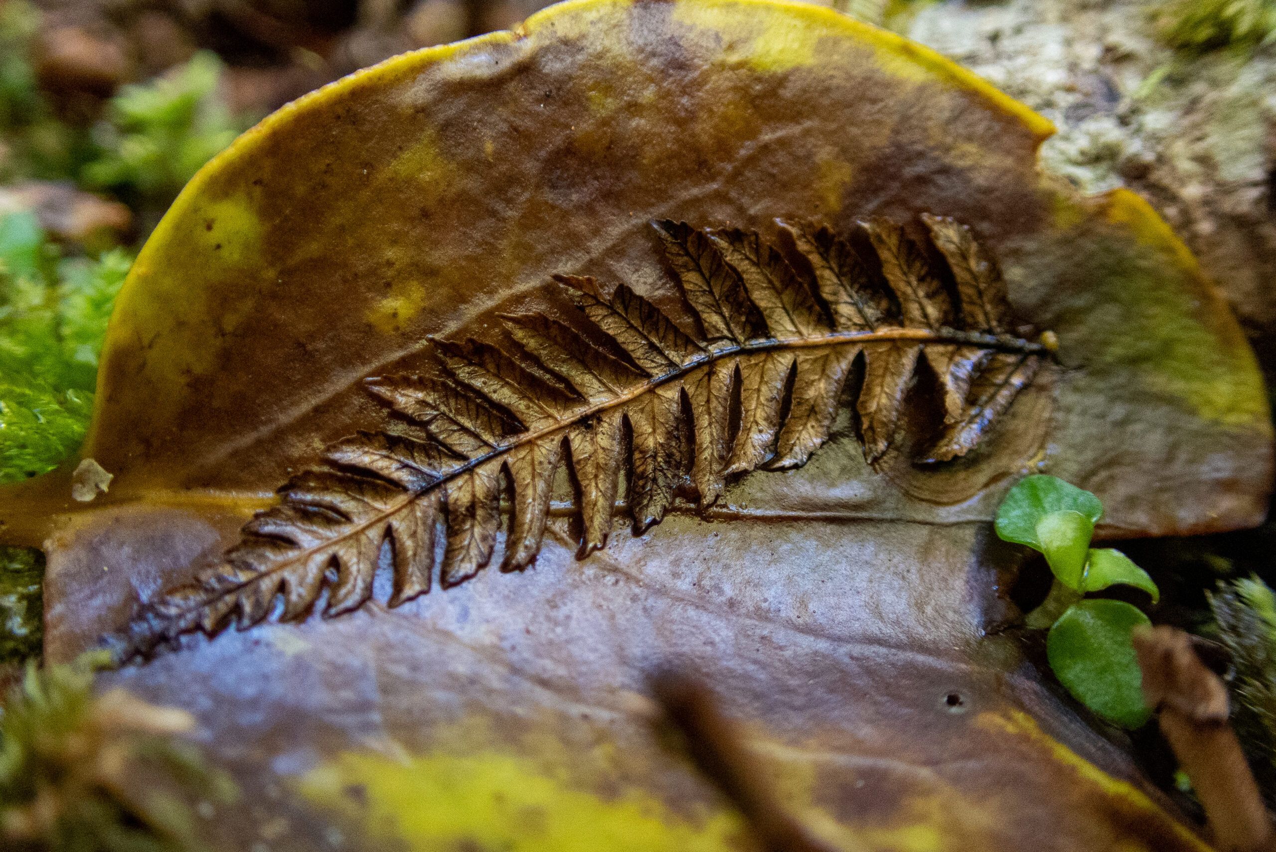
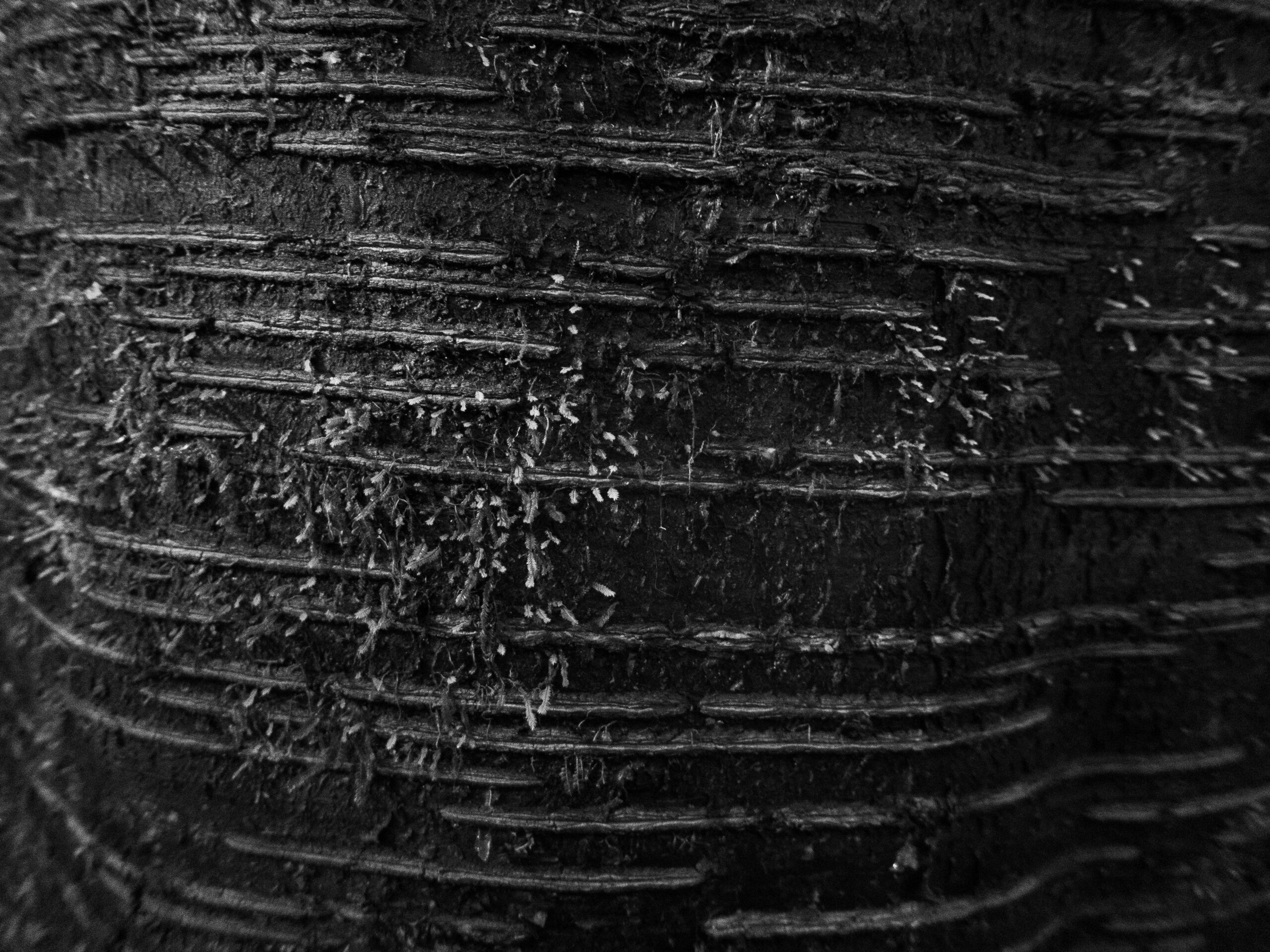
Abstracts
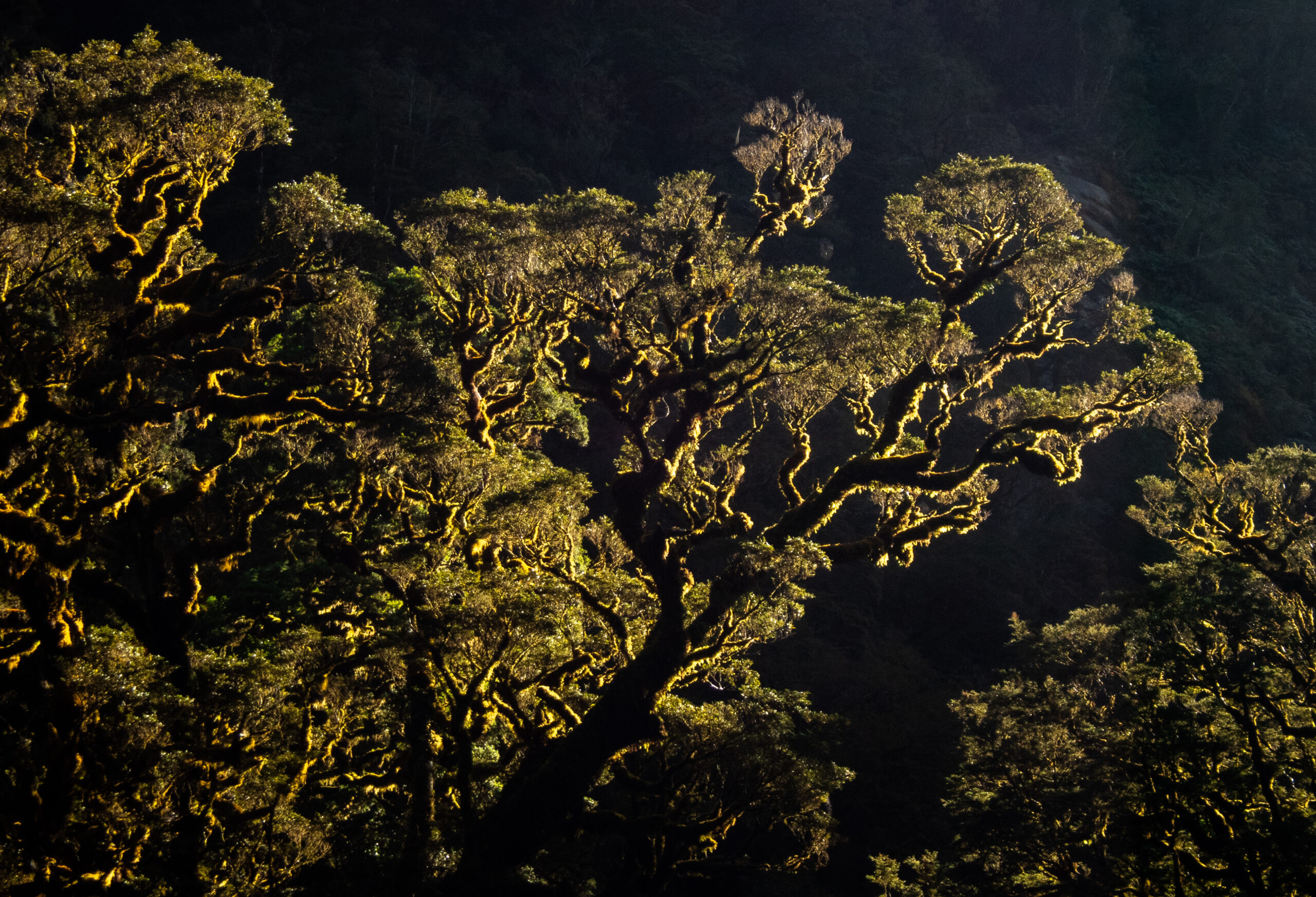
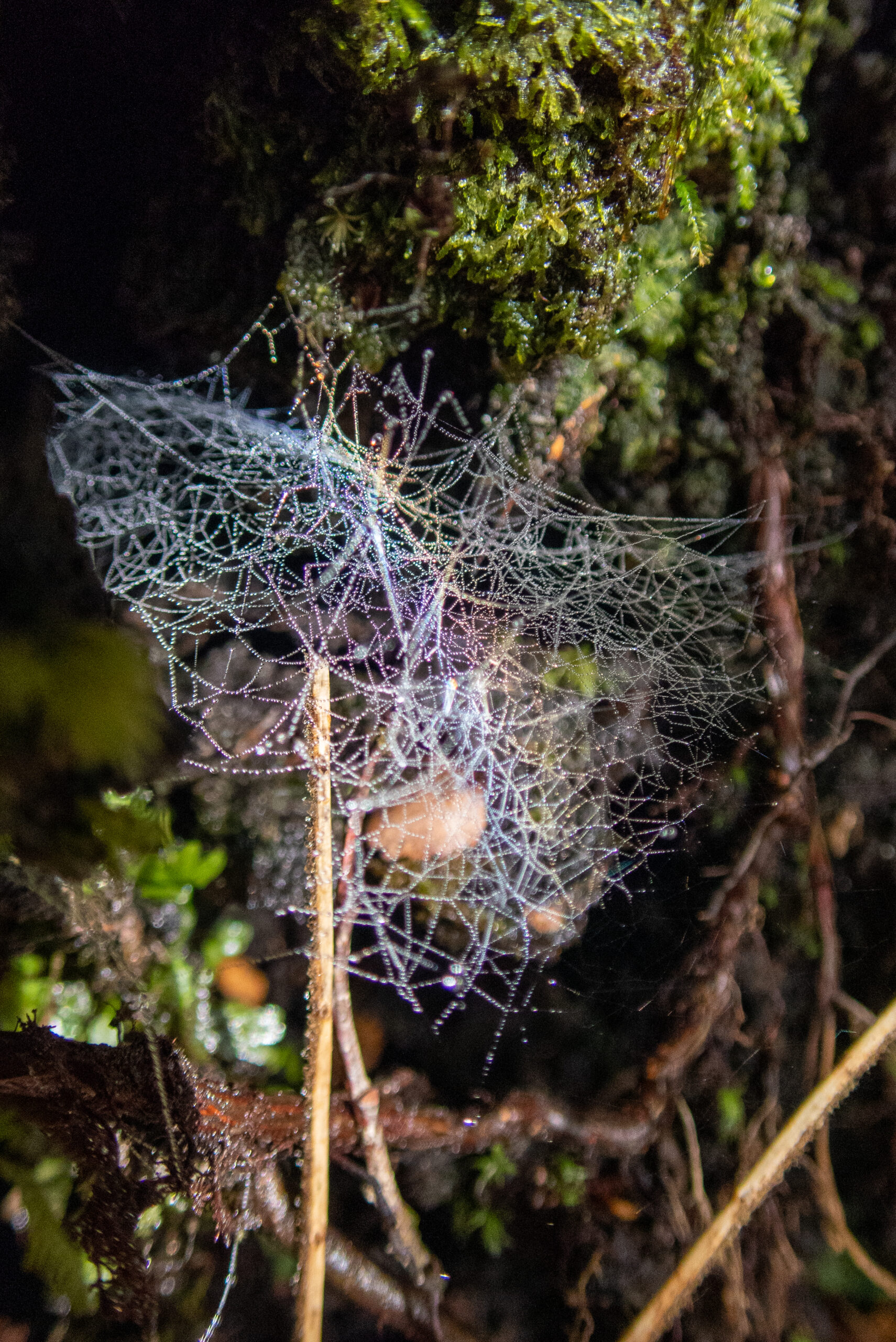
My favorite of Diana’s photographs from Fiordland are the “abstracts,” which she discovers by looking in a very careful, unique way, at the tidal line along the rocks, that magical transitional space between the hidden world underwater and the green, vibrant life-on-fire world above. Bare stone, stained and painted with time and color, bent and reflected by the still, secret, freshwater shimmering over the tide, the infinite, creative capacity of nature. Diana uses framing to share this vision, to point out Nature’s mastery of abstract art. It’s no surprise (and no accident) that these images feel so profoundly connected to her mosaic work. Most of the time these photographic expeditions are her solo meditations, which she shares with me when she gets back to Allora (after hours in the kayak!). But I’ve also been with her, paddling Namo gently into position, sitting right next to her, appreciating the wholeness of a beautiful place but without quite seeing what she is seeing. These images, for me, represent a particular (and particularly magical) collaboration between Diana and this very, very special world we are navigating in Fiordland.~MS
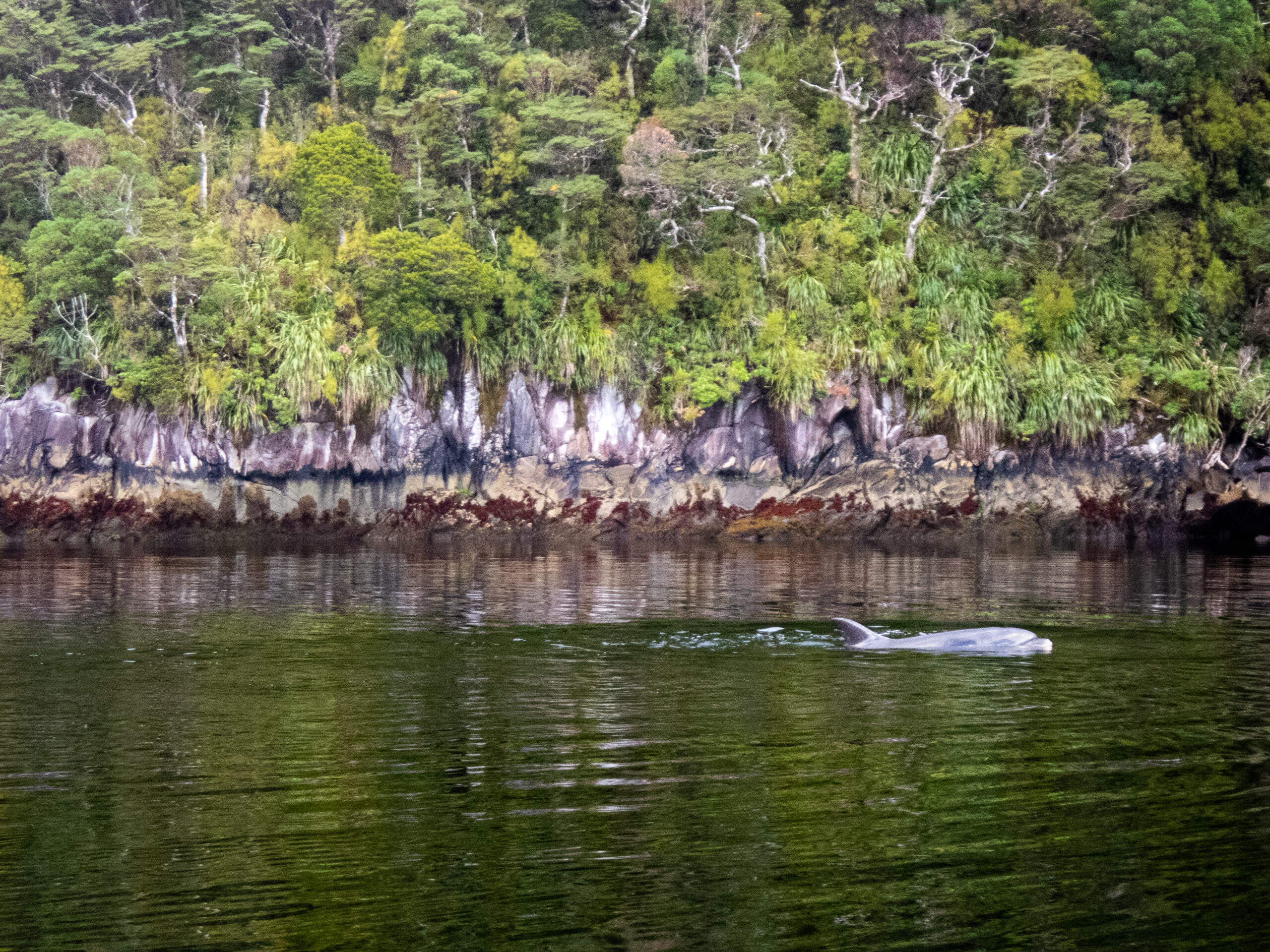
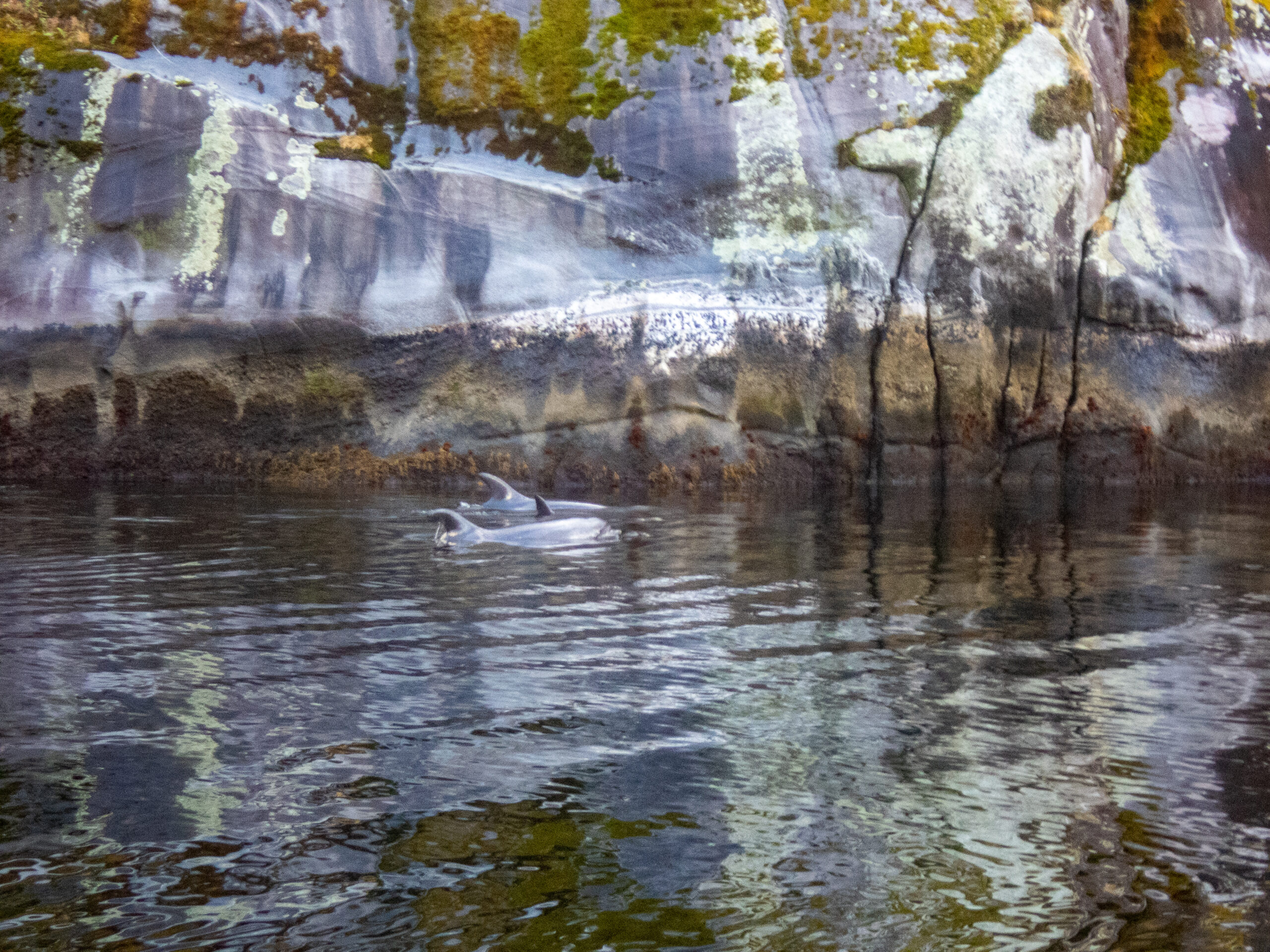
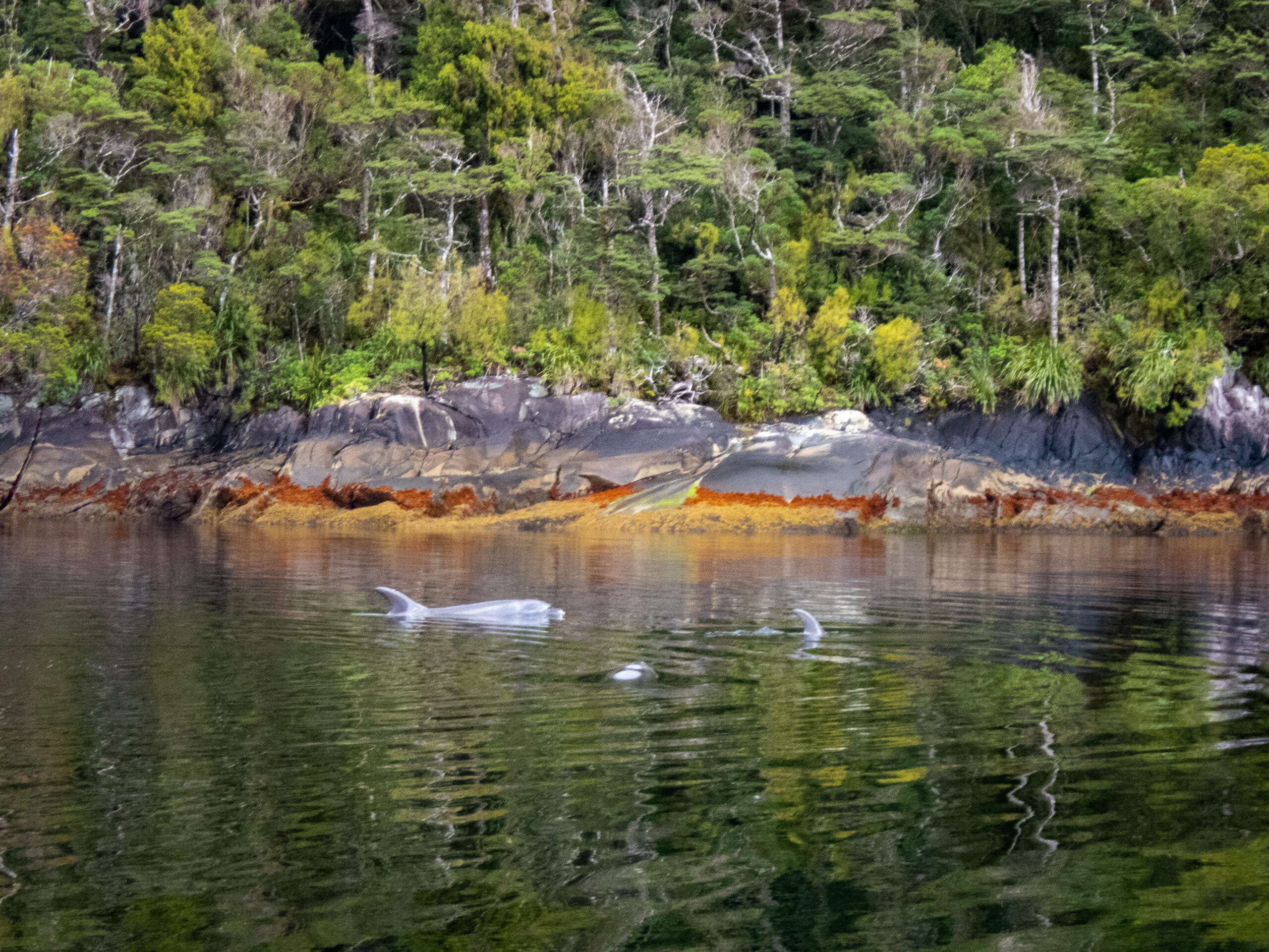
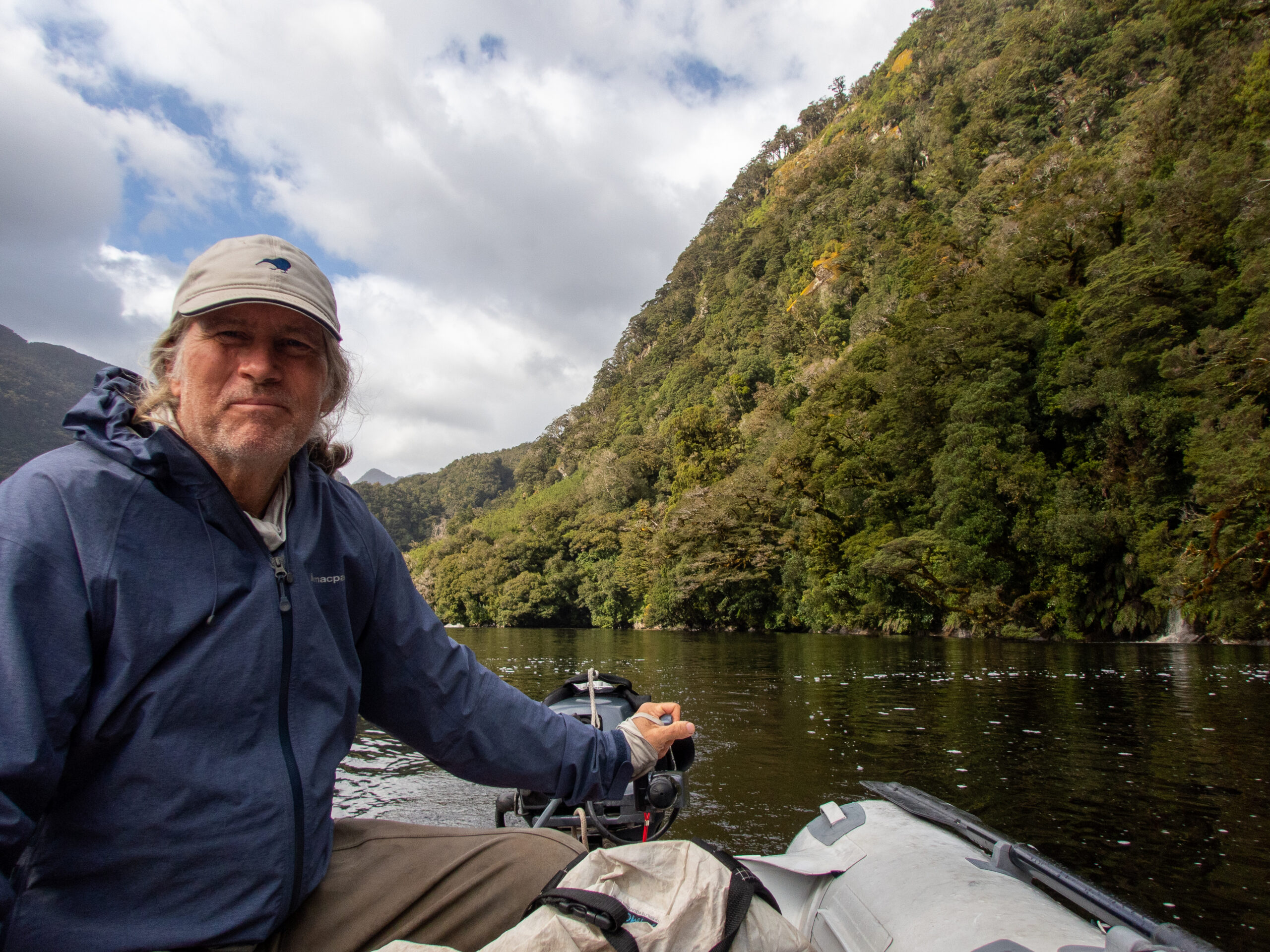
We heard dolphins exhale RIGHT beside Allora, so donned our goofy outfits, lowered Namo off the davits and went out around the corner to see if they’d still be about. A visual feast: the bush, the shoreline, dolphins and the water, ahhh!!!There were 6, and they were nonplussed by us. (I just went down a Wifi wormhole reading about how ‘nonplussed’ is a contronym!)See the dorsal fin shape in the intertidal zone, too?!
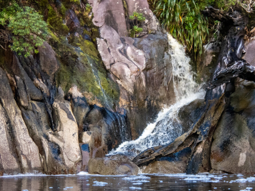
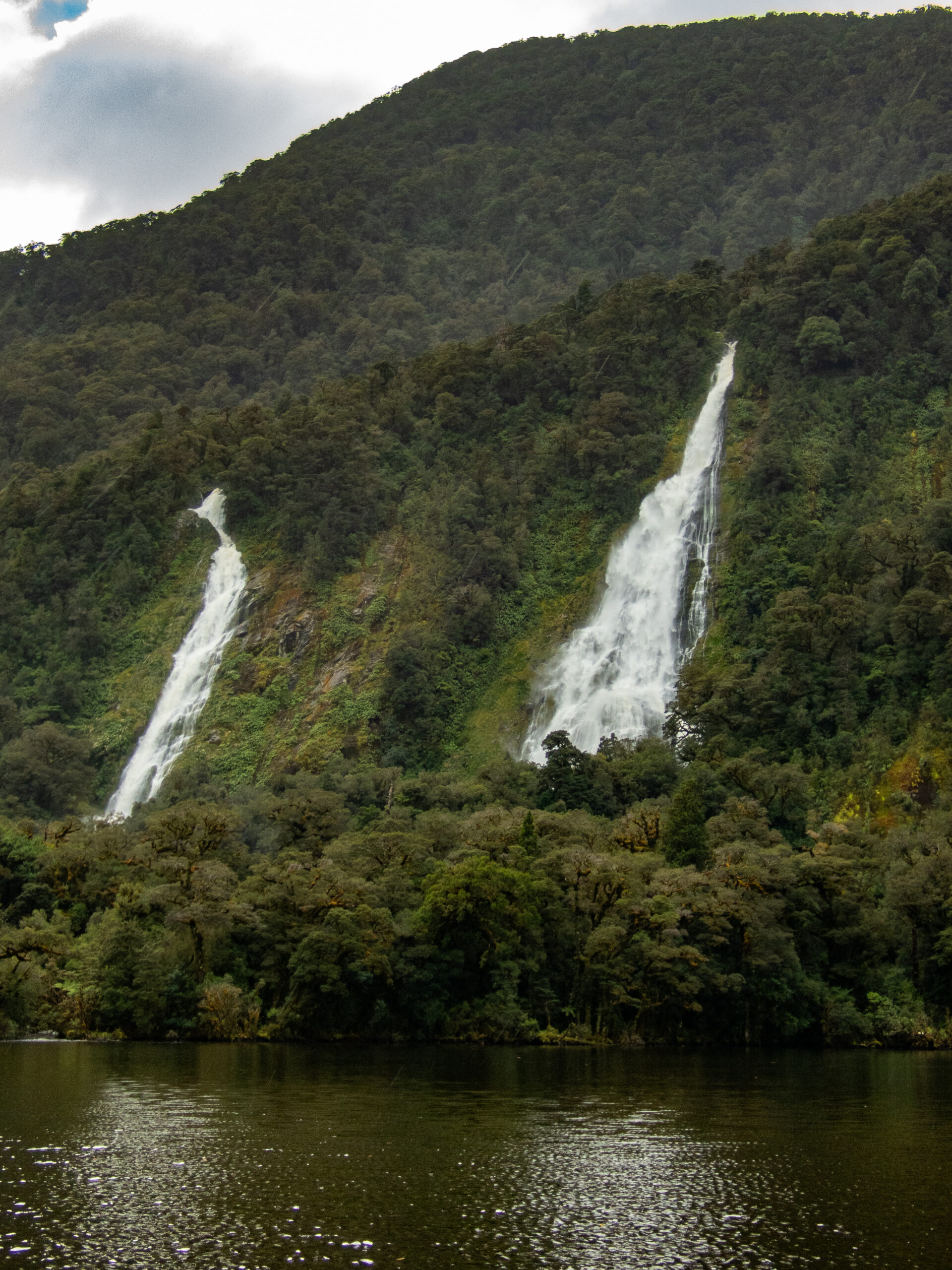
After that glorious evening light, we settled in for what would be torrential rain all night. We saw 38.5 knots of wind as our max, but from the N/NW – a good direction for this location.In the morning the water was chocolate colored and there were gushing waterfalls EVERYWHERE!
We had hopes of taking Namo up the Windward River at the head of the bay, but it was a raging ‘NO!’
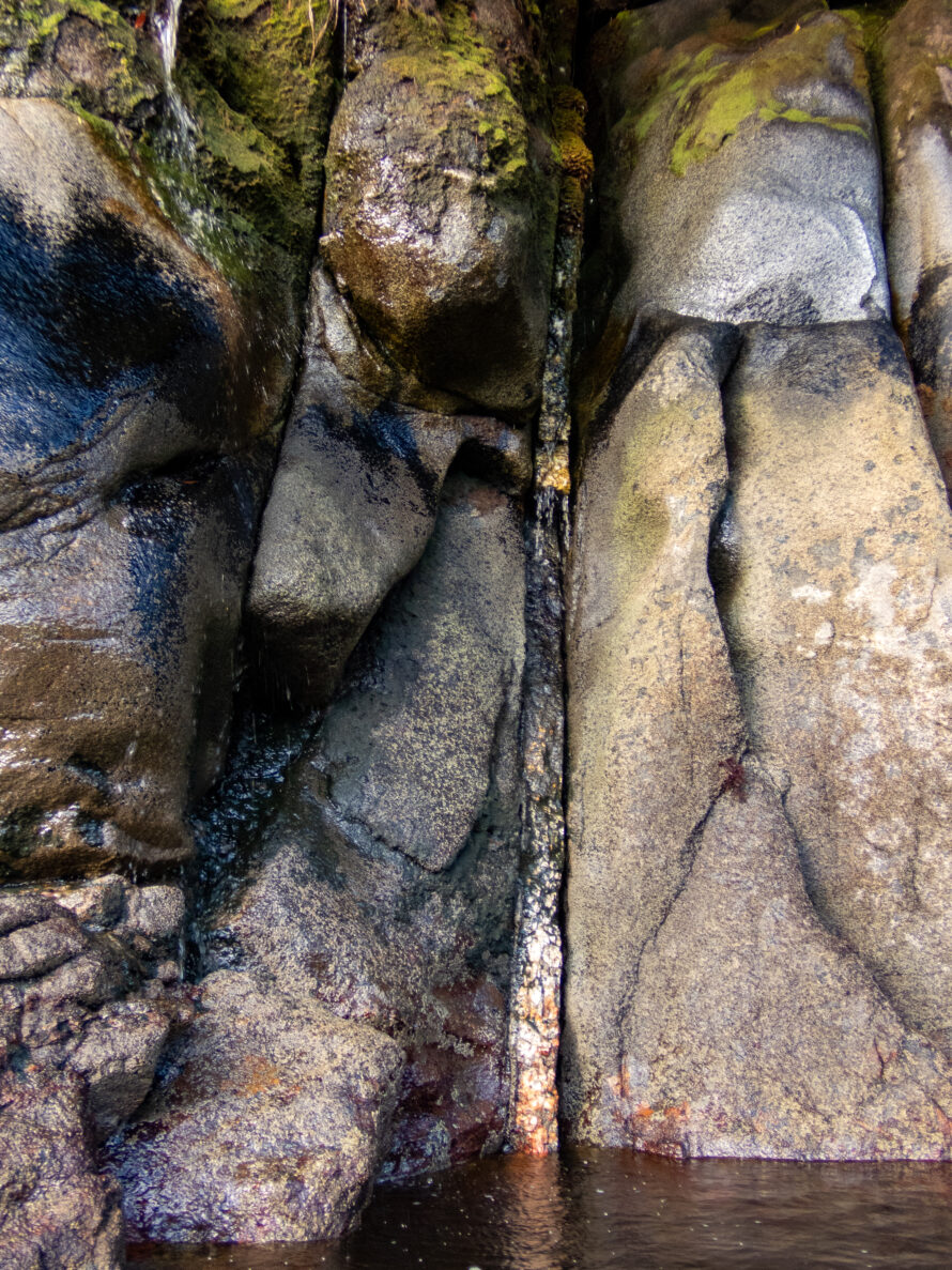
Sinuous lines, ‘tidelines’ of foam where two currents meet.
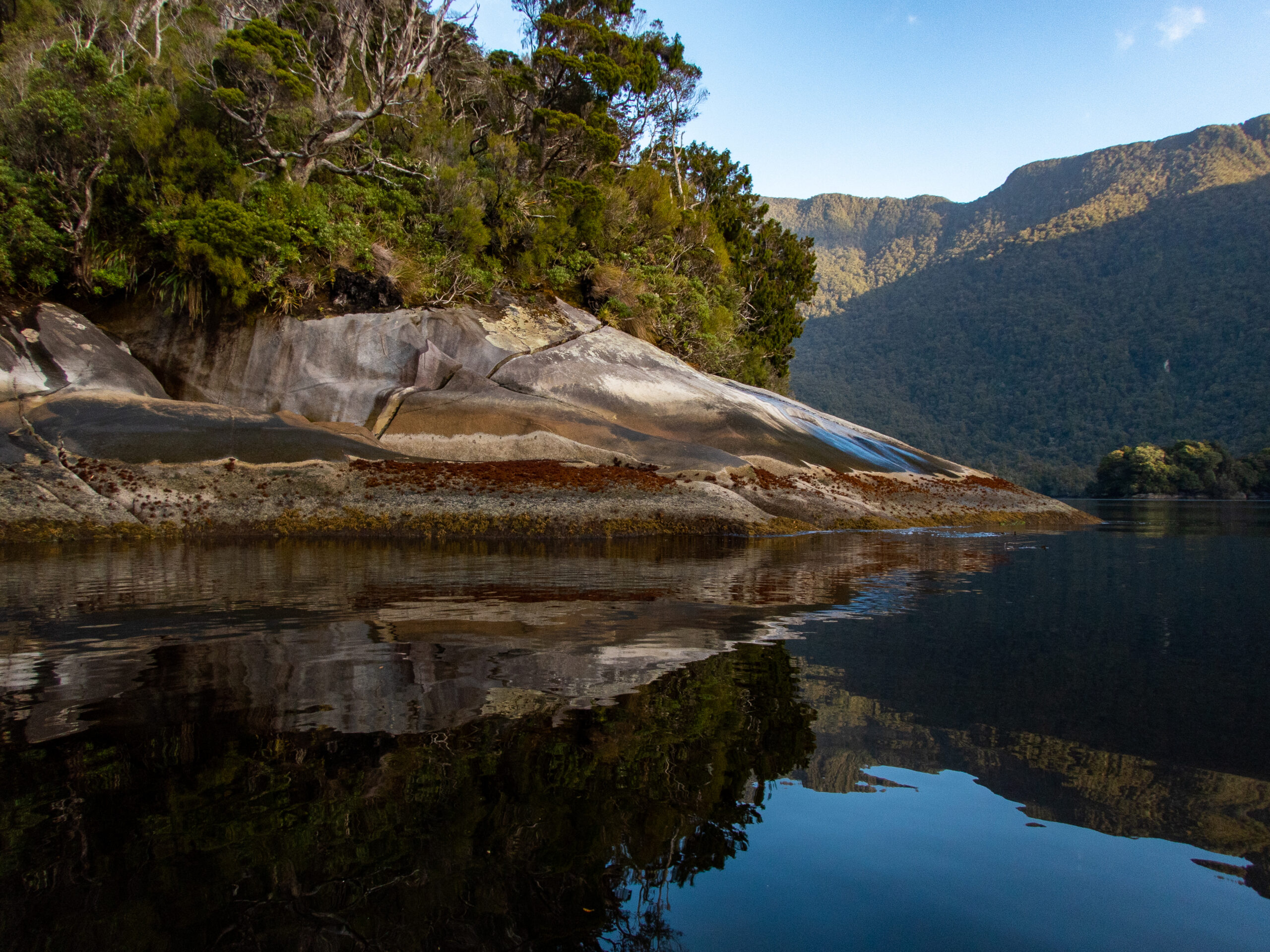
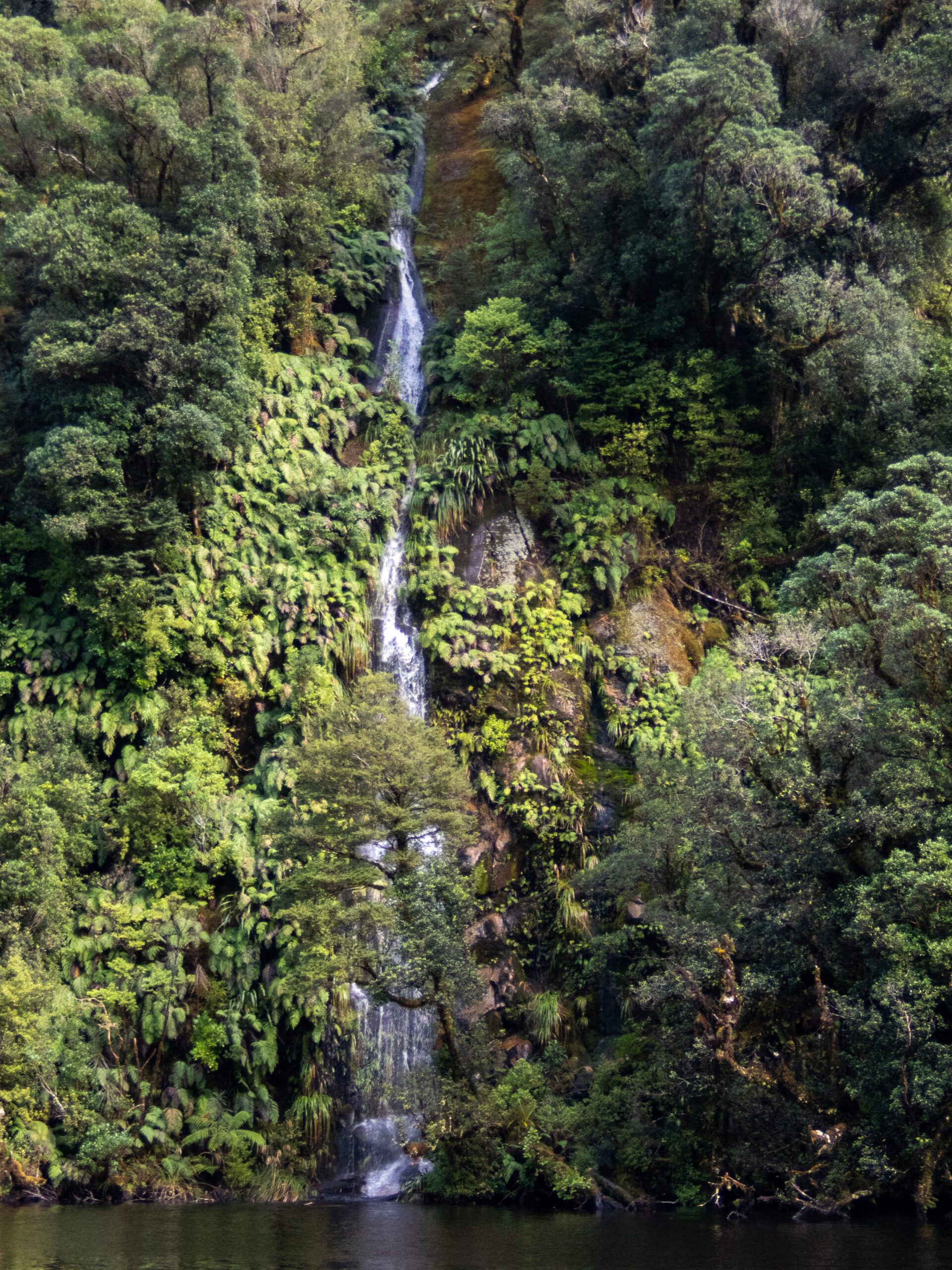
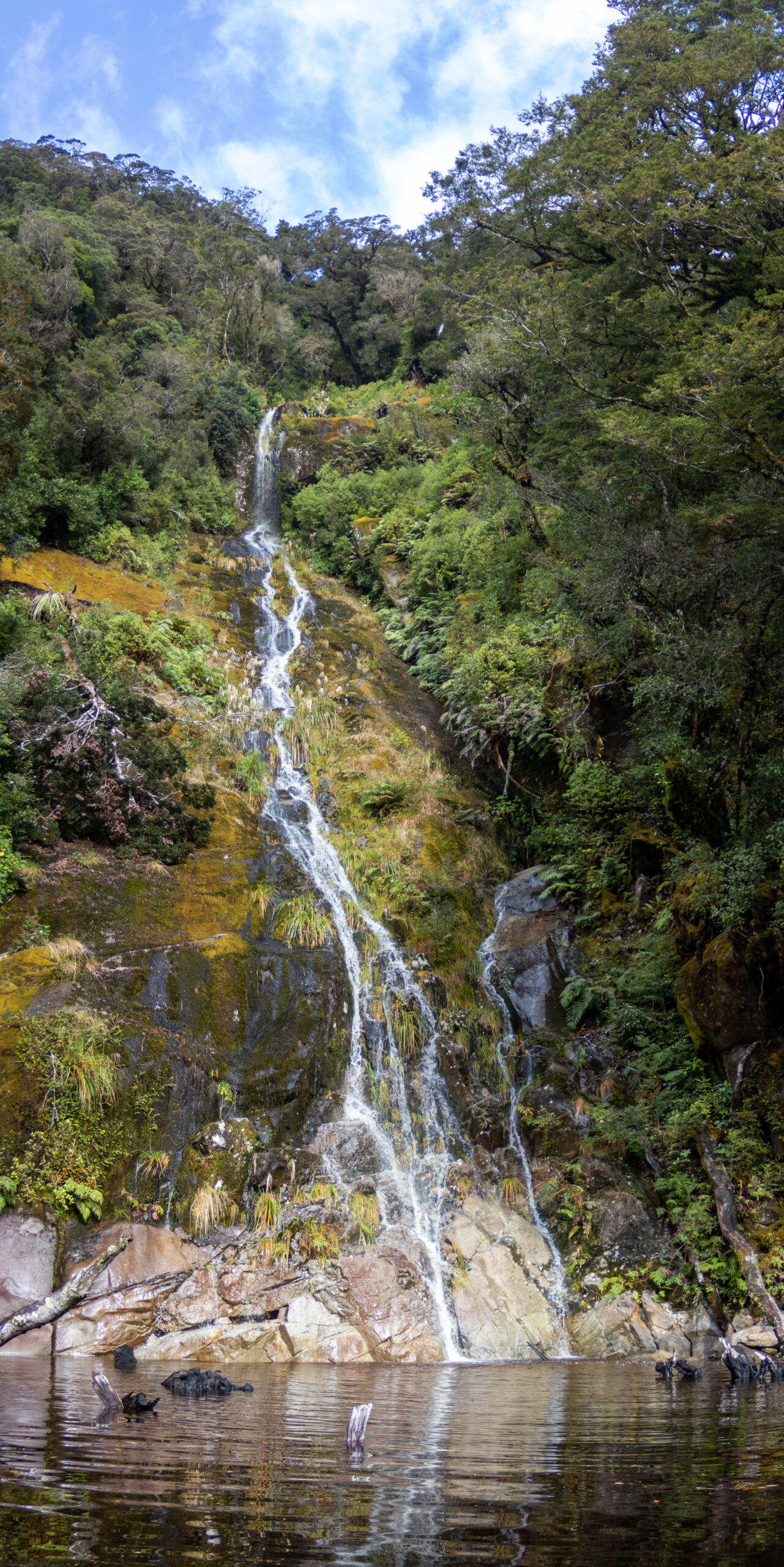
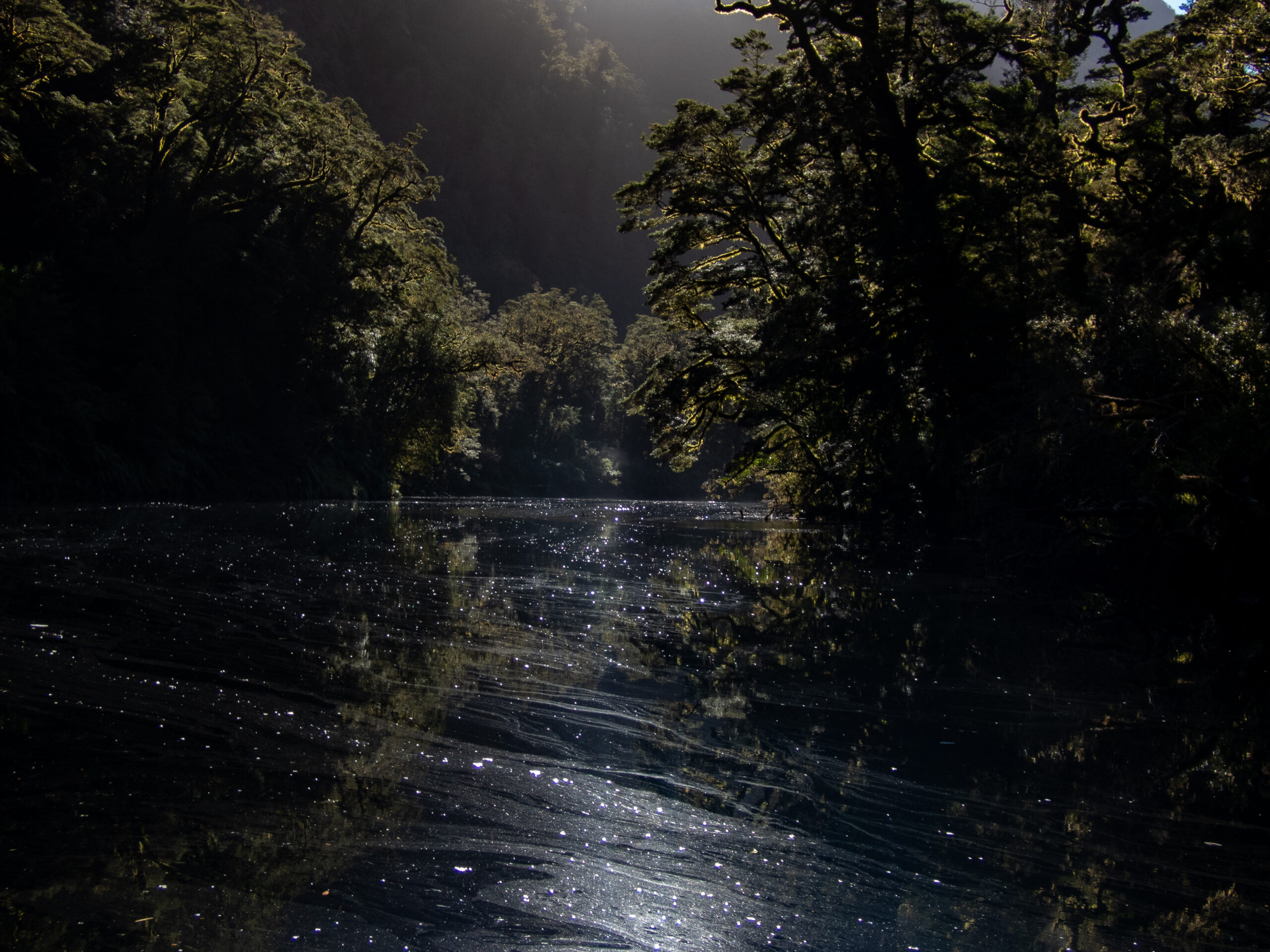
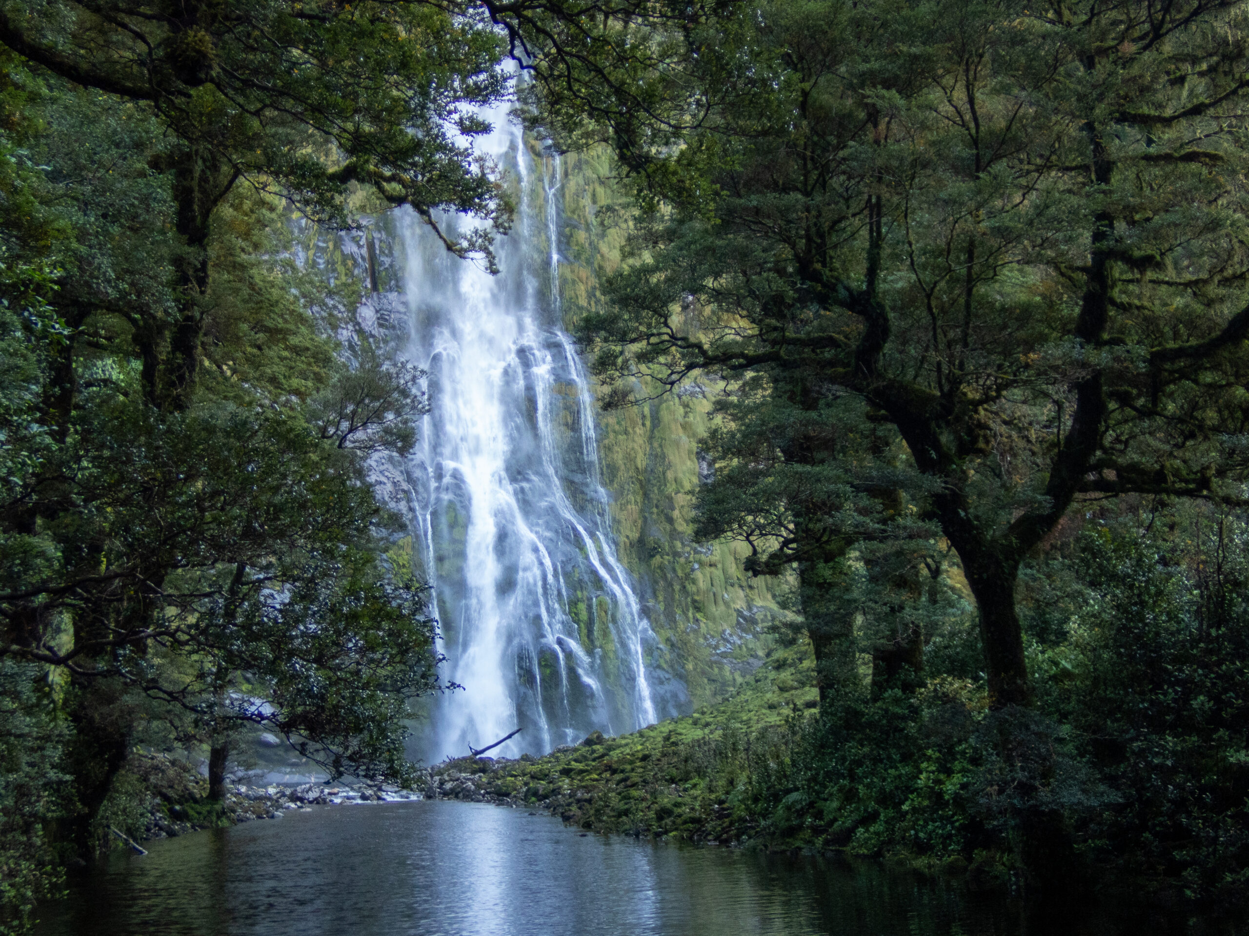
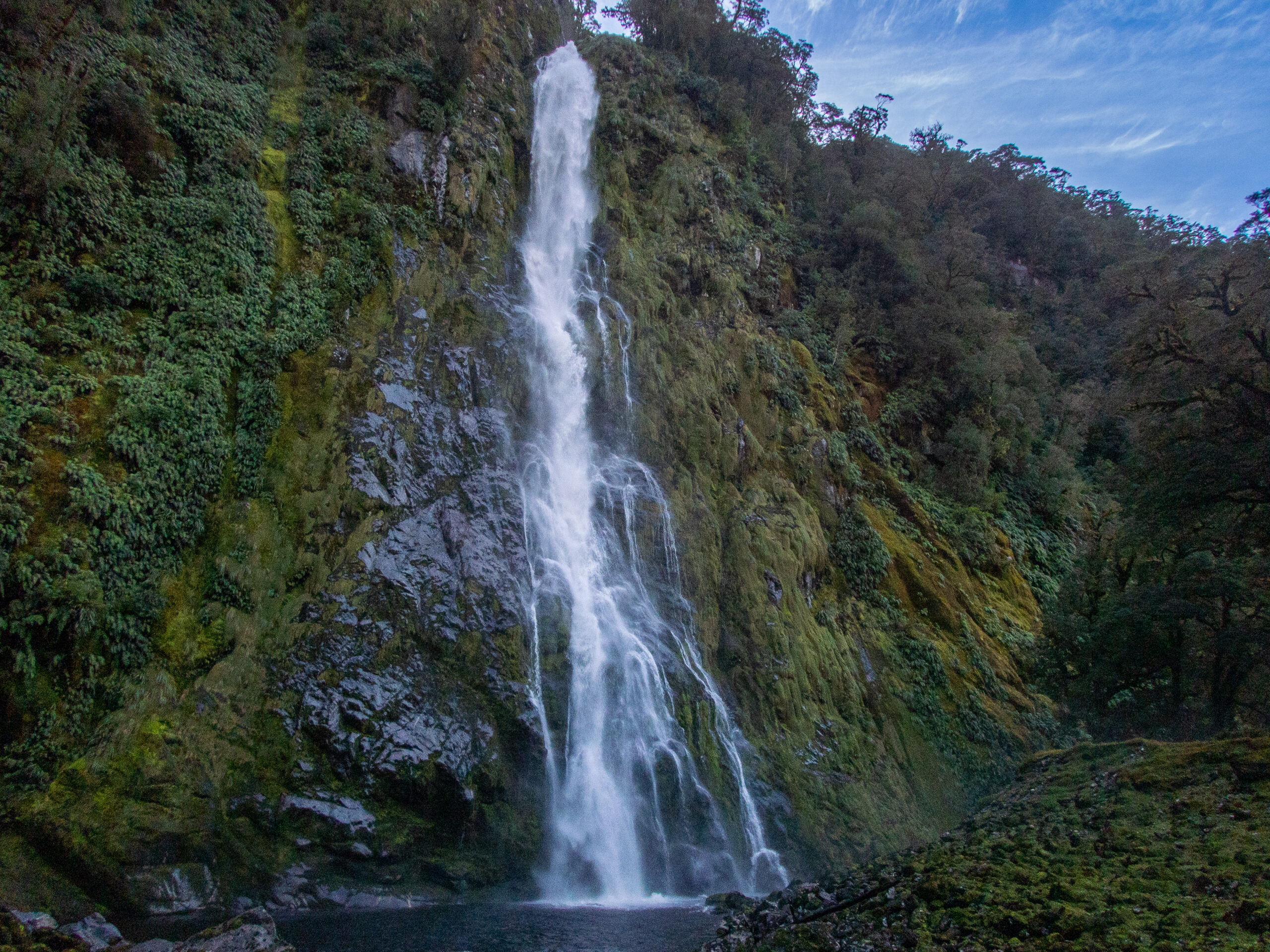
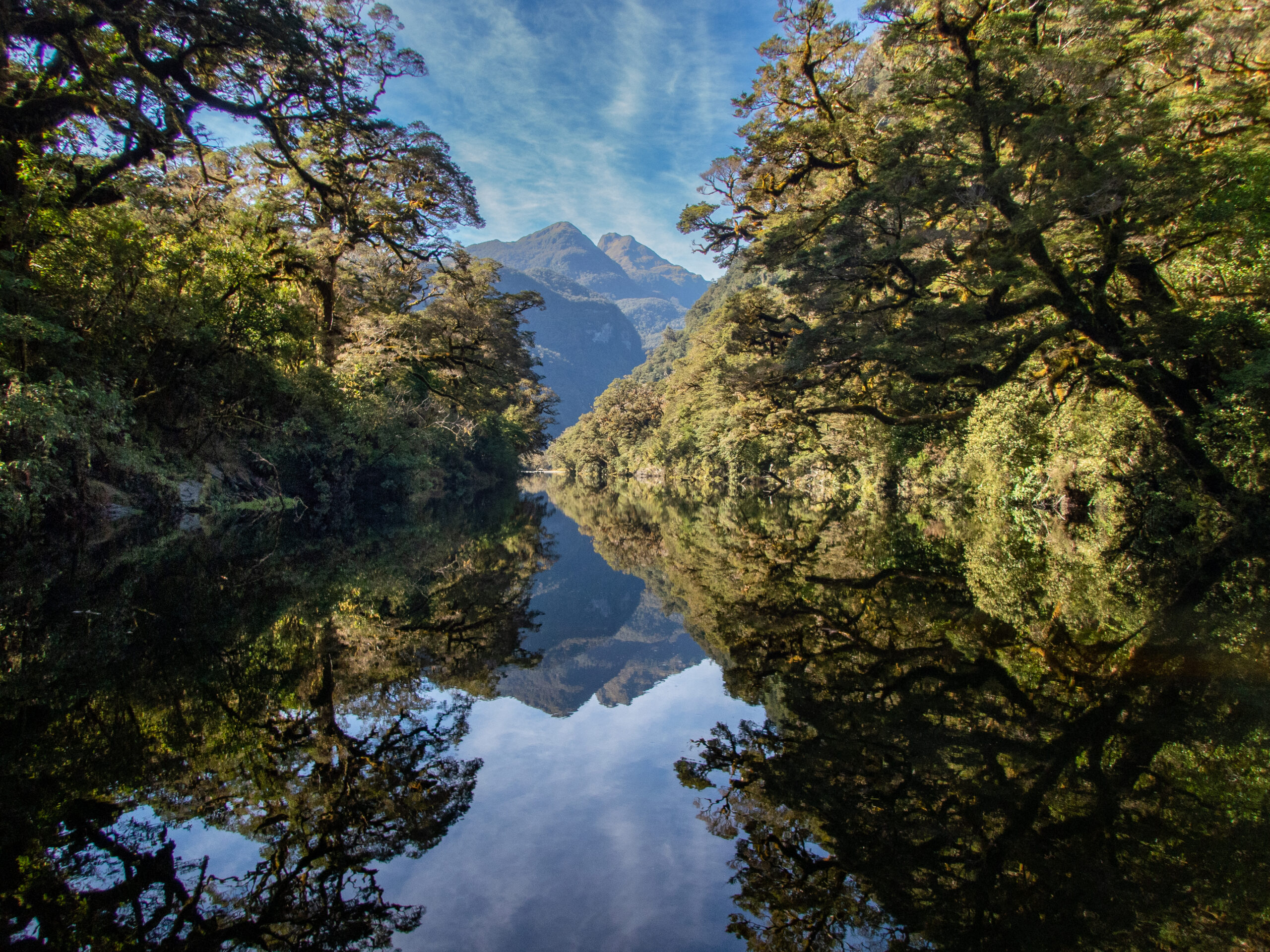
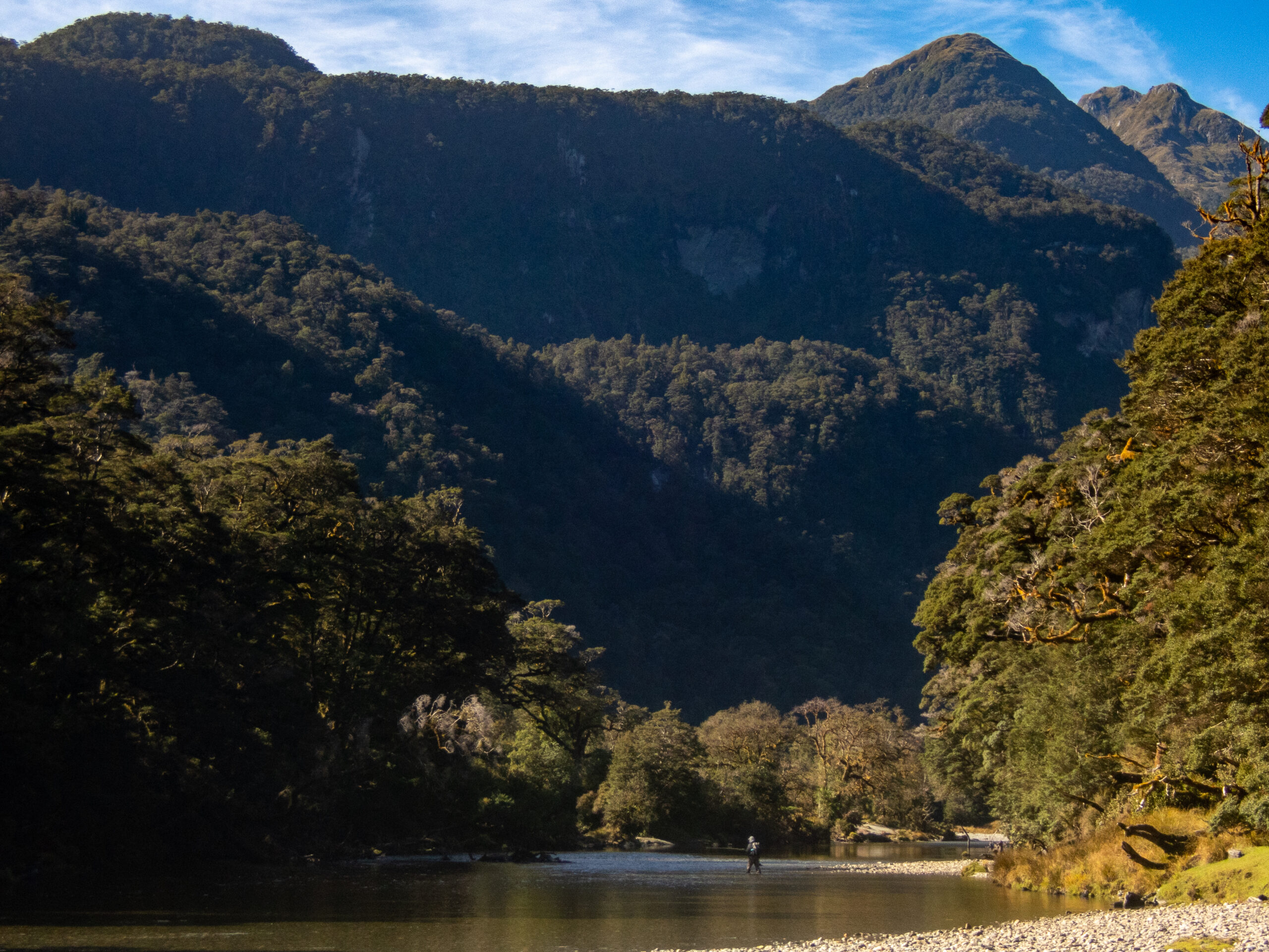
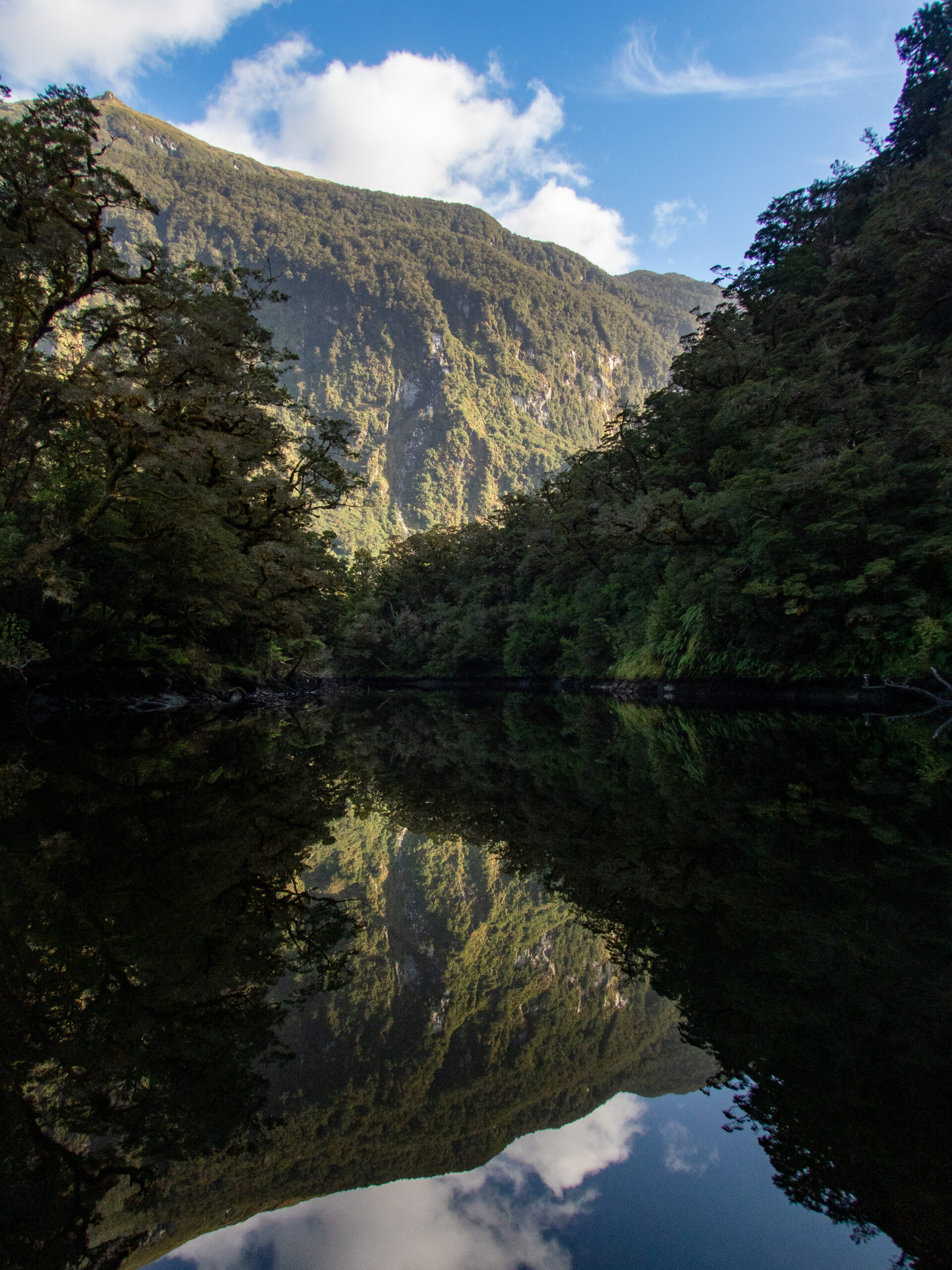
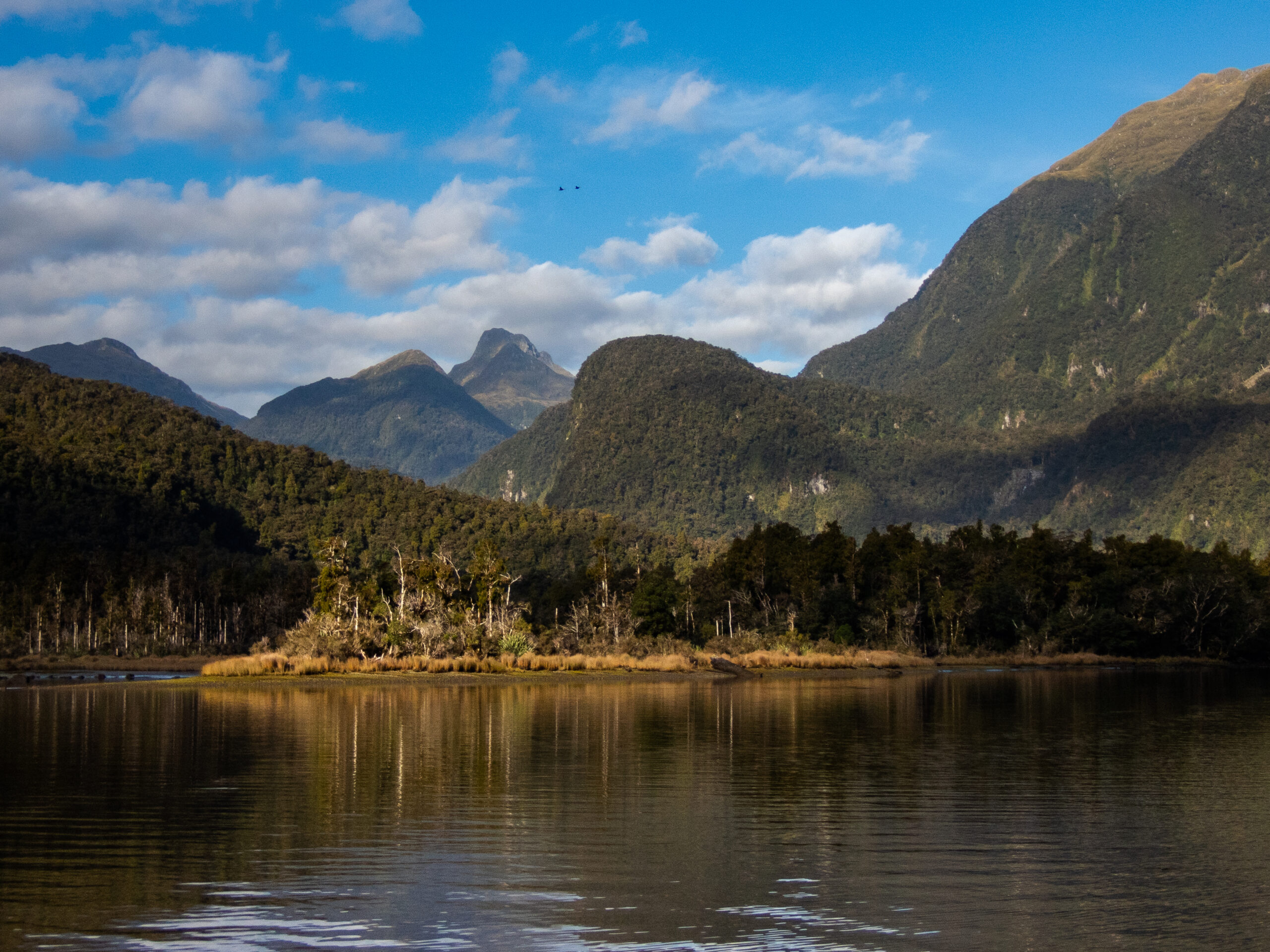
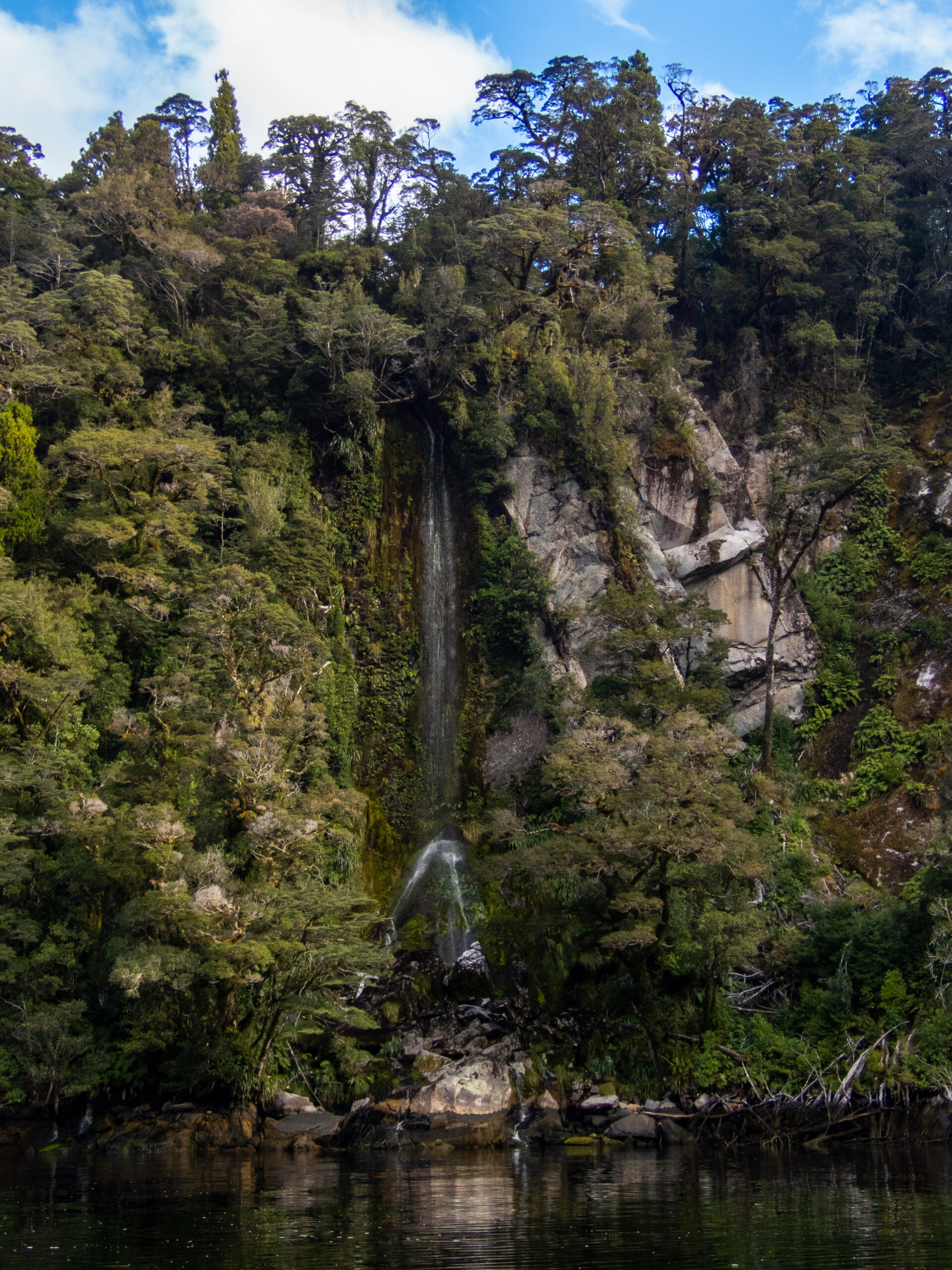
Instead of moving Allora over to Emelius Arm, we left her tucked by Catherine Island and ventured 5 miles with Namo in the FREEZING early morning! Visibility was almost nil, but we went slowly and visualized a log free path!By the time we arrived at the head of Emelius Arm, the sun had started coming up over the peaks, so we knew we’d be warm soon! It’s always harder than we imagine to find where the river (which comes from up high in the canyon ) flows into the sound. Sometimes our guide books showed an approximate position, but not always. We were tempted to follow these shadow arrows, as they seemed to be pointing the way!Found the Irene River, though at this early stage it was as still as a lake. Our plan was to take Namo up as far as we could and then hike up beyond that until the tide dictated we return.Hallelujah for the sun!Sun makes us all so warm and fuzzy!Through a narrow little offshoot, trees all around, we took Namo back and in (following the sound and a glint of white water) and look what we found?!
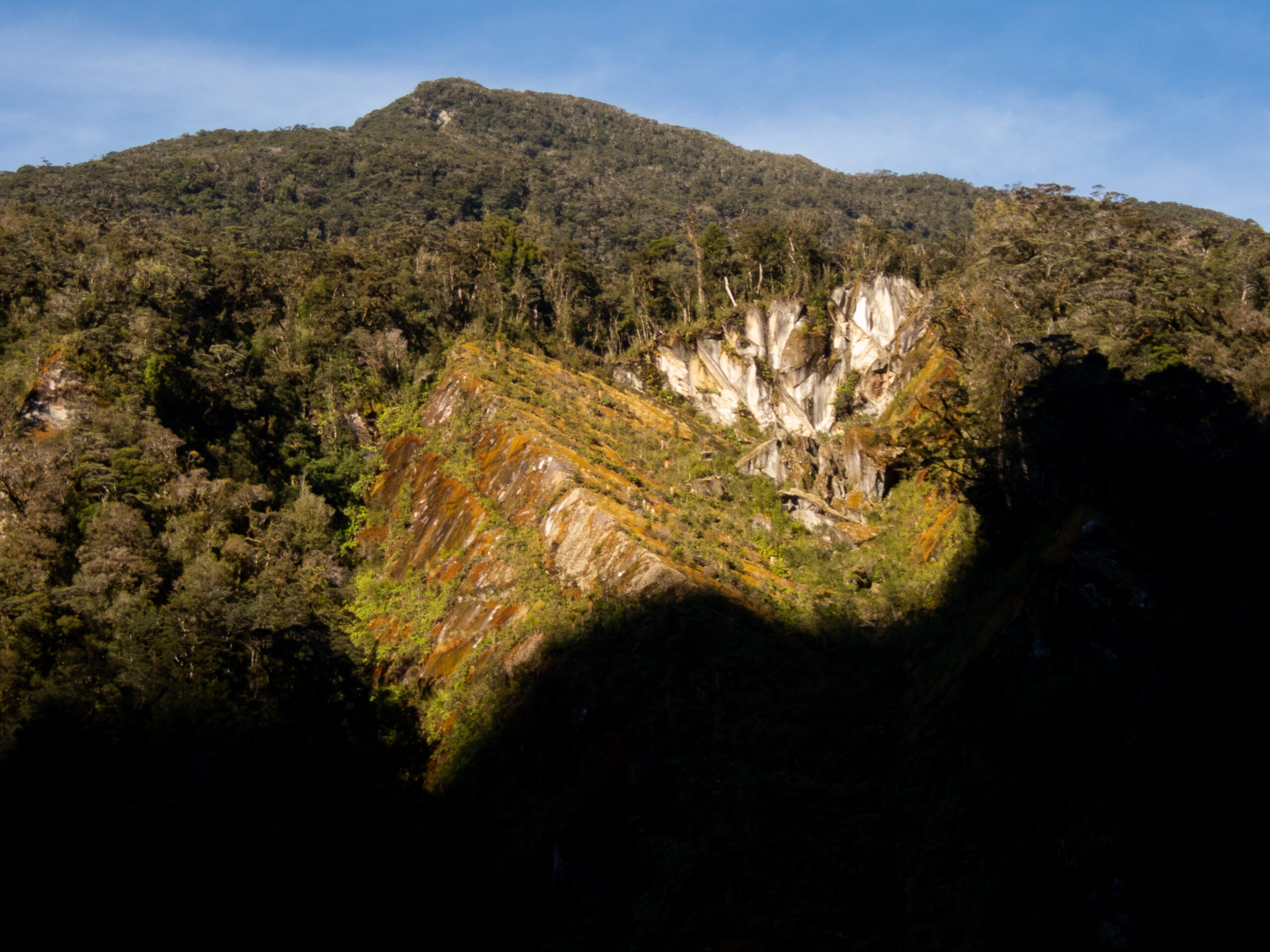
Looked it up on our favorite (offline) app, NZ TOPO 50, and learned that this beauty is Marjorie Falls!
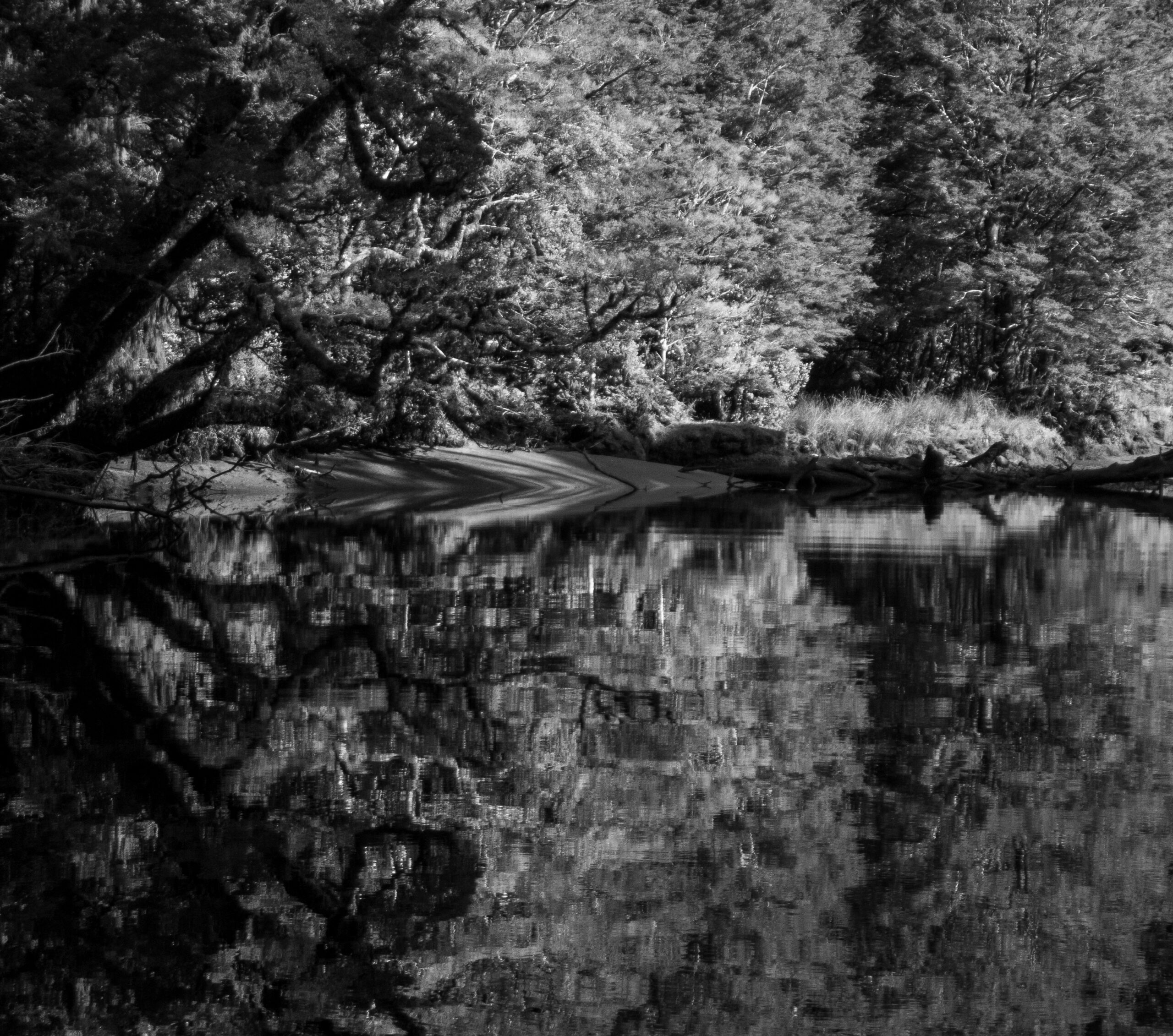
Super hard visibility for seeing the myriad snags. It was gorgeous, but took intense focus getting upriver.
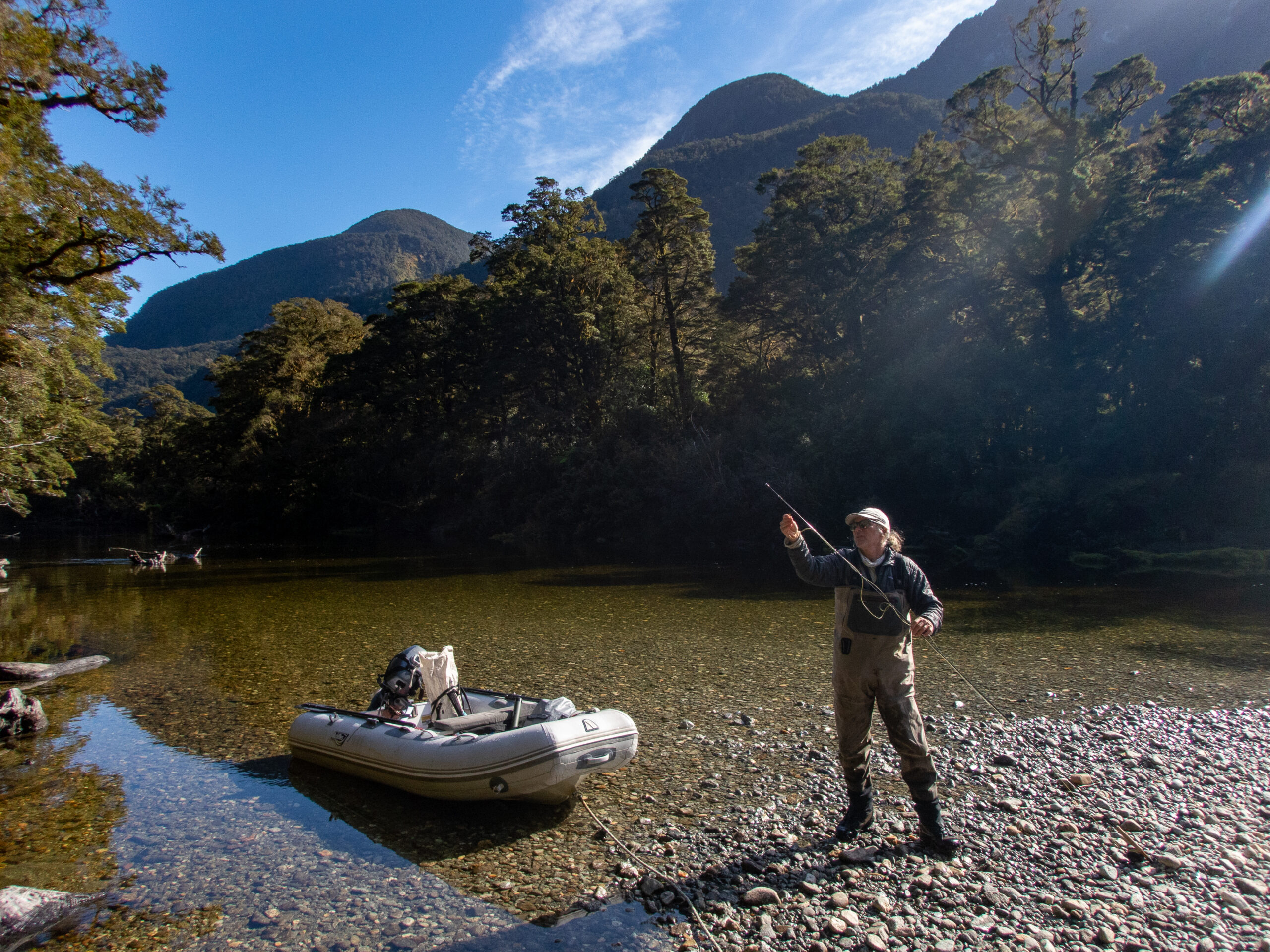
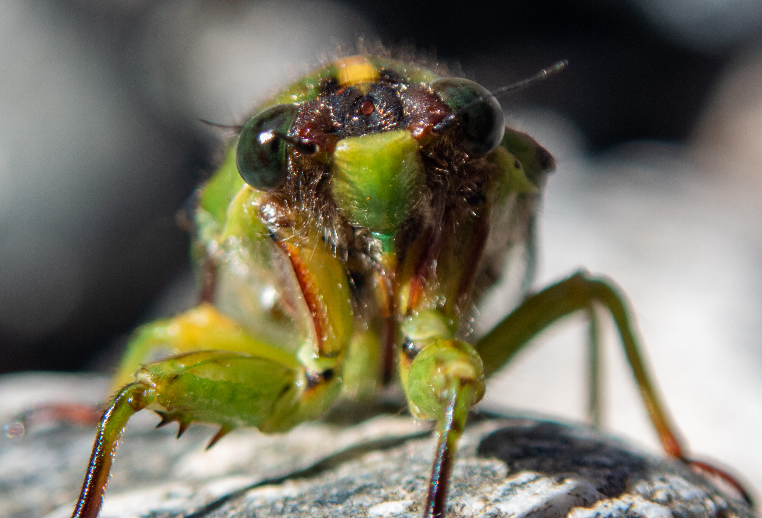
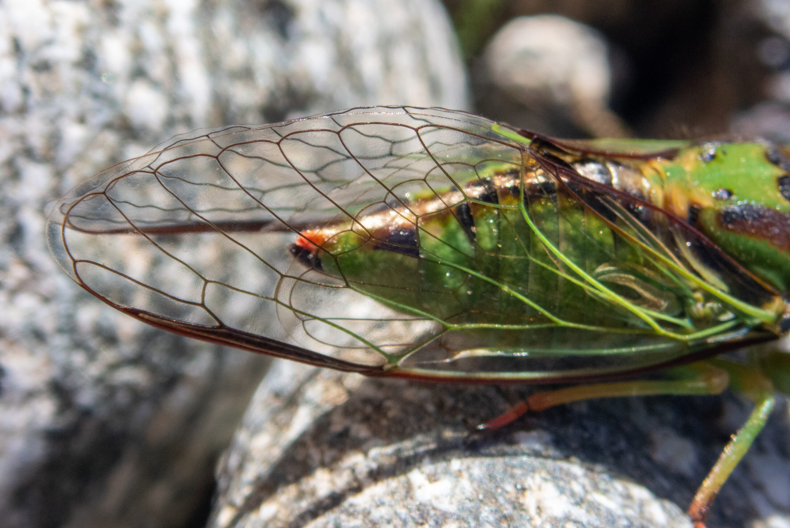
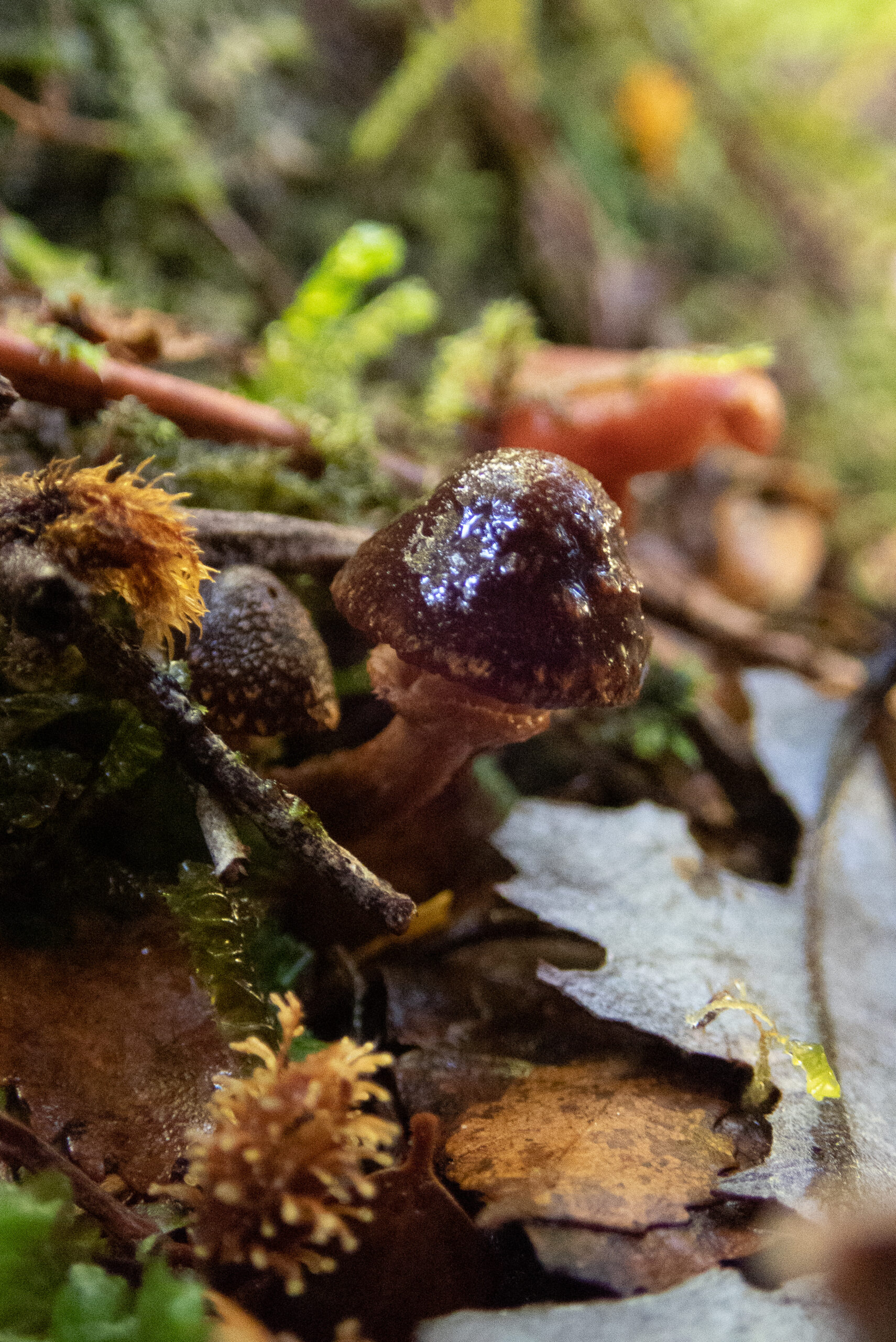
Time to hike/fish and let Namo rest.And to the cicada’s surprise, two new creatures showed up!
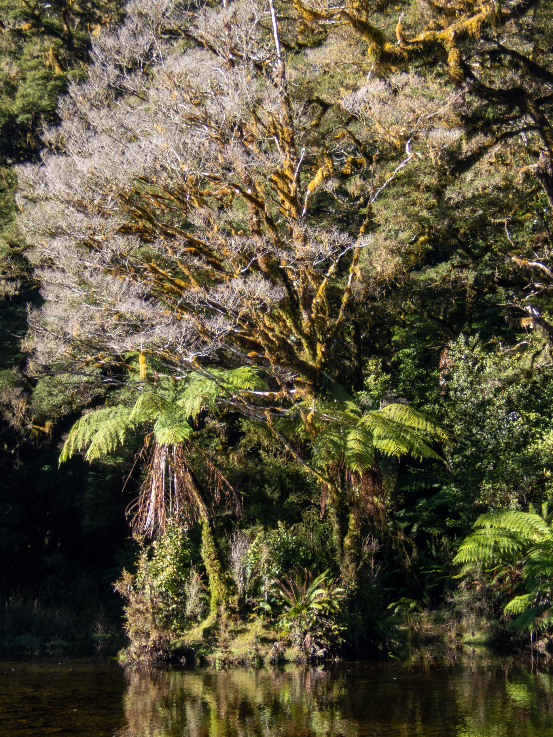
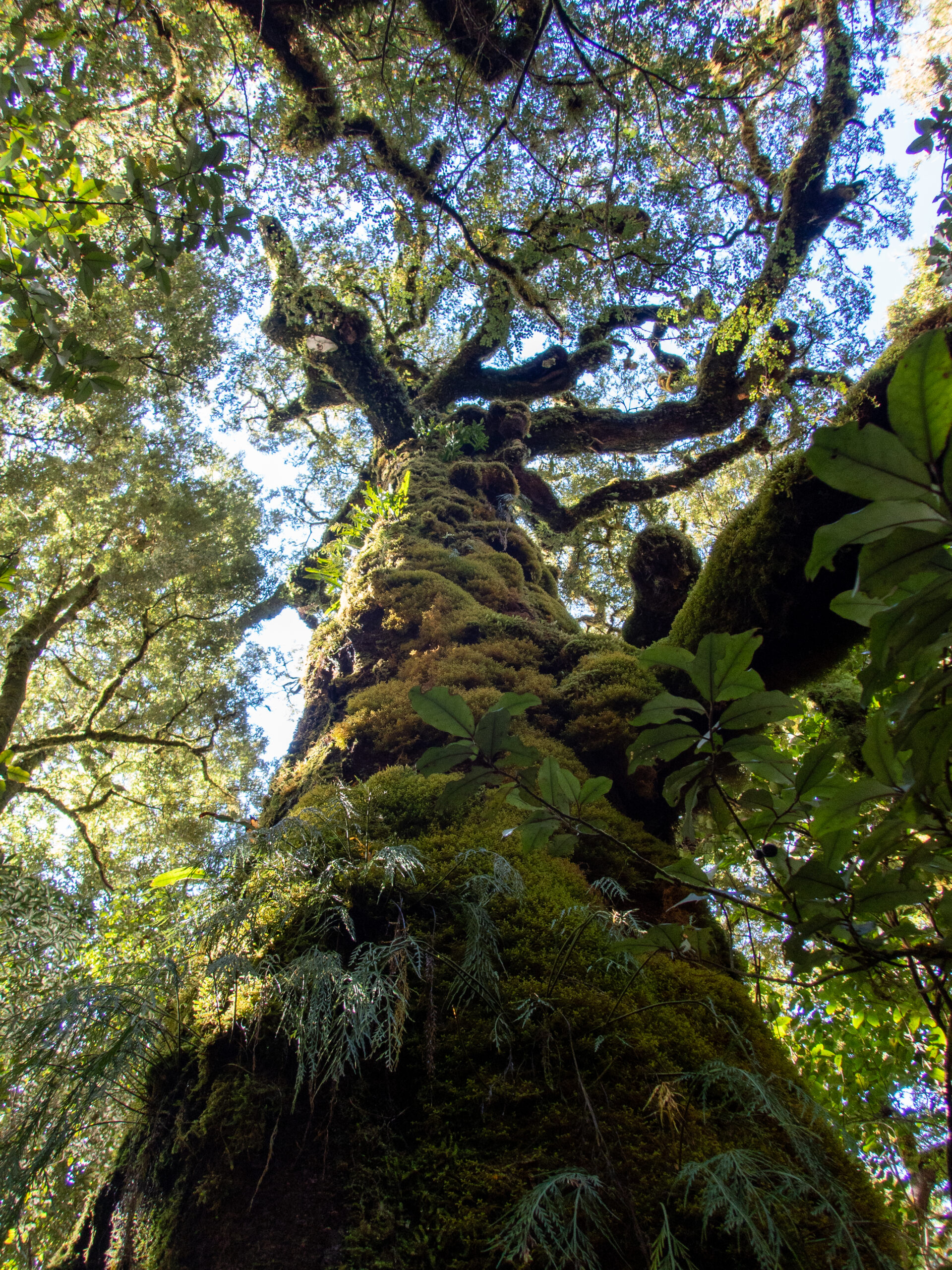
Happy to get in the forest on foot and lay some hands on these wise elders!Marcus didn’t end up seeing any fish, but it was such a pleasure: gravel beds, a reasonable trail on the true left bank, deer sign and a sun dappled forest.I left this for Marcus so he might see it on his way back down river. Glad I took the pic, because he didn’t!
A fine, fine day!Had to tear ourselves away and still we left about 1.5 hours after our intention, so the water was REALLY ‘skinny’ for our return.
We negotiated snags the whole way and had to walk/pull Namo out the last 200′!
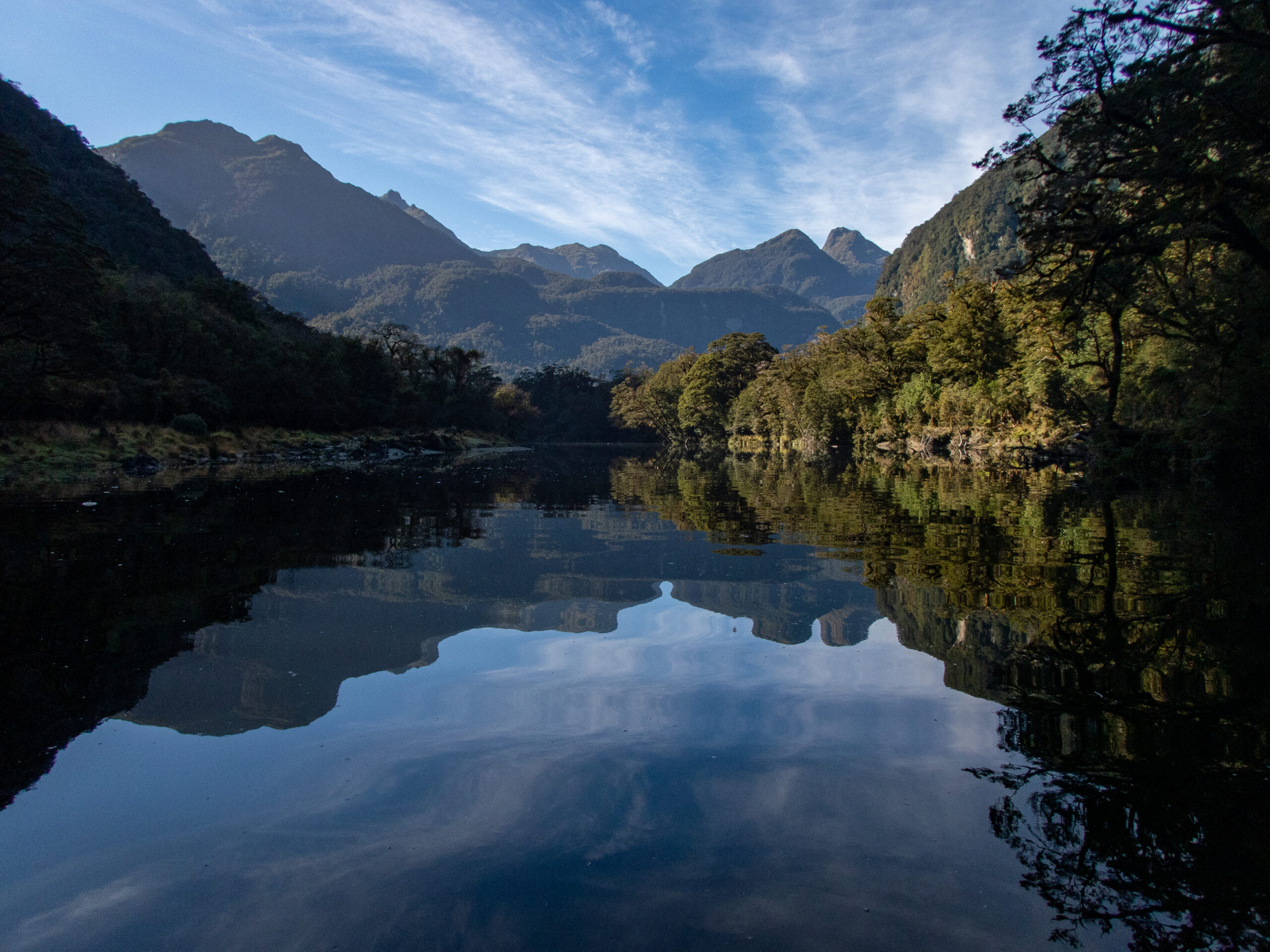
What a beautiful sight, to see Allora peacefully resting just as we’d left her! Phenomenal day!Left Charles Sound at 10am – 3 days of solitude and bliss.